We’ve traveled the length of Long Island Sound, up the Connecticut River, through the Race, up Buzzard’s Bay, through the Cape Cod Canal and up Cape Cod Bay to Provincetown out on the tip of Massachusetts’ famous hook. We’ve enjoyed our trip so far through these waters that are all new to us. There are many differences, and some similarities to our experiences on the Chesapeake Bay.
PORTS OF CALL
New York - Long Island
We made 2 stops on the Long Island side of the sound.
New York - Long Island
We made 2 stops on the Long Island side of the sound.
Port Washington
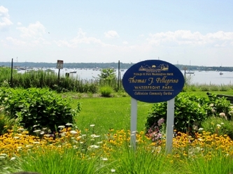
The first was at Port Washington in Manhasset Bay. The town offers free mooring balls for 2 nights, most of which were readily available on the Tuesday morning (July 31) when we arrived. It was going to be a hot day, which normally would have caused us to take it easy. However, we needed to get a replacement shackle for one that had fallen overboard as Dave re-attached the headsail when it came back from re-stitching. (oops!) So we decided to explore the town and find the promised West Marine that was “a little walk” outside of town. The “little walk” was also a little lacking in shade, but we made it there and back, then turned up the hill and explored this combination of waterfront and commuter town. (It’s only a 45 minute train ride to NYC.) To cool off before returning to the boat, we treated ourselves to an Italian ice. That made the walk worth it.
We spent most of the 2nd day at Port Washington planning our route through Long Island sound, checking on availability of moorings, etc. We decided to stop next at Northport, NY, which was a short trip east, but was supposed to have a welcoming yacht club and a quaint New England town to explore.
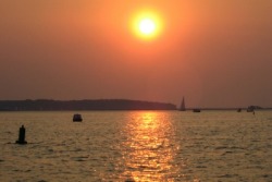
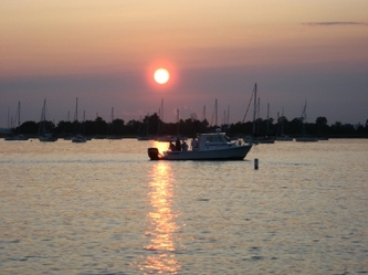
Northport harbor at sunset
Northport
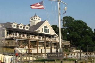
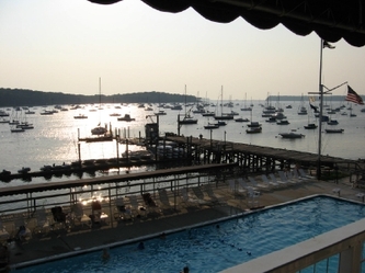
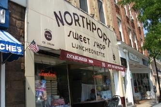
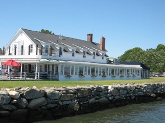
Northport was easily one of our favorites ports so far on our trip north. We stayed on a mooring ball at the Northport Yacht Club. With the 90 degree heat during the day, keeping cool became a priority. We took a couple of walks down the tree-lined streets to town seeking shade wherever we could find it along the way (and, of course, the delicious homemade ice cream at Northport Sweet Shop helped). But we could easily beat the heat in the huge pool at the yacht club when we returned, which became our afternoon retreat to cool off and get some exercise in the process. With the launch service, we didn’t have to fool with the dinghy either. This was the life. We stayed in Northport three nights, partially because we liked it so much, and partially because we learned that we might meet the Bravermans there. They were on a weeklong vacation on the sound. We didn’t see them there, but we were too hook up later.
Northport was easily one of our favorites ports so far on our trip north. We stayed on a mooring ball at the Northport Yacht Club. With the 90 degree heat during the day, keeping cool became a priority. We took a couple of walks down the tree-lined streets to town seeking shade wherever we could find it along the way (and, of course, the delicious homemade ice cream at Northport Sweet Shop helped). But we could easily beat the heat in the huge pool at the yacht club when we returned, which became our afternoon retreat to cool off and get some exercise in the process. With the launch service, we didn’t have to fool with the dinghy either. This was the life. We stayed in Northport three nights, partially because we liked it so much, and partially because we learned that we might meet the Bravermans there. They were on a weeklong vacation on the sound. We didn’t see them there, but we were too hook up later.
Connecticut – Black Rock and Essex
Our remaining stays on the Long Island Sound were on the Connecticut side of the sound.
Our remaining stays on the Long Island Sound were on the Connecticut side of the sound.
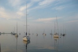
Black Rock Yacht Club
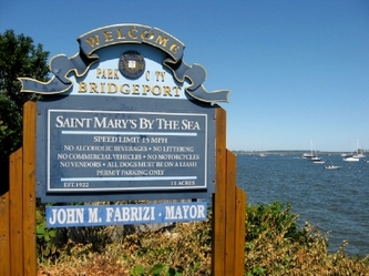
We knew that we wanted to visit the Connecticut River, highly recommended by several people we talked to. However, it was a long trip from Northport to the Connecticut River and the prospect of timing the current and the opening RR bridge on the river made us look for a closer port to stage the trip to the river. We decided to try Black Rock Yacht Club just west of Bridgeport, Connecticut.
Black Rock is just off the sound, so the entrance was straightforward, but that also made the harbor a little exposed as the winds shifted to the south. The dockmaster put us on a member’s mooring ball however, which gave us a little more protection from the waves. Black Rock also had a complimentary launch, a pool and a restaurant at the clubhouse. We enjoyed cooling off in the pool again. The only disappointment was the dinner we decided to try on Sunday night at the club’s restaurant. Oh well. The view from Black Rock was nice, and there is a nice walkway by the shore, but there is no town or any stores within a reasonable walk from the yacht club. We stayed a 2nd night to wait for some bad weather to pass and then headed to the Connecticut River.
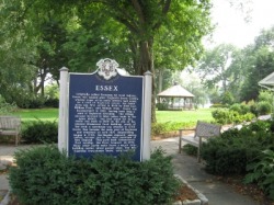
Essex town park
Essex
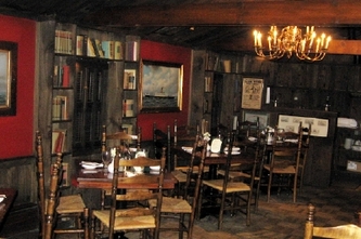
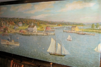
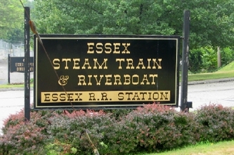
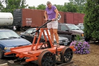
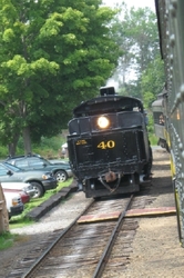
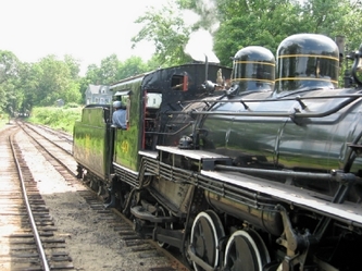
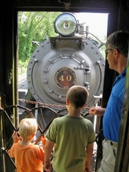
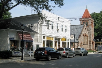
Although we had recommendations for three different stops on the Connecticut River, we decided to head to Essex, since we discovered that the Bravermans would be there as well. Essex is an historic town, incorporated in 1852, but with English settlement starting back in the mid-1600’s. The town was an important shipbuilding center in the 1700’s. Its most famous landmark is The Griswold Inn (“The Griz”), a restaurant and pub that dates back to 1776. We joined the Bravermans for a drink while we chatted about our experiences and theirs since we last saw them. The next day we took a ride on the Essex Steam Train which took us further north along the Connecticut River, than we were willing to take Orion. It was a nice way to see the river.
Although we had recommendations for three different stops on the Connecticut River, we decided to head to Essex, since we discovered that the Bravermans would be there as well. Essex is an historic town, incorporated in 1852, but with English settlement starting back in the mid-1600’s. The town was an important shipbuilding center in the 1700’s. Its most famous landmark is The Griswold Inn (“The Griz”), a restaurant and pub that dates back to 1776. We joined the Bravermans for a drink while we chatted about our experiences and theirs since we last saw them. The next day we took a ride on the Essex Steam Train which took us further north along the Connecticut River, than we were willing to take Orion. It was a nice way to see the river.
Rhode Island – Block Island and Newport
We parted company with the Bravermans again, who headed up to Hamburg Cove for a night before heading back west on the sound. We were instead heading east toward Block Island. This would take us through the Race, at the Sound’s eastern edge and into Block Island Sound, which is bounded by Connecticut, Long Island and Block Island.
We parted company with the Bravermans again, who headed up to Hamburg Cove for a night before heading back west on the sound. We were instead heading east toward Block Island. This would take us through the Race, at the Sound’s eastern edge and into Block Island Sound, which is bounded by Connecticut, Long Island and Block Island.
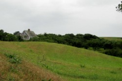
House on a hill on Block Island
Block Island
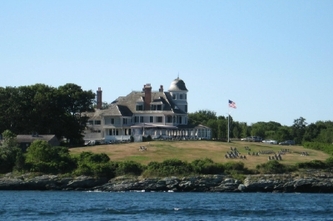
Unlike our stops thus far on Long Island Sound, which were all only a train or car ride from NYC or another major metropolitan area (e.g Essex is on I-95), Block Island is not on any commuter route. Although there are many high speed ferry lines that serve it, they are primarily bringing the many beachgoers who come to vacation on the island, or just spend a day on the beach. This is a family beach resort, and there were enough ice cream shops and T-shirt stores to prove it.
Since most of the island’s shores are exposed to either the Atlantic Ocean on the east or the Block Island Sound on the west, the only practical place to stay is within the Great Salt Pond at New Harbor on the western side. (There is a limited amount of anchoring room in Old Harbor on the eastern side, but it looked very unappealing.) Great Salt Pond is full of moorings. There are 90 town moorings, which we were told were full every night of the summer. There were also hundreds of private moorings and many boats at anchor. We knew we would not be comfortable anchoring here, especially since the winds were predicted to kick up the next day and the water is so deep. We decided to try for a town mooring. If we couldn’t find one, we would simply head out for Newport, our next port of call. When we arrived at 1pm on Thursday (August 9), we were discouraged to see no available town mooring balls. We weaved in and out of the moored boats to try to find a mooring ball that might be free or with an occupant that was leaving soon. Our first and second pass were unsuccessful, although one boater told us that the town would possibly rent us a private mooring ball if we called them after 5pm. That was too late to make us feel comfortable. We decided to make one more pass through the field to see what we could find. Cathy was convinced this was going to be as hopeless as the first 2 passes and tried to begin plugging in the route to Newport on the chartplotter. When we had almost given up, someone on a boat near the back of the mooring field waved to us to say that he was leaving his mooring ball and we could have it. This was unbelievable! Cathy was trying to turn in the tight field to line up on the ball, while giving its current occupant enough room to vacate it. In her haste, she came too close to the boat behind us, snagging their anchor on our lifeline. We disentangled quickly, and moved forward to pick up the mooring ball. The good news was we had a place to stay. The bad news was we had never come that close to another boat before, and Cathy was feeling horrible.
We launched the dinghy, and Dave went over to our neighbors to talk to them about the incident. No one was home, and he couldn’t see any damage from the vantage point of the dinghy. Our lifeline seemed undamaged as well. Dave said that one other thing in our favor was that our neighbors had some weathered fuel cans on deck that meant they might be cruisers and (maybe) a little more forgiving. We decided to go explore the town and see if we could catch them when we returned. When we came back from our brief walk, we hailed the Judith Arlene and told Judy and Ed about the damage. They were extremely gracious about it, but we offered to take care of anything they might find. To our surprise and delight, Judy then invited us to dinner with them and some friends. What a way to meet your neighbors! Not one we would recommend, but they were a wonderful couple and we enjoyed the evening together with them and their friends, Paul and Kathy, tremendously.
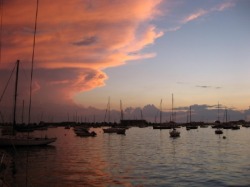
Sunset over Newport mooring field
Newport
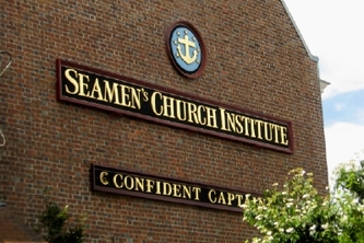
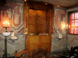
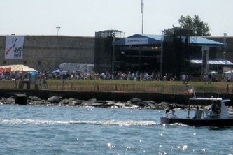
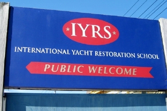
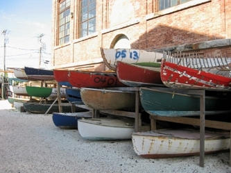
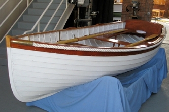
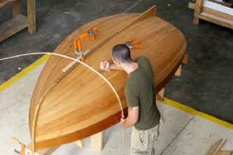
Newport, Rhode Island is back on the mainland on the Narragansett Bay, a short 25 miles from Block Island. We headed out early from Block Island on Sunday and arrived in Newport by 11am. It is a busy harbor on most days and, on a Sunday, with the Jazz festival underway, it was even more so. Dave was once again at the wheel as he navigated between the huge tanker leaving the Narragansett Bay for the sound and the many pleasure boats heading out to enjoy a Sunday sail. The radio traffic was heavy as well as we tried to hail the Oldport launch for a mooring assignment. After some of the most confusing directions and most disorganized mooring field to date, we managed to tie up to a mooring ball right off the dinghy dock. We headed off into town to explore, stopping at the Seaman’s Church Institute, which offers sailors showers for a small donation and has a beautiful chapel on the 2nd floor. Our next stop was a warehouse sale for Helly Hansen that happened to be going on. Then we toured the International Yacht Restoration School, where some students were finishing up some independent study projects before the summer session ended.
Newport, Rhode Island is back on the mainland on the Narragansett Bay, a short 25 miles from Block Island. We headed out early from Block Island on Sunday and arrived in Newport by 11am. It is a busy harbor on most days and, on a Sunday, with the Jazz festival underway, it was even more so. Dave was once again at the wheel as he navigated between the huge tanker leaving the Narragansett Bay for the sound and the many pleasure boats heading out to enjoy a Sunday sail. The radio traffic was heavy as well as we tried to hail the Oldport launch for a mooring assignment. After some of the most confusing directions and most disorganized mooring field to date, we managed to tie up to a mooring ball right off the dinghy dock. We headed off into town to explore, stopping at the Seaman’s Church Institute, which offers sailors showers for a small donation and has a beautiful chapel on the 2nd floor. Our next stop was a warehouse sale for Helly Hansen that happened to be going on. Then we toured the International Yacht Restoration School, where some students were finishing up some independent study projects before the summer session ended.
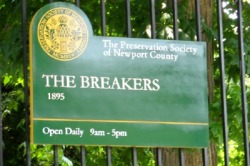
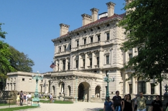
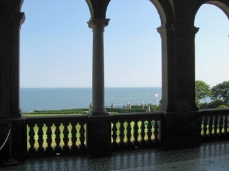
The next day we took the bus to see the famous Newport mansion, The Breakers, which has a breathtaking view of the ocean. The house is huge and its beautifully decorated rooms in near-original condition, giving you a sense of how the upper crust, in this case the Cornelius Vanderbilts, lived at the turn of the twentieth century. I can see why George Vanderbilt (Cornelius’ younger brother) felt compelled to continue the building spree with Biltmore in Asheville.
Massachusetts – Cuttyhunk to Provincetown
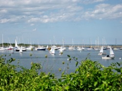
Cuttyhunk
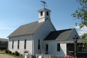
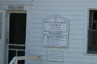
We left Newport for Cuttyhunk Island in Buzzards Bay on Tuesday morning (August 14) and were able to sail much of the way. Cuttyhunk is the westernmost of the Elizabeth Islands, which make up the southern boundary of Buzzards Bay. Cuttyhunk is even more remote than Block Island, with only limited ferry service to the mainland. It is a quant island, with a history as a summer resort for a NY fishing and hunting club and then a group of wealthy families who built summer homes here. This was the tightest mooring field we had been in so far, and the mooring balls had no pennants, so we had to navigate the tight field and secure ourselves to the mooring ball with a temporary line so Dave could rig a more permanent pennant. After the Block Island experience, Cathy was much relieved when this went smoothly.
We left Newport for Cuttyhunk Island in Buzzards Bay on Tuesday morning (August 14) and were able to sail much of the way. Cuttyhunk is the westernmost of the Elizabeth Islands, which make up the southern boundary of Buzzards Bay. Cuttyhunk is even more remote than Block Island, with only limited ferry service to the mainland. It is a quant island, with a history as a summer resort for a NY fishing and hunting club and then a group of wealthy families who built summer homes here. This was the tightest mooring field we had been in so far, and the mooring balls had no pennants, so we had to navigate the tight field and secure ourselves to the mooring ball with a temporary line so Dave could rig a more permanent pennant. After the Block Island experience, Cathy was much relieved when this went smoothly.
We explored the island that afternoon, and then decided to move on the next day, which would bring favorable winds and currents to travel Buzzards Bay. We initially planned to stop at Onset on the western edge of the Cape Cod Canal. However, the current upon entering the canal was favorable enough, we decided to continue to Provincetown. The only hesitation was that the winds had been building throughout the day. Cathy was a little concerned that they might get too high for comfort as we crossed Cape Cod Bay for Provincetown. The winds were definitely higher than forecast, gusting well over 30 knots, but they were behind us. So we sailed wing-on-wing up the Bay, making Provincetown by 3pm.
Unfortunately, the waves were building behind us along with the wind. Cathy decided it was the better part of wisdom not to turn around and look at them very often. As we made the turn for the final entrance to Provincetown, the waves were a little more at an angle off our starboard stern quarter, but still manageable. Now, the fishing floats were much harder to see as they bobbed in the rough seas. The final mile and half of the trip into the harbor put us abeam to the winds and waves. The water was splashing over the side of the cockpit as we strained to make out the breakwater with the red daymark, which was our landmark for the mooring field. With every mooring ball around us taken and the wind blowing 30 knots, we knew we had no room for error. We would fall back on the boats behinds us quickly if we missed. We had another successful pick-up and were on the ball safely. Why is this always so stressful?
Charts and Other Boat Stuff
Being cheap is a cruiser’s trademark, but we try to balance our “frugal” nature with safety concerns. Our most recent concern that pitted these 2 considerations against each other was concerning the purchase of charts for our Garmin chartplotter. Our model of chartplotter has the annoying requirement that we purchase charts region by region. (Later versions come with all the charts.) In reviewing the charts we needed for the trip, there appeared to be a gap of about 25 miles in the middle of Long Island sound. As we drew closer to this area, which we refer to as the “black hole”, Dave tried to assess what we would be without. Remember, we rely heavily on the chartplotter for navigation. We decided that the area was not one where we would likely stop, so we opted to skip buying these charts. We would rely on our back up paper charts and the electronic version of them on the computer using Mapsource software. The first harbor we entered that forced us to try this approach was Northport. Although Huntington Bay was on our charts, the narrow entrance to the Northport harbor was missing. That meant we had to rely on paper charts, and binoculars more than usual when entering the channel. When this seemed to work OK, we tried this approach again navigating up the Connecticut River. Dave had verified his waypoints on our Maptech electronic charts and we made our way up the River to Essex successfully. Since these were the only 2 harbors affected by the “black hole”, we felt we made the right decision in not spending the extra money on these charts.
The only other boat activities were routine. We changed the oil, refilled with water and re-provisioned in Newport, and did laundry (and more grocery shopping) in Essex. We were once again the beneficiaries of a kind stranger in Essex, who saw us toasting on the sidewalk with our soon to be spoiled groceries. She offered us a ride into town and took us to the marina parking lot. She would take nothing for the ride except our thanks. We are constantly impressed with the generosity of strangers in our travels.
Massachusetts to New Hampshire
If we so desired, we are within a couple of days journey of Newburyport and our friends in New Hampshire. We plan to spend more time in Provincetown, Scituate and Boston first before joining them in a week or so. So, we’ll find out about the Carnival festival in Provincetown and let you know all about it in our next update.
