Orion Specifications - Navigation
October 2009

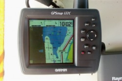
Garmin 172C Chartplotter
Our first independent trip with Orion was to the Rhode River with David's dad. It was the 4th of July weekend and the anchorage was filled with boats. Our guidebook indicated that the best anchorage was between the first and second island. David was at the helm while Cathy and his dad studied the chart. Although David was concerned that there weren't any other boats where we were headed, Cathy assured him we were on track. As we came alongside the first island, the depth alarm went off and Orion came to a halt. After the towboat got us moving again, we discovered that the first island is completely under water at high tide. Thus we were attempting to go pass the second island where there is only a couple of feet of water. We needed better tools.
David had installed a Garmin 172C at the helm to serve as a GPS. Unfortunately, it takes time to use a GPS to determine ones exact position on a paper chart. Fortunately, the Garmin 172C is a chartplotter that can show ones exact position on an electronic chart. We quickly purchased electronic charts of the Chesapeake Bay and have continued to purchase charts for new areas that we plan to visit. The chartplotter gave us confidence to extend our travels to new areas. It served us well for 4 years.
David had installed a Garmin 172C at the helm to serve as a GPS. Unfortunately, it takes time to use a GPS to determine ones exact position on a paper chart. Fortunately, the Garmin 172C is a chartplotter that can show ones exact position on an electronic chart. We quickly purchased electronic charts of the Chesapeake Bay and have continued to purchase charts for new areas that we plan to visit. The chartplotter gave us confidence to extend our travels to new areas. It served us well for 4 years.

Reconfigured Nav Station
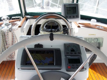
As we extended our areas of travel and often found ourselves alone, we decided it would be a good idea to add radar as it would allow us to see navigation obstacles and weather. We wanted the ability to display our charts, position, radar and AIS data at the helm. After a lot of research and thought, we decided to go with a Garmin solution. As luck would have it, were able to pick up a Garmin 5208 at substantial discount when Boater’s World went out of business.
Our first step was to reconfigure our helm so that it would accommodate the Garmin 5208 and interface it with our existing systems. We feed the Garmin from our AIS receiver, DSC radio, Raymarine autopilot, and Raymarine ST60 multi instrument. Additionally, the Garmin feeds data to our DSC radio, Raymarine autopilot, and PC. Everything worked fine.
Our first step was to reconfigure our helm so that it would accommodate the Garmin 5208 and interface it with our existing systems. We feed the Garmin from our AIS receiver, DSC radio, Raymarine autopilot, and Raymarine ST60 multi instrument. Additionally, the Garmin feeds data to our DSC radio, Raymarine autopilot, and PC. Everything worked fine.

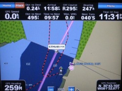
Garmin 5208 Display
Next we installed a Garmin 18” 4KW HD radar on Orion and interfaced it to the Garmin 5208. It allowed us to view radar overlaid on our charts, along with the AIS transmissions of nearby ships.
The chartplotters give us confidence to extend our travels to new areas. While it's great to see where you are on a chart as you travel, it's even better to have a route to follow. Identifying a series of waypoints and connecting them with a line creates a route. This can be a painstakingly done on the chartplotters, but is easily accomplished on a PC using Garmin's Mapsource product.
The chartplotters give us confidence to extend our travels to new areas. While it's great to see where you are on a chart as you travel, it's even better to have a route to follow. Identifying a series of waypoints and connecting them with a line creates a route. This can be a painstakingly done on the chartplotters, but is easily accomplished on a PC using Garmin's Mapsource product.
Challenge

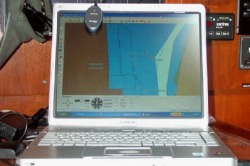
PC with Fugawi S/W and Holux GPS
We really like Garmin's capability to work with the charts on our PC, upload them to the chartplotter, and readily access them at the helm. However, the charts are expensive. While Garmin's new chartplotters come fully loaded with all the charts for the U.S. at a more reasonable price, they don't provide the capability to access those charts in Mapsource. This makes it impossible to properly establish waypoints and routes on the PC for new regions. Hopefully, someone will provide this capability in the near future.
