Waves breaking on Whale Cay
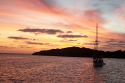
Beyond the Whale
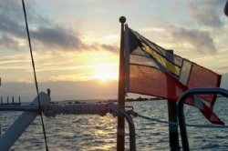
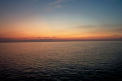
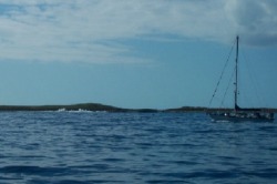
We made it through the “Whale”, the passage outside the protected reefs on the Bahama Bank to enter the Sea of Abaco. We are now not far from any of the various ports on this protected sea, including Marsh Harbor, our final destination.
We made it through the “Whale”, the passage outside the protected reefs on the Bahama Bank to enter the Sea of Abaco. We are now not far from any of the various ports on this protected sea, including Marsh Harbor, our final destination.
Taming the Whale
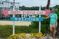
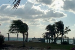
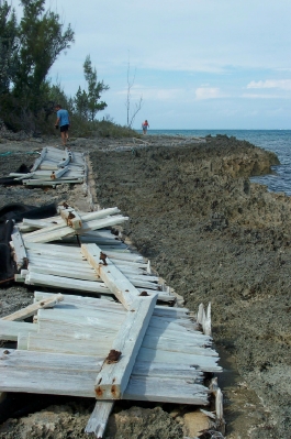
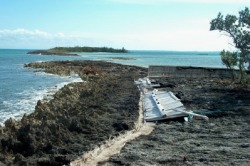
Before leaving Green Turtle Cay, we had read an article (kindly posted on the wall of the Bluff House) about a boat that had capsized in the Whale Cay Passage 20 years ago, losing 2 of its crew, on an otherwise beautiful day in the Abacos. The exposed Whale was being affected by a large storm well north in the Atlantic, which created 25 foot waves, while the interior islands experienced a mild 10-15 knots of wind. They call this a “rage” sea, and these are taken seriously, as evidenced by the damage a similar rage sea did to the sea wall at Spanish Cay, in the picture below.
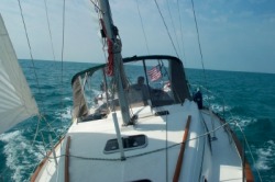
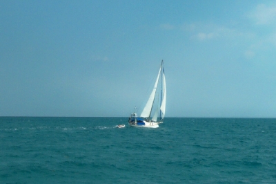
When we awoke last Wednesday morning, the day was as calm as we have seen in a couple of weeks. We were optimistic that this would be the day we could make the passage around Whale Cay. The day before had been rough, and we were among a dozen or more boats that had elected to wait it out for calmer seas. Not too be over-confident, we waited for the morning Cruisers Net report, which reported that the Whale was indeed calm.
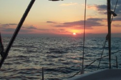
We couldn’t have timed our passage better. The swells outside the Whale Cut were so gentle and the water so still, we could see the bottom in the 40+ foot water beneath us as it glided by. Even with this flat sea, the waves breaking not too far away on Whale Cay were a reminder that this can be treacherous under different conditions.
Before leaving Green Turtle Cay, we had read an article (kindly posted on the wall of the Bluff House) about a boat that had capsized in the Whale Cay Passage 20 years ago, losing 2 of its crew, on an otherwise beautiful day in the Abacos. The exposed Whale was being affected by a large storm well north in the Atlantic, which created 25 foot waves, while the interior islands experienced a mild 10-15 knots of wind. They call this a “rage” sea, and these are taken seriously, as evidenced by the damage a similar rage sea did to the sea wall at Spanish Cay, in the picture below.
When we awoke last Wednesday morning, the day was as calm as we have seen in a couple of weeks. We were optimistic that this would be the day we could make the passage around Whale Cay. The day before had been rough, and we were among a dozen or more boats that had elected to wait it out for calmer seas. Not too be over-confident, we waited for the morning Cruisers Net report, which reported that the Whale was indeed calm.
We couldn’t have timed our passage better. The swells outside the Whale Cut were so gentle and the water so still, we could see the bottom in the 40+ foot water beneath us as it glided by. Even with this flat sea, the waves breaking not too far away on Whale Cay were a reminder that this can be treacherous under different conditions.
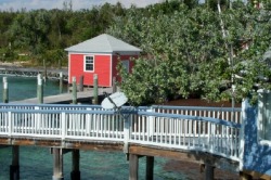
Bakers Bay, Great Guana Cay
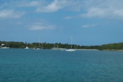
We anchored shortly after passing back into the Sea of Abaco at the northern end of Great Guana Cay, in Bakers Bay. This used to be the “private island” for a cruise ship (The Big Red Boat), but was abandoned after just a few years, because so many stops had to be cancelled due to bad sea conditions (i.e., the Whale).
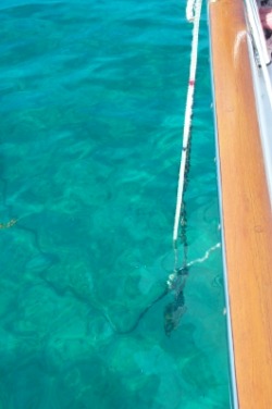
The amazingly calm day allowed both Dave at the bow and Cathy at the helm to watch the anchor on the bottom as it landed on its side and then swung around and dug in. It was amazing to see what was really happening when we had only been able to guess before. Everyone learning to anchor should get a chance to do it in these conditions to get a sense of what is actually happening. Up to now, anchoring in murky waters (and spared evidence to the contrary), we would usually guess optimistically that everything was fine. With the light winds, seeing the anchor on its side, it was obvious that Cathy had to actively back down on the anchor with some force to get the anchor to swing into a position where it would dig in.
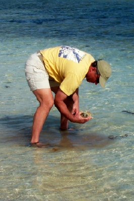
This was also the first really warm day since we had arrived in the Bahamas, so the water looked inviting enough for a swim. Dave made it a “working swim”, diving on the anchor, cleaning the bottom, and checking the zinc. After initially declaring the sacrificial zinc on the propeller to be “just fine”, upon further inspection he realized that the zinc was far from fine. It was gone. (This is the second time we have gone to replace it in the past 3 months where it was completely gone.) For the first time, the water clarity allowed Dave to replace the zinc himself.
We anchored shortly after passing back into the Sea of Abaco at the northern end of Great Guana Cay, in Bakers Bay. This used to be the “private island” for a cruise ship (The Big Red Boat), but was abandoned after just a few years, because so many stops had to be cancelled due to bad sea conditions (i.e., the Whale).
The amazingly calm day allowed both Dave at the bow and Cathy at the helm to watch the anchor on the bottom as it landed on its side and then swung around and dug in. It was amazing to see what was really happening when we had only been able to guess before. Everyone learning to anchor should get a chance to do it in these conditions to get a sense of what is actually happening. Up to now, anchoring in murky waters (and spared evidence to the contrary), we would usually guess optimistically that everything was fine. With the light winds, seeing the anchor on its side, it was obvious that Cathy had to actively back down on the anchor with some force to get the anchor to swing into a position where it would dig in.
This was also the first really warm day since we had arrived in the Bahamas, so the water looked inviting enough for a swim. Dave made it a “working swim”, diving on the anchor, cleaning the bottom, and checking the zinc. After initially declaring the sacrificial zinc on the propeller to be “just fine”, upon further inspection he realized that the zinc was far from fine. It was gone. (This is the second time we have gone to replace it in the past 3 months where it was completely gone.) For the first time, the water clarity allowed Dave to replace the zinc himself.

We also took advantage of the weather to refinish the teak in the cockpit and the swim platform. This meant that we couldn’t do too much else. We did manage to crawl over the teak carefully so we could take the dinghy to the nearby “shell island” created from the dredging of the channel for the cruise ship. It has a nice beach with tons of shells, mostly small, but still intact and beautiful.
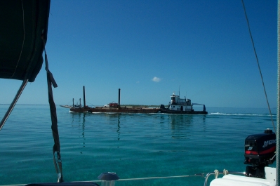
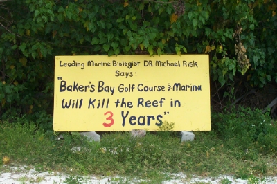
The Bakers Bay anchorage is in the midst of some controversial re-development of a new resort, which is to include a marina, golf course and villas. There is concern that this will damage the Great Guana Cay reef. There is an active opposition to the development (see www.saveguanacayreef.com). We could see the dredging barges nearby as we anchored there, which was the only negative to this wonderful anchorage.
The Bakers Bay anchorage is in the midst of some controversial re-development of a new resort, which is to include a marina, golf course and villas. There is concern that this will damage the Great Guana Cay reef. There is an active opposition to the development (see www.saveguanacayreef.com). We could see the dredging barges nearby as we anchored there, which was the only negative to this wonderful anchorage.
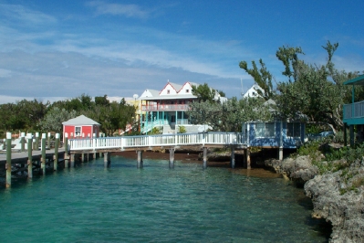
Settlement Point, Great Guana Cay
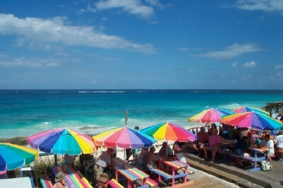
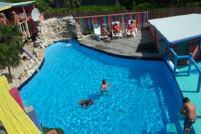
Since the winds were predicted to increase and shift to a direction that would make Bakers Bay uncomfortable, we decided to move further south to Great Guana Cay’s more-protected Settlement Point. (Bonnie Lass had left the day before for Treasure Cay to see to some engine repairs. We plan to hook up again once they are done.) We picked up the last available mooring ball in the harbor in the shallowest water we have yet seen. At the extreme low tides being driven by the new moon, we should have technically been aground, since the depth sounder was reading 3’ 6”. We add 2 feet for the distance from the meter to the water line, which gives us our fully-loaded draft of 5’ 6”. Ouch! The worst part is that the anchor for the mooring ball is a 3 x 3 x 3 foot cube of concrete, and there is an out-of-place mooring ball immediately in front of us. Should the wind shift to a northerly direction, we will swing on top of the concrete block, which is not something we want to do. As soon as a deeper water mooring ball is available, we planned to move -- before the wind shifted.
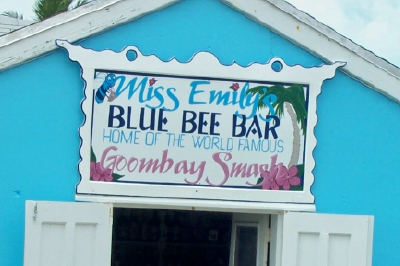
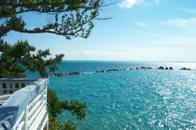
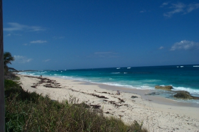
Despite the low water, we decided to stay, so explored the island, including the famous bar, Nippers. In addition to its restaurant and bar, it also has a freshwater pool, which felt great after a long walk on the Atlantic beach which Nippers overlooks. On Sunday, we enjoyed an all-you-can-eat pig roast at Nippers, which perhaps is intended to describe those of us partaking in it as well as the beast we were eating. It was good.
Since the winds were predicted to increase and shift to a direction that would make Bakers Bay uncomfortable, we decided to move further south to Great Guana Cay’s more-protected Settlement Point. (Bonnie Lass had left the day before for Treasure Cay to see to some engine repairs. We plan to hook up again once they are done.) We picked up the last available mooring ball in the harbor in the shallowest water we have yet seen. At the extreme low tides being driven by the new moon, we should have technically been aground, since the depth sounder was reading 3’ 6”. We add 2 feet for the distance from the meter to the water line, which gives us our fully-loaded draft of 5’ 6”. Ouch! The worst part is that the anchor for the mooring ball is a 3 x 3 x 3 foot cube of concrete, and there is an out-of-place mooring ball immediately in front of us. Should the wind shift to a northerly direction, we will swing on top of the concrete block, which is not something we want to do. As soon as a deeper water mooring ball is available, we planned to move -- before the wind shifted.
Despite the low water, we decided to stay, so explored the island, including the famous bar, Nippers. In addition to its restaurant and bar, it also has a freshwater pool, which felt great after a long walk on the Atlantic beach which Nippers overlooks. On Sunday, we enjoyed an all-you-can-eat pig roast at Nippers, which perhaps is intended to describe those of us partaking in it as well as the beast we were eating. It was good.


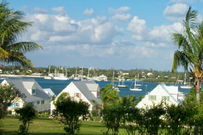
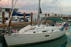
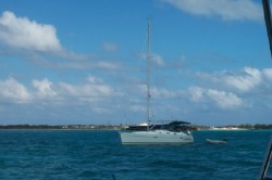
Marsh Harbor Anchorage
Marsh Harbor – that toddlin’ town
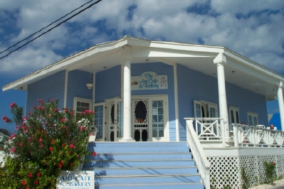
On Monday (Feb. 27), we moved from Guana Cay to Marsh Harbor, the largest town in the eastern Abacos. It has a large, busy harbor, with a lot of boats anchored there. We managed to squeeze in the first night, but were able to re-position in a bigger space the next morning when many boats left. We re-connected with White Bird, who were also anchored in the harbor. They joined us on board shortly after arrival. Joanne from White Bird gave us a walking tour of the town, which is a good place to re-provision with multiple large grocery stores, hardware stores and other shopping available. In general, this is the place to get what you need or have it shipped to. For the most part, the prices are double what they would be in the US, with the exception of some staples, like butter, cheese, and eggs. Of course, some non-food items are very similar to the US, such as diesel, slip fees, and (very important) mixed drinks.
With the help of Joanne, we also discovered 2 different Happy Hours, where we got to enjoy some good food and company. At one of the events, the cruisers bring their own food, and the bar/restaurant offers discounted drinks, a novel idea that brought out a lot of people. We also discovered Café La Florence, a small café / bakery where we had a delicious cinnamon bun. Apparently, they are famous. Florence, the owner’s mother-in-law, has been making them for 20 years. We also tried chicken souse there, a traditional Bahamian breakfast stew, complete with whole chicken wings. Different. Dave made friends with the owner and even conned Cathy into making an announcement about them on the Cruisers Net. She actually generated some business for them. It could be a new career. (Well, maybe not.)
Being such a busy harbor, we kept running into other boaters we’ve met before. The most unexpected was the couple from Bum’s Rest, whom we had met back in Georgetown, SC before Thanksgiving. We also saw Kokopelli and Valhalla (a trawler from Riviera Beach). Valhalla was kind enough to be the recipient of a Fed-Ex package for us. It contained tax-related mail, allowing us to figure out our taxes, so we don’t run afoul of the IRS. We are still talking to Bonnie Lass, but don’t expect to re-connect with them for another few days. On Saturday, we met 2 couples for lunch that had been down for the week chartering a catamaran. Bob was a member of the Power Squadron in MD and had inspected our boat back in Solomons. We kept in touch and were glad to see them after so many months (and miles).
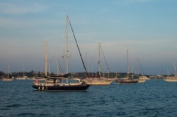
Kokopelli at anchor in Baker's Bay
Cruisers Net
Every morning at 8:15 we listen in on the cruisers net, broadcast on VHF 68 by local boaters who give weather, news, announcements , current passage conditions and invitations to area events. It is a critical link to information in the Abacos. It was also where we learned that Kokopelli, the buddy boat for our friends from LunaSea on their journey from the Chesapeake to the Bahamas, was in the area. They actually joined us in the Bakers Bay anchorage for one of the nights there.
Every morning at 8:15 we listen in on the cruisers net, broadcast on VHF 68 by local boaters who give weather, news, announcements , current passage conditions and invitations to area events. It is a critical link to information in the Abacos. It was also where we learned that Kokopelli, the buddy boat for our friends from LunaSea on their journey from the Chesapeake to the Bahamas, was in the area. They actually joined us in the Bakers Bay anchorage for one of the nights there.
Does someone smell smoke?
Shortly after arriving at Settlement Point, Dave was trying the computer out to see if we could once again connect to the internet, since we'd been suffering withdrawal from lack of access since leaving Green Turtle. Sure enough, he was able to connect, but shortly after giving the computer over to Cathy, she noticed smoke emitting from the power connection into the PC. (Honestly, I didn't do anything!) Dave discovered the connector on our DC cord, which had been giving us problems had shorted out and blown a fuse. Luckily, we had another connector on board, that he was able to use to repair the power cord. Whew! I don't know what we would do without the PC. That's scarier than the shallow water and the concrete block!
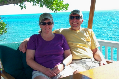
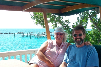
Hanging Out
We’re not sure what our next stop will be as we consider our options. We may stay in Marsh Harbor longer, but there are still more places we want to visit before we start our journey back in a few weeks. As they say on the Cruisers Net, it’s always a great day in the Abacos.
Shortly after arriving at Settlement Point, Dave was trying the computer out to see if we could once again connect to the internet, since we'd been suffering withdrawal from lack of access since leaving Green Turtle. Sure enough, he was able to connect, but shortly after giving the computer over to Cathy, she noticed smoke emitting from the power connection into the PC. (Honestly, I didn't do anything!) Dave discovered the connector on our DC cord, which had been giving us problems had shorted out and blown a fuse. Luckily, we had another connector on board, that he was able to use to repair the power cord. Whew! I don't know what we would do without the PC. That's scarier than the shallow water and the concrete block!
Hanging Out
We’re not sure what our next stop will be as we consider our options. We may stay in Marsh Harbor longer, but there are still more places we want to visit before we start our journey back in a few weeks. As they say on the Cruisers Net, it’s always a great day in the Abacos.