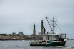
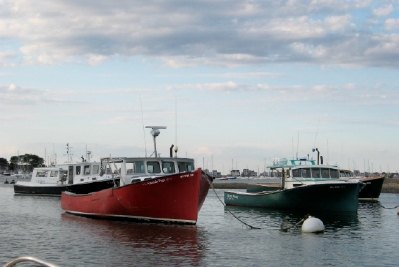
Lobster Boat off Cape Ann
We finally made it to New Hampshire – by truck, that is. Orion now sits in the Merrimac River, near Newburyport, MA, where Marianna, Merlin and Eleanor M live. Marianna and Eleanor M sit side by side on land, both of them getting fitted out for the next trip south. Merlin is a bit upriver on a mooring ball.
For most of the trip and several days after we arrived, we had only a vague understanding of the location of Mass / NH border. We just knew Pat and Fred lived in NH. Although they live in New Hampshire, their boating centers here in Newburyport. So, our “New Hampshire” destination appears to have shifted to Massachusetts as well. Cruisers are nothing if not flexible.
Getting here
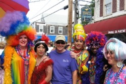
Cathy with some of the Carnival 'ladies'
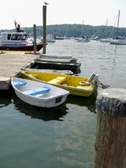
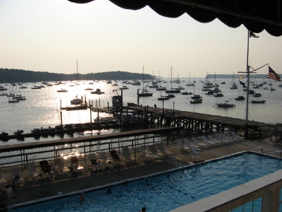
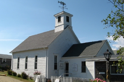
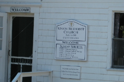
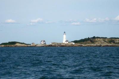
Provincetown
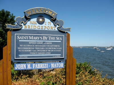
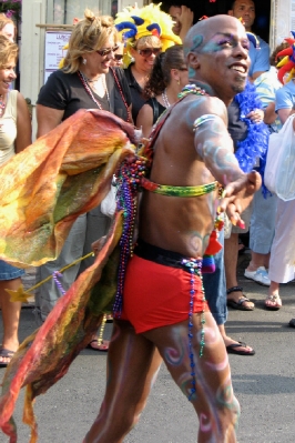
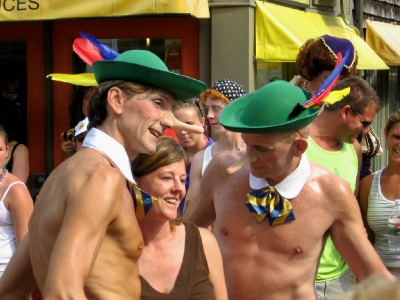
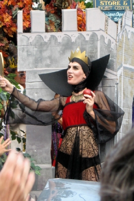
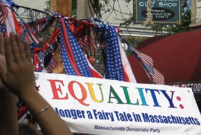
Our last update left off as we began to explore Provincetown. Its history as a seaside artist community has also made it a center of gay life. Although this connection was something we learned from the guidebooks, it took only minutes to discover it firsthand – the most dramatic examples being the over-the-top outfits the many “ladies” sported. The Carnival celebration we happened on was a celebration of gay pride and its centerpiece was an extravagant parade on Thursday afternoon (our 2nd day in Provincetown), which had a “Fairy Tales” theme (pun obviously intended). It’s hard to describe, but you’ll get some idea from the pictures we include below. (Some of the costumes left little to the imagination, so we had to choose our shots carefully.)
Our last update left off as we began to explore Provincetown. Its history as a seaside artist community has also made it a center of gay life. Although this connection was something we learned from the guidebooks, it took only minutes to discover it firsthand – the most dramatic examples being the over-the-top outfits the many “ladies” sported. The Carnival celebration we happened on was a celebration of gay pride and its centerpiece was an extravagant parade on Thursday afternoon (our 2nd day in Provincetown), which had a “Fairy Tales” theme (pun obviously intended). It’s hard to describe, but you’ll get some idea from the pictures we include below. (Some of the costumes left little to the imagination, so we had to choose our shots carefully.)


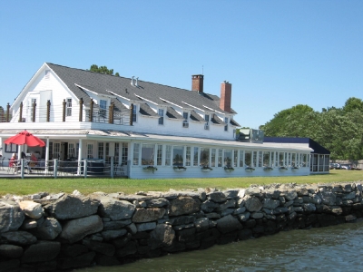
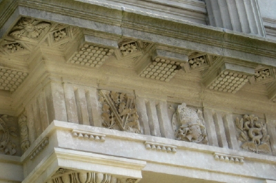
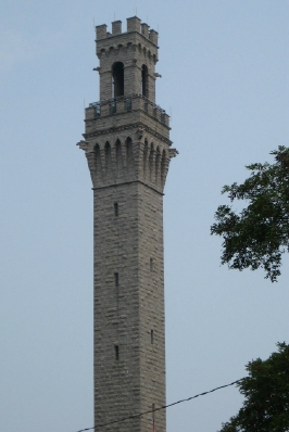
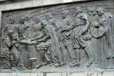
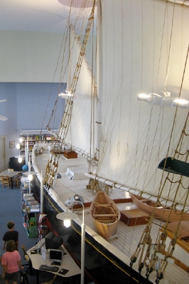
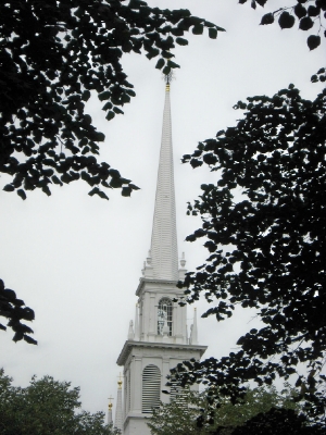
Provincetown also lays claim to a long history, dating back to the arrival of the Pilgrims in 1620. Although Plymouth is where the newcomers stayed, apparently, they came ashore here first. It was also here that the Mayflower Compact (an agreement on the rudimentary representative government that was to eventually influence the country’s founders) was signed. The imposing tower placed on the high point in town is there to make sure you don’t forget it. Also, in the early 1900’s, before the commercial sailing ships were eclipsed by power vessels, the local Rose Dorothea won a race from Provincetown to Boston, and her lines were recreated in a half-scale model that consumes the 2nd floor of the library. (This “model” is 60 ft long.) The elaborate silver cup awarded to the winner is also on display there.
Scituate
Having made reservations on Monday (August 20th) in Boston, we decided to cross the Cape Code Bay on Sunday and make a quick stop at Scituate (pronounced Sich-u-it). This a small harbor that is a mix of workboats and pleasure boats. What attracted us was the convenience of grocery and laundromat, the latter of which had been a little overdue. We only spent one night there before heading out to Boston on Monday.
Having made reservations on Monday (August 20th) in Boston, we decided to cross the Cape Code Bay on Sunday and make a quick stop at Scituate (pronounced Sich-u-it). This a small harbor that is a mix of workboats and pleasure boats. What attracted us was the convenience of grocery and laundromat, the latter of which had been a little overdue. We only spent one night there before heading out to Boston on Monday.

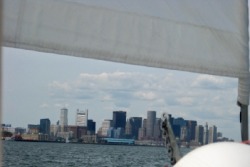
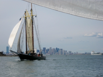
Boston skyline from the harbor
Boston
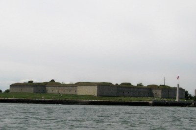
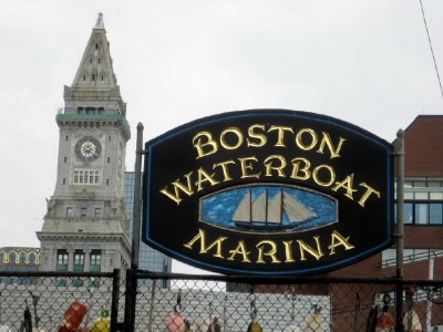
As big city harbors go, Boston was incredibly easy to navigate. There were few big ships and none of them were in motion while we entered. The entrance is dotted with several islands that define the various channels. Since we were coming from the south, we entered via the southern-most Nantasket Roads and then cut north through the Narrows to the more heavily-traveled President Roads channel. To our amazement, we were able to sail almost all the way into the Inner Harbor, where we were to take a mooring ball at the Boston Waterboat Marina. (If we had realized how light the boat traffic would be, we probably would have sailed all the way.)
As big city harbors go, Boston was incredibly easy to navigate. There were few big ships and none of them were in motion while we entered. The entrance is dotted with several islands that define the various channels. Since we were coming from the south, we entered via the southern-most Nantasket Roads and then cut north through the Narrows to the more heavily-traveled President Roads channel. To our amazement, we were able to sail almost all the way into the Inner Harbor, where we were to take a mooring ball at the Boston Waterboat Marina. (If we had realized how light the boat traffic would be, we probably would have sailed all the way.)
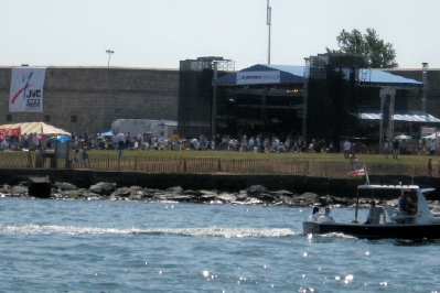
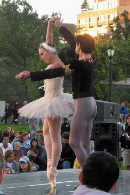
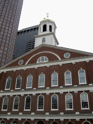
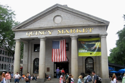
Our location was right downtown Boston. With Logan Airport’s landing strip on one side of the river and Fanieul Hall / Quincy Market within a block of the marina on the other side, we were in the thick of it. Of course, being in the thick of it also meant that we were a little close to the route of the many ferries and tour boats that traversed the harbor. The definition of a “little close” meant that they would pass between us and the other boats in the mooring field. Dave could have shaken hands with some of the passengers at one point when they passed. One night, the waterfront park at the edge of the marina hosted a concert with a mixture of the Boston Pops Ensemble, a pax de deux from Giselle by the Boston Ballet, ending with a concert by members of the Boston Opera. City life has its rewards.

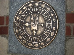
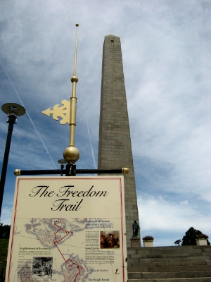
Cathy had visited Boston as a child, walking the famous “Freedom Trail” with her sisters, (well, part of it) but David had never been there. The first day, we just walked the town, exploring the mix of historic buildings and modern high rises, ending up at Fanieul Hall and Quincy Market. Our second day, we started at the Visitors Center for the Boston Freedom Trail National Historic Site, joining a park ranger who would lead us through the trail, interpreting the history that had taken place along it.
The Freedom Trail is marked by a line of bricks embedded in the sidewalk, which changes into a painted red line as it crosses streets. (The red footprints that Cathy remembered from 40 years ago have long since been replaced.) It starts at the State House, where the earliest signs of the unrest that would erupt in the Revolution began to be seen. The park ranger did an excellent job of giving us the perspective of the evolution of the early Colonial Englishman into revolutionary Patriots. What does it take for a person to turn against his country? It’s an interesting question to consider.
The Freedom Trail is marked by a line of bricks embedded in the sidewalk, which changes into a painted red line as it crosses streets. (The red footprints that Cathy remembered from 40 years ago have long since been replaced.) It starts at the State House, where the earliest signs of the unrest that would erupt in the Revolution began to be seen. The park ranger did an excellent job of giving us the perspective of the evolution of the early Colonial Englishman into revolutionary Patriots. What does it take for a person to turn against his country? It’s an interesting question to consider.
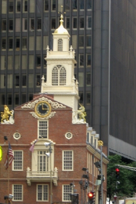

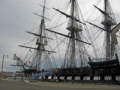
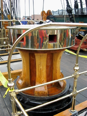
The Freedom Trail crosses from the North End of Boston (where we managed to fortify ourselves with some of the delicious Italian food it’s famous for) across the Charles River to Bunker Hill and ends at the USS Constitution in the old Navy Yards. There were ranger talks at Bunker Hill and an active duty sailor took us on the tour of the USS Constitution, the oldest Commissioned ship in the Navy. It was a fascinating tour, and equally amazing that all of this was available free to the public.


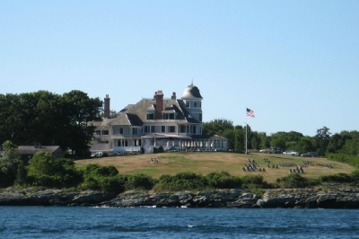
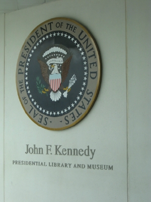
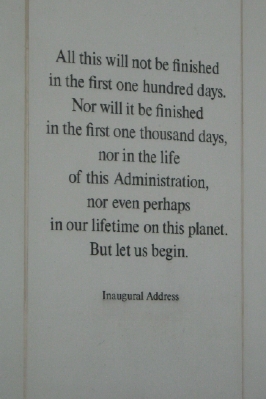
On our 3rd day, we traveled out to the JFK Library, which was an easy subway ride to a free shuttle. It is located on the Univ. of Massachusetts campus overlooking Boston Harbor, with a breathtaking water view. Dedicated in 1979, the library takes you back to the days leading up to the Kennedy presidency, through its almost 3 years and the legacy he left behind. It is a fascinating place.
Newburyport
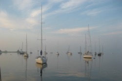
After 2-1/2 days in Boston, we headed north on the final leg of our journey north. We decided to skip a planned side trip to Gloucester in favor of a single ride to Newburyport. The Merrimac River has a fierce current when it is against you, and we wanted to time our entry right. We left Boston harbor early on a grey Thursday morning and headed round Cape Ann toward the mouth of the Merrimac River. Shortly into our journey, we started hearing warnings from the Coast Guard about entering the river today. The bar that crosses its mouth, combined with east winds and four foot swells was making for treacherous conditions for small craft. We called Fred to confirm that it was wise to enter in these conditions, and he said the Coast Guard was being extra cautious due to a capsized, heavily-loaded 19ft boat the week before. We decided to continue on.
After 2-1/2 days in Boston, we headed north on the final leg of our journey north. We decided to skip a planned side trip to Gloucester in favor of a single ride to Newburyport. The Merrimac River has a fierce current when it is against you, and we wanted to time our entry right. We left Boston harbor early on a grey Thursday morning and headed round Cape Ann toward the mouth of the Merrimac River. Shortly into our journey, we started hearing warnings from the Coast Guard about entering the river today. The bar that crosses its mouth, combined with east winds and four foot swells was making for treacherous conditions for small craft. We called Fred to confirm that it was wise to enter in these conditions, and he said the Coast Guard was being extra cautious due to a capsized, heavily-loaded 19ft boat the week before. We decided to continue on.
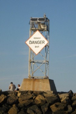
The winds picked up some as we approached the mouth of the river, but it and the large swells we’d had all day were coming at our stern. We couldn’t see anything ahead that told us to change our minds, and we knew the current had shifted by this time in our favor. We were soon to learn what the warning was about. As we came within a few hundred yards of the entrance jetties, the depth dropped to only a few feet, and we were smacked by a wave on our stern that caused Dave to work to regain our course. It was the only one that did that, but we could see why a smaller boat could have been in trouble.
Once inside the river, we passed easily through the opening Rt. 1 Bridge and found ourselves shortly on a mooring at the Merri-Mar Yacht Basin. Fred rode out with Jay on the launch to welcome us in. It was great to see him again. We hurried to get ashore and were reunited with, not only Fred, but Skip and Cherylle from Eleanor M. Pat joined us later when her workday was done. It was a few days before we were able to see Dave and Donna from Merlin, when we joined them for supper.
Once inside the river, we passed easily through the opening Rt. 1 Bridge and found ourselves shortly on a mooring at the Merri-Mar Yacht Basin. Fred rode out with Jay on the launch to welcome us in. It was great to see him again. We hurried to get ashore and were reunited with, not only Fred, but Skip and Cherylle from Eleanor M. Pat joined us later when her workday was done. It was a few days before we were able to see Dave and Donna from Merlin, when we joined them for supper.
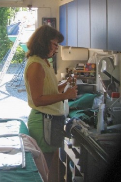
Pat at work in her truck
Putting Pat to Work
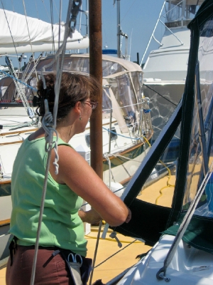
On Saturday, Pat began taking measurements for our enclosure. She took notes on what we wanted and how we used the cockpit for sailing and to access the rest of the deck. We took off the bimini to allow her to stitch zippers on the edge that would be the point of attachment for the enclosure, which she did quickly and returned the same day.
The next day, she returned with some plastic to create a pattern of the enclosure, which would allow her to cut and stitch together the glass and material for the next fitting. We installed the fixtures to ensure that they aligned with the pattern and then she went back to work on the job of building the enclosure.
We had decided to completely enclose the cockpit, and this meant a number of considerations for getting in and out of it. We finally decided to switch the direction of the zippers on the aft side in order to make it easier to exit the cockpit that way. This meant the bimini had to come down again to do this.
While we were waiting for Pat and Angela to construct the enclosure, we took her advice and cleaned and waterproofed the bimini. This required us to take it off and put it back on a third time. We were getting good at this.
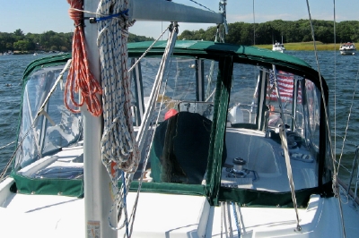
On Wednesday, Pat arranged for us to tie up on the dock to enable her to do several fittings more easily. Jay (owner of the marina) made this happen, even helping us with the move from mooring ball to slip, using the currents to navigate Orion sideways in the fairway. It was amazing. After taking another fitting with all the panels in place, Pat made some notes for the final adjustments. By Thursday afternoon, the entire enclosure was done, transforming the appearance of Orion both from within and without. The new strataglass is amazing clear and easy to see through. And the lines of the enclosure are clean and form-fitting to look at. We were thrilled.
As Pat predicted we would, we are fumbling with the zippers a bit and getting used to the need to undo them to get out of the cockpit, but the extra protection they provide is something that will be greatly appreciated as we face the colder weather coming over the next few weeks.
On Saturday, Pat began taking measurements for our enclosure. She took notes on what we wanted and how we used the cockpit for sailing and to access the rest of the deck. We took off the bimini to allow her to stitch zippers on the edge that would be the point of attachment for the enclosure, which she did quickly and returned the same day.
The next day, she returned with some plastic to create a pattern of the enclosure, which would allow her to cut and stitch together the glass and material for the next fitting. We installed the fixtures to ensure that they aligned with the pattern and then she went back to work on the job of building the enclosure.
We had decided to completely enclose the cockpit, and this meant a number of considerations for getting in and out of it. We finally decided to switch the direction of the zippers on the aft side in order to make it easier to exit the cockpit that way. This meant the bimini had to come down again to do this.
While we were waiting for Pat and Angela to construct the enclosure, we took her advice and cleaned and waterproofed the bimini. This required us to take it off and put it back on a third time. We were getting good at this.
On Wednesday, Pat arranged for us to tie up on the dock to enable her to do several fittings more easily. Jay (owner of the marina) made this happen, even helping us with the move from mooring ball to slip, using the currents to navigate Orion sideways in the fairway. It was amazing. After taking another fitting with all the panels in place, Pat made some notes for the final adjustments. By Thursday afternoon, the entire enclosure was done, transforming the appearance of Orion both from within and without. The new strataglass is amazing clear and easy to see through. And the lines of the enclosure are clean and form-fitting to look at. We were thrilled.
As Pat predicted we would, we are fumbling with the zippers a bit and getting used to the need to undo them to get out of the cockpit, but the extra protection they provide is something that will be greatly appreciated as we face the colder weather coming over the next few weeks.

Engine leaks and other stuff
While we were on the dock, Dave asked Jay to look at our engine to check out a few things and suggest changes we might need to make. We had a leak that had just started to appear that Jay determined to be a fuel leak. Also, we had been adding more oil between oil changes that Jay suggested might be caused by the 30 weight oil we’ve been using. We subsequently changed the oil to a heavier 15W40. Next week, Jay plans to zero in on the source of the fuel leak and remove and clean the injectors to see if this, plus the oil change will solve the problem of adding oil.
While we were on the dock, Dave asked Jay to look at our engine to check out a few things and suggest changes we might need to make. We had a leak that had just started to appear that Jay determined to be a fuel leak. Also, we had been adding more oil between oil changes that Jay suggested might be caused by the 30 weight oil we’ve been using. We subsequently changed the oil to a heavier 15W40. Next week, Jay plans to zero in on the source of the fuel leak and remove and clean the injectors to see if this, plus the oil change will solve the problem of adding oil.
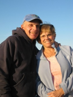
Skip and Cherylle from Eleanor M
The Merri-Mar Community
It’s hard to describe the welcoming atmosphere at the Merri-Mar Yacht Basin. Dave had only been ashore a few minutes before he was engaged with Skip in a discussion about the work he is doing on the engine. Then he joined Debra to give her an overview of the capabilities of her charting software. This led to many more exchanges of advice and help between Pat and Fred, Skip and Cherylle, Dave and Donna, Jay and Debra and us. We joined a community of boaters for a “dinghy drift” on the river Saturday night, where we tied our dinghy to about 8 others, passed hor d’ouvres and shared stories. Dave, from Merlin took us on an historic tour of downtown Newburyport. We’ve been offered the generous use of Pat’s truck. It’s endless. We have tried, in return, to make ourselves useful to the others here. The effect has been to make us feel at home and very welcome.
It’s hard to describe the welcoming atmosphere at the Merri-Mar Yacht Basin. Dave had only been ashore a few minutes before he was engaged with Skip in a discussion about the work he is doing on the engine. Then he joined Debra to give her an overview of the capabilities of her charting software. This led to many more exchanges of advice and help between Pat and Fred, Skip and Cherylle, Dave and Donna, Jay and Debra and us. We joined a community of boaters for a “dinghy drift” on the river Saturday night, where we tied our dinghy to about 8 others, passed hor d’ouvres and shared stories. Dave, from Merlin took us on an historic tour of downtown Newburyport. We’ve been offered the generous use of Pat’s truck. It’s endless. We have tried, in return, to make ourselves useful to the others here. The effect has been to make us feel at home and very welcome.
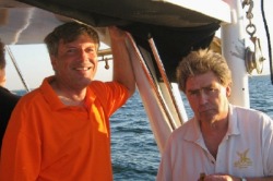
Dave and Fred
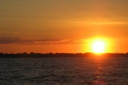
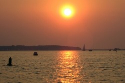
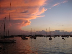
Sunset over Plum Island
Planning to head south
At one point, we were hoping to head north to Maine, but it’s too late in the season to make that happen. So, we are trying to make plans to head back south, hoping to join some others on the way. We have met Roger and Amy on Shango, who will be leaving the 2nd week in September along Donna and Dave from Merlin. Jay and Debra from Jedora will be leaving about the same time, but traveling straight outside to Norfolk – a little too aggressive for us. And Fred is still considering his plans. We’ll see what we come up with. In the meantime, we are enjoying our stay in this very welcoming community, among many friends.
At one point, we were hoping to head north to Maine, but it’s too late in the season to make that happen. So, we are trying to make plans to head back south, hoping to join some others on the way. We have met Roger and Amy on Shango, who will be leaving the 2nd week in September along Donna and Dave from Merlin. Jay and Debra from Jedora will be leaving about the same time, but traveling straight outside to Norfolk – a little too aggressive for us. And Fred is still considering his plans. We’ll see what we come up with. In the meantime, we are enjoying our stay in this very welcoming community, among many friends.