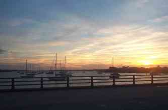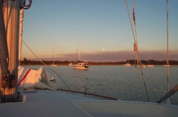
Boats anchored at Mile Hammock on Camp Lejeune
We have had a full moon most of the last week. You might think that's interesting to us because it makes for beautiful pictures. Or maybe because Halloween has just come and gone and the eerie behavior one associates with it. Or maybe because it makes the night so much brighter so that we can see to navigate.
No. None of those.
It's interesting to us because a full moon makes for much higher -- and lower -- tides. With these higher tides also come stronger ebb and flood currents, which we got to experience firsthand as we anchored near the inlet at Wrightsville Beach.
No. None of those.
It's interesting to us because a full moon makes for much higher -- and lower -- tides. With these higher tides also come stronger ebb and flood currents, which we got to experience firsthand as we anchored near the inlet at Wrightsville Beach.
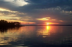
South River Sunset
Civilization
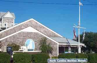
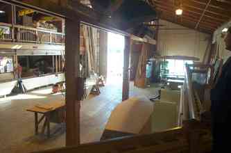
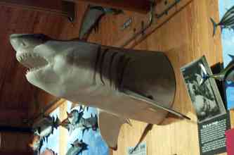
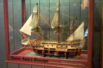
We moved further south in NC this week, back into cell phone range and therefore closer to the hum of civilization. After anchoring near Oriental, NC on South River (a tributary of the Neuse River where Oriental sits), we headed toward Beaufort, which is on the coast, just south of the Outer Banks. (The ferry to Ocracoke departs from the mainland a short distance from Beaufort). Beaufort and Morehead City face each other across the Newport River. The Morehead City side is a commercial port with its large ocean-going ships arriving via the Beaufort Inlet. Beaufort is more of a sailor's town, with its popular waterfront shops and docks. We stayed at the Beaufort Town Docks, which allowed us easy access to the Front Street attractions, including the NC Maritime Museum and Clawson's 10 cent shrimp on Friday night.
We moved further south in NC this week, back into cell phone range and therefore closer to the hum of civilization. After anchoring near Oriental, NC on South River (a tributary of the Neuse River where Oriental sits), we headed toward Beaufort, which is on the coast, just south of the Outer Banks. (The ferry to Ocracoke departs from the mainland a short distance from Beaufort). Beaufort and Morehead City face each other across the Newport River. The Morehead City side is a commercial port with its large ocean-going ships arriving via the Beaufort Inlet. Beaufort is more of a sailor's town, with its popular waterfront shops and docks. We stayed at the Beaufort Town Docks, which allowed us easy access to the Front Street attractions, including the NC Maritime Museum and Clawson's 10 cent shrimp on Friday night.
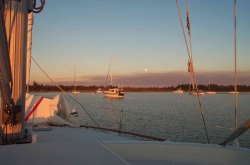
Mile Hammock anchorage: It doesn't convey the closeness we felt with 25 boats.
The trip from Beaufort to Wrightsville Beach is another long narrow stretch, with limited places to stop along the way. That found us Sunday night in Mile Hammock, an anchorage in the middle of the Marine's Camp Lejeune. We had spoken to a boater one day ahead of us who had stayed there with 13 boats, and thought it crowded, but manageable. We were joined by 24 other boats, one of which was anchored between us and our anchor. Luckily the high winds of the day died down to reduce the potential for any of us to swing or drag into each other.
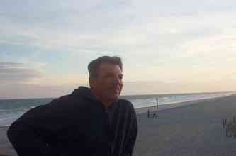
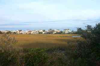
We finished the week at Wrightsville Beach, where we sat one night at anchor and the rest at Seapath Marina. We are within walking distance from the beach, which allowed us to take a walk just before sunset on one of the warmer evenings.
We finished the week at Wrightsville Beach, where we sat one night at anchor and the rest at Seapath Marina. We are within walking distance from the beach, which allowed us to take a walk just before sunset on one of the warmer evenings.
Tides - Gotta love 'em
Of the 2 days we spent in Beaufort (waiting out some high winds associated with an approaching cold front -- And I mean cold) -- we spent most of the time re-provisioning and trying to lay out the next leg of our route. This is becoming very time-consuming, because as we talk to other boaters and read the various publications about the current condition of the waterway. There are numerous areas of shallow water, which need to be carefully navigated. For a period of time, we weren't sure whether we could clear some of the shallower sections that we would pass as we left Beaufort. David spent hours mapping out the trickier sections, usually near ocean inlets, trying to map a safe course through them. That brings us back to tides. Once we passed from the Neuse River through the Adams Creek Canal into the Newport River near Beaufort, the tides on the waterway were once again being driven by the ocean, rather than the wind (which had been the case since we left Norfolk). We went from less than a foot of tidal variation, to over 4 feet, as the water surges in and out of the ocean inlets. This would help us in some of the shallow spots and make others unnervingly thin. The tidal currents also had to be factored into the timing of our overall journey as well as the approaches to the 4 opening bridges between Beaufort and Wrightsville Beach. The tidal currents could add or subtract 3 knots from our speed. You didn't want to be too close to a bridge that wouldn't open soon, with the current pushing you toward it. Our poorest planning happened as we approached the Wrightsville Beach bridge, which opens only on the hour. We cleared the prior bridge at its 12:30 opening. We thought it ludicrous to think we could cover 4.5 nautical miles (the distance to Wrightsville) in a half hour for the 1pm opening, so we cut back our speed to try for the 2pm opening. Too late, we discovered, we were being pushed by 3.5knots of current. Many of the sailboats who were with us made the 1pm opening. We, on the other hand, had to actually turn around and travel north bound for 20 minutes to counter the effects of the current. It could have been worse however. We passed another boat that had to sail all the way from Beaufort to Wrightsville, because their engine kept overheating. That meant fighting the current and managing the narrow channels under sail. Ouch!
Of the 2 days we spent in Beaufort (waiting out some high winds associated with an approaching cold front -- And I mean cold) -- we spent most of the time re-provisioning and trying to lay out the next leg of our route. This is becoming very time-consuming, because as we talk to other boaters and read the various publications about the current condition of the waterway. There are numerous areas of shallow water, which need to be carefully navigated. For a period of time, we weren't sure whether we could clear some of the shallower sections that we would pass as we left Beaufort. David spent hours mapping out the trickier sections, usually near ocean inlets, trying to map a safe course through them. That brings us back to tides. Once we passed from the Neuse River through the Adams Creek Canal into the Newport River near Beaufort, the tides on the waterway were once again being driven by the ocean, rather than the wind (which had been the case since we left Norfolk). We went from less than a foot of tidal variation, to over 4 feet, as the water surges in and out of the ocean inlets. This would help us in some of the shallow spots and make others unnervingly thin. The tidal currents also had to be factored into the timing of our overall journey as well as the approaches to the 4 opening bridges between Beaufort and Wrightsville Beach. The tidal currents could add or subtract 3 knots from our speed. You didn't want to be too close to a bridge that wouldn't open soon, with the current pushing you toward it. Our poorest planning happened as we approached the Wrightsville Beach bridge, which opens only on the hour. We cleared the prior bridge at its 12:30 opening. We thought it ludicrous to think we could cover 4.5 nautical miles (the distance to Wrightsville) in a half hour for the 1pm opening, so we cut back our speed to try for the 2pm opening. Too late, we discovered, we were being pushed by 3.5knots of current. Many of the sailboats who were with us made the 1pm opening. We, on the other hand, had to actually turn around and travel north bound for 20 minutes to counter the effects of the current. It could have been worse however. We passed another boat that had to sail all the way from Beaufort to Wrightsville, because their engine kept overheating. That meant fighting the current and managing the narrow channels under sail. Ouch!
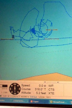
Anchor track from Fugawi
Holding Our Ground
Our worst experience with the tidal currents happened while we were at anchor in Wrightsville Beach. The glut of boats that left Beaufort with us were mostly headed to the popular anchorage near the bridge in Wrightsville Beach. We decided that it was too tight for us to anchor safely in this spot, so we moved further down the channel nearer the ocean inlet. There were only 2 boats anchored here, making it much roomier. But the water was much deeper (22 to 25 feet), so we would be required to deploy all of our 130 feet of anchor chain plus 80 feet of line to achieve the right anchoring ratio. We had not anchored on anything but all chain the entire year, so this would be a little different. Also, tidal current appeared to be having more of an effect in determining which way the boat would point, than the wind, which usually controls this in the Chesapeake. After setting the anchor and confirming it was holding, we decided to keep a close watch. The strength of the current was unsettling, and the boat didn't "feel" right. It wasn't long before we noticed also that we had never settled in to the same swing pattern as our neighbors. David was up most of the night (and Cathy to a lesser degree) trying to ensure we didn't move beyond a reasonable swing radius. Sometime around 10pm, another boat came in and anchored very near us, so near that David could talk to him from the deck. He encouraged him to move further away, given our long scope. The boat moved a little, but the tired crew obviously had no energy for a complete re-setting of the anchor. Apparently, though, they came to the same conclusion the next morning when, just before 5am, they pulled their anchor and re-set it further away. Once daylight came, we spent time fixing breakfast and working on various projects until we could move to the marina around 10am. But something was wrong. We were uncomfortably close now to the sailboat that had moved further from us the night before. Also, we were at 90 or 180 degree angles to the other boats. It made no sense. When Cathy went on deck to start the engine to pull anchor, it became more apparent that something was very wrong. The anchor line was extremely tight and was angled from the bow backwards. David couldn't move it at all. Cathy tried edging the boat forward and then backward to release the tension. Nothing. Dave then tried releasing more line. It only had the effect of allowing us to slip closer to the boat behind us. The current was now so strong coming at our beam (side), that we were actually heeling under its pressure, but we were powerless to move at all. We were a couple of hours beyond high tide. It seemed likely that the line was caught around the keel of the boat. But, how tangled was it? What options did we have to free ourselves? There was the unsettling thought that we might have to cut the line to free ourselves, but that would mean sacrificing all of our primary ground tackle (anchor, chain and line). Also, could we gain control of the boat fast enough if we did that with all this current? The Wrightsville Beach Coast Guard was close by, so we hailed them and asked for advice. They directed us to call "commercial maritime assistance", so we called TowBoat US. At about this time, we saw our friends on the sailboat Jade leaving for the day. We waved to them to get their attention. It took a second for them to realize, we weren't just waving to be friendly. They immediately guessed the same thing we had suspected -- that the anchor line was wrapped around the keel. They eased our minds greatly by saying that TowBoat US would likely be able to push us around and free us. Also, they said we weren't as close as to the neighboring boat as it felt. The TowBoat US operator expertly assessed and handled the situation. David showed him the track that the Fugawi software had plotted over the course of the night. We had never gone 360 degrees around, which meant it was likely that we were not wrapped more than once around the keel. The question was which way to spin us. He chose correctly with the first spin and we were free. He said he had only seen one other boat that had this happen in the 5 years he was with TowBoat US. However, we have since heard others who have experienced it firsthand. He also said that it would have been less likely to happen if we had been on all chain. Needless to say, David now has renewed interest in acquiring more chain.
Our worst experience with the tidal currents happened while we were at anchor in Wrightsville Beach. The glut of boats that left Beaufort with us were mostly headed to the popular anchorage near the bridge in Wrightsville Beach. We decided that it was too tight for us to anchor safely in this spot, so we moved further down the channel nearer the ocean inlet. There were only 2 boats anchored here, making it much roomier. But the water was much deeper (22 to 25 feet), so we would be required to deploy all of our 130 feet of anchor chain plus 80 feet of line to achieve the right anchoring ratio. We had not anchored on anything but all chain the entire year, so this would be a little different. Also, tidal current appeared to be having more of an effect in determining which way the boat would point, than the wind, which usually controls this in the Chesapeake. After setting the anchor and confirming it was holding, we decided to keep a close watch. The strength of the current was unsettling, and the boat didn't "feel" right. It wasn't long before we noticed also that we had never settled in to the same swing pattern as our neighbors. David was up most of the night (and Cathy to a lesser degree) trying to ensure we didn't move beyond a reasonable swing radius. Sometime around 10pm, another boat came in and anchored very near us, so near that David could talk to him from the deck. He encouraged him to move further away, given our long scope. The boat moved a little, but the tired crew obviously had no energy for a complete re-setting of the anchor. Apparently, though, they came to the same conclusion the next morning when, just before 5am, they pulled their anchor and re-set it further away. Once daylight came, we spent time fixing breakfast and working on various projects until we could move to the marina around 10am. But something was wrong. We were uncomfortably close now to the sailboat that had moved further from us the night before. Also, we were at 90 or 180 degree angles to the other boats. It made no sense. When Cathy went on deck to start the engine to pull anchor, it became more apparent that something was very wrong. The anchor line was extremely tight and was angled from the bow backwards. David couldn't move it at all. Cathy tried edging the boat forward and then backward to release the tension. Nothing. Dave then tried releasing more line. It only had the effect of allowing us to slip closer to the boat behind us. The current was now so strong coming at our beam (side), that we were actually heeling under its pressure, but we were powerless to move at all. We were a couple of hours beyond high tide. It seemed likely that the line was caught around the keel of the boat. But, how tangled was it? What options did we have to free ourselves? There was the unsettling thought that we might have to cut the line to free ourselves, but that would mean sacrificing all of our primary ground tackle (anchor, chain and line). Also, could we gain control of the boat fast enough if we did that with all this current? The Wrightsville Beach Coast Guard was close by, so we hailed them and asked for advice. They directed us to call "commercial maritime assistance", so we called TowBoat US. At about this time, we saw our friends on the sailboat Jade leaving for the day. We waved to them to get their attention. It took a second for them to realize, we weren't just waving to be friendly. They immediately guessed the same thing we had suspected -- that the anchor line was wrapped around the keel. They eased our minds greatly by saying that TowBoat US would likely be able to push us around and free us. Also, they said we weren't as close as to the neighboring boat as it felt. The TowBoat US operator expertly assessed and handled the situation. David showed him the track that the Fugawi software had plotted over the course of the night. We had never gone 360 degrees around, which meant it was likely that we were not wrapped more than once around the keel. The question was which way to spin us. He chose correctly with the first spin and we were free. He said he had only seen one other boat that had this happen in the 5 years he was with TowBoat US. However, we have since heard others who have experienced it firsthand. He also said that it would have been less likely to happen if we had been on all chain. Needless to say, David now has renewed interest in acquiring more chain.
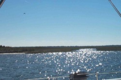
Along the waterway near Mile Hammock
It's Always Something
Whether it's docking against current or dodging traffic at bridges or getting unstuck at anchor, there's always something to keep us from getting bored. We take time off every few days to take a breather from the long days, to chat with other boaters and to stretch our legs on land.
Whether it's docking against current or dodging traffic at bridges or getting unstuck at anchor, there's always something to keep us from getting bored. We take time off every few days to take a breather from the long days, to chat with other boaters and to stretch our legs on land.
