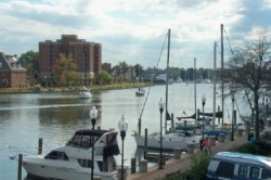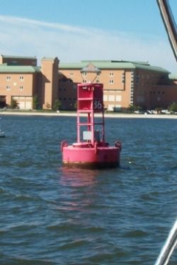
Mile Zero is located at this buoy in the Elizabeth River
Going to Carolina . . .
As we left Solomons 2 weeks ago, we hoped to be able to make enough progress along the Intra-coastal Waterway(ICW) to be in NC by October’s end. Well, we managed to make it over 100 miles south of the VA-NC border to a spot near the small coastal town of Belhaven in the Pungo River, where we sit on Halloween night. After staying put for so long in Solomons, we are adjusting to the different rhythm of moving frequently and going to places we have never visited before (or, at least, never by sea).
As we left Solomons 2 weeks ago, we hoped to be able to make enough progress along the Intra-coastal Waterway(ICW) to be in NC by October’s end. Well, we managed to make it over 100 miles south of the VA-NC border to a spot near the small coastal town of Belhaven in the Pungo River, where we sit on Halloween night. After staying put for so long in Solomons, we are adjusting to the different rhythm of moving frequently and going to places we have never visited before (or, at least, never by sea).
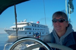
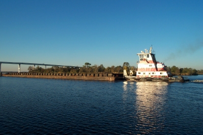
The cruise ship American Spirit passes.
Cruising
We quickly discovered that we are not the only ones traveling the ICW. It is an amazing flood of people on boats heading south – sailboats, trawlers, single-handers, couples, professional “delivery” captains. There are even cruise ships, and, of course, working boats: tugs with barges, ferries, fishermen.
We quickly discovered that we are not the only ones traveling the ICW. It is an amazing flood of people on boats heading south – sailboats, trawlers, single-handers, couples, professional “delivery” captains. There are even cruise ships, and, of course, working boats: tugs with barges, ferries, fishermen.

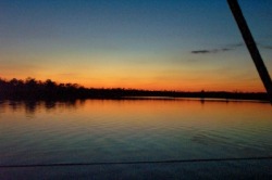
Sunset at Pungo Ferry
The ICW is a combination of natural waterways: rivers, sounds, bays, etc. and manmade canals or “land cuts” that can be narrow channels of shallow water that all of these boats must share. With the volume of boat traffic, there is a little tension between the faster power boats and the more plodding sailboats (who must spend most of the trip under power, rather than sail). The faster boats generate huge wakes, which sends the overtaken boat rocking violently when passed. However, many long timer cruisers are very polite to each other, following a protocol for passing that makes it a little easier. The overtaking vessel usually hails the slower boat on the radio, declares his intention to pass to port or starboard, and offers to “go slow” for the pass. Those who don’t offer this courtesy or at least don’t slow down and rock the waterway with their wakes are roundly criticized on the VHF radio chatter. Those sailboats that don’t want to deal with the tight quarters and the long hours of motoring can choose to “go outside”, i.e., take the ocean route south, which is something we are seriously considering for a portion of the trip.
As first-time cruisers, our trip involves a lot of research and trip planning, almost every day. We study the charts, the guides, the weather and weave together a trip plan that David then turns into a route to load into the chart plotter. On some sections of the ICW, there are very few places to stay, which increases the competition for space in these few places. We encountered this problem on our first day out, when our planned stopover in Great Bridge, VA was full. As we studied the guides, we realized that we had only 1 or 2 options with enough depth for our boat. We had to travel until late in the day to reach them, with no assurance of there being any space for us. The anchorages listed all seemed to be too shallow to accommodate us. There were only 2 marinas on the route, the first didn’t appear to have the depth for us. The 2nd was not staffed regularly, and could not be raised by phone. We called all day, and never connected to the dockmaster. Cathy finally tried a round-about way of getting information. She contacted another restaurant in the same chain in Hampton that had, until last year, operated the restaurant next to the Pungo Ferry marina. The person at the Hampton restaurant actually knew about the marina, and told us that we could stay there, even if the manager didn’t appear, and that it had the depth we would need. This confirmation came just as the marina came into view. We docked in an 18 knot wind, but we managed to tie up for the night. Of course, the manager had arrived by now, so he was available to collect the slip fees. (Funny, how that works, isn’t it?) We swore we wouldn’t be caught again if we could help it and plan our routes much more carefully, making reservations at a marina before we leave for the day, if that is our destination.
As first-time cruisers, our trip involves a lot of research and trip planning, almost every day. We study the charts, the guides, the weather and weave together a trip plan that David then turns into a route to load into the chart plotter. On some sections of the ICW, there are very few places to stay, which increases the competition for space in these few places. We encountered this problem on our first day out, when our planned stopover in Great Bridge, VA was full. As we studied the guides, we realized that we had only 1 or 2 options with enough depth for our boat. We had to travel until late in the day to reach them, with no assurance of there being any space for us. The anchorages listed all seemed to be too shallow to accommodate us. There were only 2 marinas on the route, the first didn’t appear to have the depth for us. The 2nd was not staffed regularly, and could not be raised by phone. We called all day, and never connected to the dockmaster. Cathy finally tried a round-about way of getting information. She contacted another restaurant in the same chain in Hampton that had, until last year, operated the restaurant next to the Pungo Ferry marina. The person at the Hampton restaurant actually knew about the marina, and told us that we could stay there, even if the manager didn’t appear, and that it had the depth we would need. This confirmation came just as the marina came into view. We docked in an 18 knot wind, but we managed to tie up for the night. Of course, the manager had arrived by now, so he was available to collect the slip fees. (Funny, how that works, isn’t it?) We swore we wouldn’t be caught again if we could help it and plan our routes much more carefully, making reservations at a marina before we leave for the day, if that is our destination.
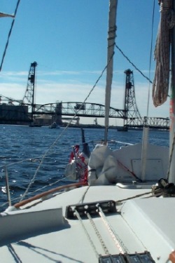
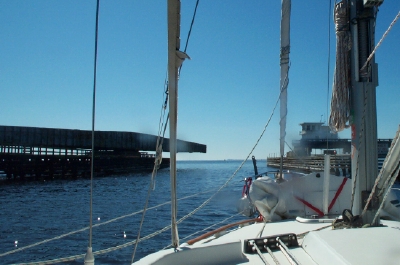
The first bridge opens on the Elizabeth River
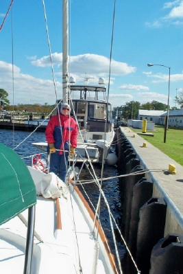
Another thing we had to learn quickly was the process for passing through various styles of opening bridges and even a canal lock.
Each bridge has its own procedures for opening and the bridge tenders are managing the demands of the boat traffic vs. the car or rail traffic in determining when to open. On the first day, in the Norfolk, VA area, we had to go through 6 opening bridges, which had the effect of clustering the boats that go through on an opening. Since we also had winds over 15 knots for most of the day, we had to carefully manage to stay close to the bridges (or lock) without running aground or into another vessel while waiting for a scheduled opening. At the Great Bridge lock, the opening for our southbound trip was delayed due to some tug boats carrying half a mile of dredge pipe headed northbound. This meant that we had even more time jockeying in the narrow space before the canal, and then we had to squeeze to the side to let the large load through as it left the canal. The actual “locking through” on the canal was done easily, thanks to skilled lock tenders assisting the boats.
Each bridge has its own procedures for opening and the bridge tenders are managing the demands of the boat traffic vs. the car or rail traffic in determining when to open. On the first day, in the Norfolk, VA area, we had to go through 6 opening bridges, which had the effect of clustering the boats that go through on an opening. Since we also had winds over 15 knots for most of the day, we had to carefully manage to stay close to the bridges (or lock) without running aground or into another vessel while waiting for a scheduled opening. At the Great Bridge lock, the opening for our southbound trip was delayed due to some tug boats carrying half a mile of dredge pipe headed northbound. This meant that we had even more time jockeying in the narrow space before the canal, and then we had to squeeze to the side to let the large load through as it left the canal. The actual “locking through” on the canal was done easily, thanks to skilled lock tenders assisting the boats.
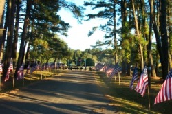
Entrance to the Moving Wall exhibit in Coinjock
What to see?
So, the trip is not all about the work.
There is much beauty in the marshes, woodlands, and waterways that we are passing as we travel the ICW. We’ve also enjoyed our ability to explore the area along the way.
Our longest stay so far was at the little town of Coinjock, NC, which appears to be the town that the ICW built. It sits on a land cut between the Currituck and Albemarle sounds and its primary businesses are 2 marinas – one on each side of the waterway. To our surprise, when we pulled into the marina, we were told that there was a big event in town through Sunday. The Vietnam Veterans memorial “Moving Wall” was at the nearby Veterans park, only a half mile from the marina. With bad weather headed our way – high winds for several day – we decided to stay for a few days, allowing us to see the Moving Wall, try some fresh NC shrimp and crab cakes, take a few bike rides with our neighbors on the dock and even enjoy the hot tub in the chilly fall air.
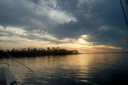
Alligator River Anchorage - Oct. 30
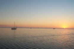
Since then we have spent a couple of nights in anchorages – one on the Alligator River and one on the Pungo River (not to be confused with Pungo Ferry 100 miles north) – which have allowed us to enjoy some beautiful sunsets and sunrises.
Slade Creek Anchorage - Oct. 31
Hello again
Another aspect of cruising is the familiar faces (and their boats) that you start to see again and again as you travel. We enjoyed some fellowship with a couple from Webster, NY (near Rochester), who were traveling on a “trawlercat” a multi-hulled trawler. They graciously shared their insights into traveling the ICW, having been doing it for 10 years. We initially met them in Hampton, and struck up a friendship over our several days in Coinjock. We hope to see them more as we leapfrog our way down the waterway. (Trawlers move much faster than sailboats.)
Another aspect of cruising is the familiar faces (and their boats) that you start to see again and again as you travel. We enjoyed some fellowship with a couple from Webster, NY (near Rochester), who were traveling on a “trawlercat” a multi-hulled trawler. They graciously shared their insights into traveling the ICW, having been doing it for 10 years. We initially met them in Hampton, and struck up a friendship over our several days in Coinjock. We hope to see them more as we leapfrog our way down the waterway. (Trawlers move much faster than sailboats.)
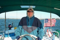
Baby, it’s cold outside
The week started out cold and very windy. We left Hampton in 30 knot winds which generated huge waves crossing Hampton Roads and, with the low temperatures, generated an amazing wind chill. Luckily the waves and winds reduced as we entered the Elizabeth River, although (as mentioned above) they still were higher than we would have liked for the tight quarters of bridge openings. However, we kept our many layers on while underway to stay warm. Cathy was motivated to do a lot of baking to take the chill off the cabin in the evening, and hot oatmeal replaced cold cereal for breakfast. Since last Tuesday, the temperatures have steadily climbed to the low 70’s, which makes for much more comfortable cruising. As temperatures inevitably decline again, we will want to make more progress south in search of warmer weather.
So, we’re waiting for our first Trick or Treater on board Orion, but we’ve been disappointed so far. We have our candy ready, just in case . . .