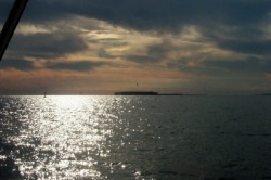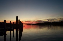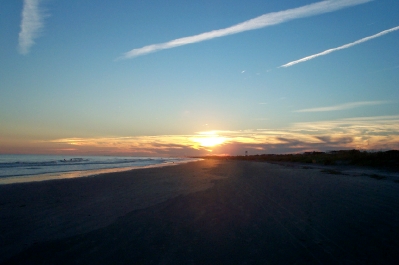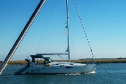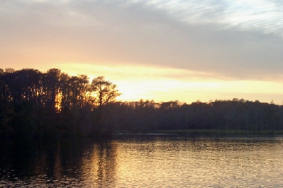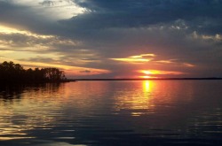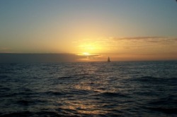
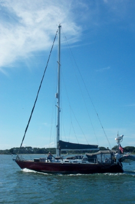
Merlin sails at sunset on the ocean
Going “Outside”
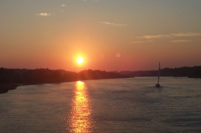
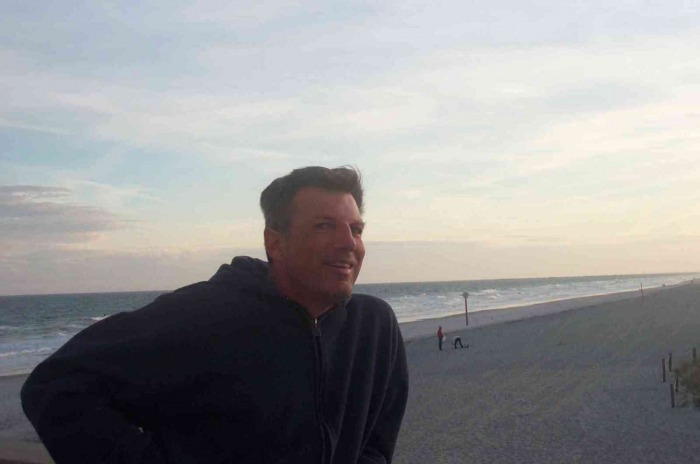
It’s been an eventful week, starting with a bountiful Thanksgiving dinner in Charleston and ending with our first ocean voyage from the Savannah River to Fernandina Beach, where we dropped anchor shortly after coming in from the all night ocean trip.
It’s been an eventful week, starting with a bountiful Thanksgiving dinner in Charleston and ending with our first ocean voyage from the Savannah River to Fernandina Beach, where we dropped anchor shortly after coming in from the all night ocean trip.
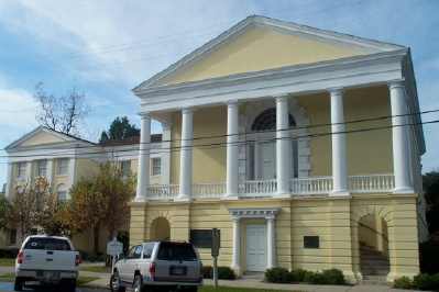
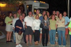
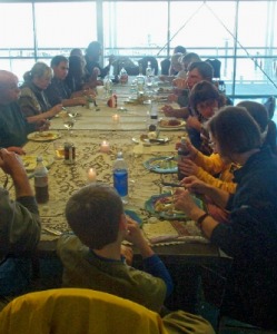
We originally had a little confusion about where we would be for Thanksgiving -- not just because it’s hard to plan very far ahead, but also because we hadn’t looked at a calendar in weeks. The effect was that we were well into November before we realized that Thanksgiving was a week earlier than we had thought. That put us in Charleston at the Maritime Center where a number of other boats had decided to wait out the nasty weather blowing through as Thanksgiving approached. We got together to organize a Thanksgiving potluck of all the boats who had no other plans for Thanksgiving. We ended up with 19 people attending. This might have been a problem, since no boat could accommodate that many people, but the dockmaster made the Maritime Center’s large meeting room and adjacent kitchen available to us (coming in on his day off to unlock it), which solved that problem. We cooked an 18 lb turkey, complete with stuffing and gravy and enjoyed a table full of side dishes and desserts along with the bird. Just as we were about to eat, the sun came out, giving us a beautiful view of Charleston Harbor to enjoy as a backdrop to our meal. We all hung around for several hours, enjoying the food and good company.
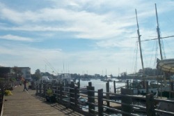
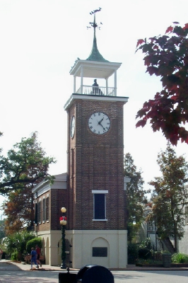
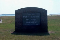
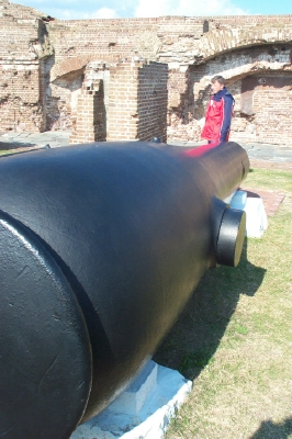
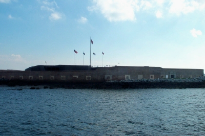
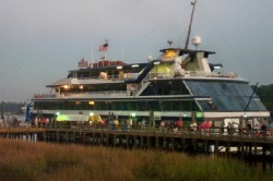
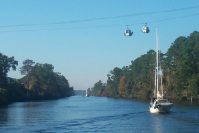
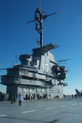
We continued to enjoy touring Charleston, taking advantage of a bus tour of the city on one of the messier weather days and then taking the water taxi over to Mt. Pleasant to tour the USS Yorktown as par t of the Naval Museum at Patriot’s Point.

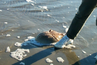
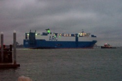
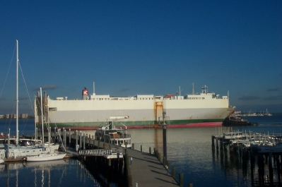
One surprise on Thanksgiving day was the activity at the busy commercial docks near the marina. The large ships docked and loaded and unloaded all day. It never ceased to amaze us as these huge vessels pivoted only feet off the pier of the Maritime Center.

Traveling Companions
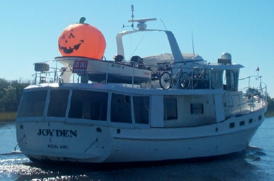
One of the benefits of sharing our Thanksgiving with fellow boaters was the ability to talk about plans for the remaining trip south. Several boats wanted to go “outside” to the ocean, especially to go around Georgia, which has long stretches of extremely low water. (Georgia has not funded the ICW maintenance and the resulting shoaling makes it a treacherous trip for keel boats like ours.) This is how we came to join 3 other boats – Marianna, Merlin, and Milano Myst – for this leg of our journey into Florida.
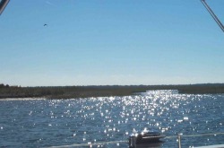
After reviewing the winds and waves for a Charleston to St. Mary’s run (about 24 hours travel time) for several days running, we were disappointed with the high winds and waves that we would face at the Florida end of the journey. So, the group of us motored south through the waterway a little further. First, to an anchorage in the Bull River, north of Beaufort, SC and then to an anchorage south of Hilton Head in Bull Creek (must be like “Mill Creek” in the Chesapeake area – a popular name). We finally decided that we had the right weather window to leave Tuesday am for a Wednesday arrival in St. Mary’s. We would head out the Tybee Roads inlet, approaching it from Calibogue Sound (after a call to Boat US to confirm this approach). Leaving at noon, we expected to arrive around 8am in the Fernandina Beach anchorage.
One of the benefits of sharing our Thanksgiving with fellow boaters was the ability to talk about plans for the remaining trip south. Several boats wanted to go “outside” to the ocean, especially to go around Georgia, which has long stretches of extremely low water. (Georgia has not funded the ICW maintenance and the resulting shoaling makes it a treacherous trip for keel boats like ours.) This is how we came to join 3 other boats – Marianna, Merlin, and Milano Myst – for this leg of our journey into Florida.
After reviewing the winds and waves for a Charleston to St. Mary’s run (about 24 hours travel time) for several days running, we were disappointed with the high winds and waves that we would face at the Florida end of the journey. So, the group of us motored south through the waterway a little further. First, to an anchorage in the Bull River, north of Beaufort, SC and then to an anchorage south of Hilton Head in Bull Creek (must be like “Mill Creek” in the Chesapeake area – a popular name). We finally decided that we had the right weather window to leave Tuesday am for a Wednesday arrival in St. Mary’s. We would head out the Tybee Roads inlet, approaching it from Calibogue Sound (after a call to Boat US to confirm this approach). Leaving at noon, we expected to arrive around 8am in the Fernandina Beach anchorage.


Getting Ready
Having never gone offshore before, we were grateful for the guidance of the more experienced sailors we were now traveling with.
First there was a constant check of the weather and sea conditions along the entire route. We used NOAA, some information from the buoys about wind and waves in the ocean and the additional weather information that the other cruisers had access to via paid services.
Once we had to decided to make the run, we ran through a checklist of things to do to prepare for the trip, which included running jacklines, securing anything on deck that might come loose (to remove any need to go forward during the trip), having food prepared for snacks and meals and to have PFD’s and tethers out and ready to wear once we passed the inlet.
We found out we were unprepared in one aspect, which was lighting. It’s important to restrict the amount of white light shining at night, so that your night vision isn’t restricted. This means having red light flashlights and red covers for dome lights. We scrambled around the boat looking for ways of covering the lights. We discovered some plastic lids in the galley that looked like they might work. We taped them over the lights and hoped it would hold. Our only red flashlight was a head light that had a red setting. It would have to do.
So, what was it like?
We were grateful that the weather warmed up considerably for our trip into the ocean. With only a bimini over our cockpit, we are very exposed to the elements. Cold, rain and wind can make our lives miserable. Although it rained a little throughout the night, it was only a light rain, and therefore manageable. We did have to be careful keeping any item on deck covered with plastic.
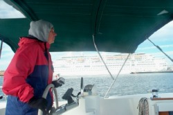
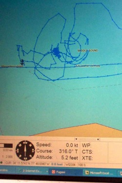
After some discussions with other boaters, Dave decided to increase our engine rpm’s to allow our speed to better match that of the other boats in our group. We had been holding to 2400rpm’s at the advice of our other boaters, but this seemed to be slowing down the whole group. He raised it to 2600 rpm’s. Having made this change, we realized soon after we made it out past the effects of the tidal current, that we were on track for a 1:30am arrival at Fernandina Beach. Since no one wanted to enter an inlet at night, we decided to change our destination to St. Augustine. This would make for a noon arrival, putting us 60 more miles down the coast. Dave redid our route for the new destination, so we were set.
The wave action was not “ideal” according to our fellow cruisers, who would have preferred a Northeast wind and associated waves. The winds had shifted to the east, causing the waves to approach on our side, magnifying the rolling effect. This first affected Dave, who took a pill early on to counter the effects of spending too much time below on some tasks, such as adjusting the route. After a couple of hours, he was fine. However, Cathy woke from an early nap to find she was getting overwhelmed by the rolling. Too late, she realized she needed to take some medicine too. However, it took 2 episodes of losing her stomach before the medicine had any effect. This forced Dave to stay up all night. By 2 or 3am, the medicine took effect and Cathy was able to take the helm.
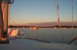
Part of the reason for the seasickness was the increasing wind intensity and wave height as day turned to night. We lacked the radar to see the weather, but we were told by our traveling companions about 30 knot squalls surrounding us as we traveled. About midnight, the call came out to consider returning to our original destination of Fernandina Beach. Although this meant a nighttime arrival, it seemed preferable to the alternative of an additional 12 hours of turmoil on the ocean. We carefully lined up behind Merlin to head into the inlet. The St. Mary’s channel is well lit and therefore better than many for a nighttime transit. However, that’s not to say it wasn’t confusing, distinguishing one set of marks from another and ensuring which were the lights of the boats ahead. We carefully used the GPS and radio communication to each other as we navigated up the inlet. The waves refused to calm down until we were well inside the breakwater. We had to contend with shrimp boats leaving the inlet to begin their day around 5:30am, and a dredger positioned to the right of a critical turn with a bright light on. Then, the well-lit paper plant in Fernandina beach nearly obliterated the lights of the buoys and other boats at a point where we had to make some critical turns. We finally reached the anchorage around 6am, still before sunup, but, unlike our companions, we couldn’t find a spot to anchor with enough swing room and the right depth, until about 7am, when other boats started leaving the anchorage to start their day. We collapsed shortly after setting anchor, grateful to be at the end of the voyage and safe.
Florida
So we are enjoying the warmer weather here in Florida and plan to enjoy some more time with the folks from Merlin, Marianna, and Milano Myst as we continue south before we go our separate ways.
Having never gone offshore before, we were grateful for the guidance of the more experienced sailors we were now traveling with.
First there was a constant check of the weather and sea conditions along the entire route. We used NOAA, some information from the buoys about wind and waves in the ocean and the additional weather information that the other cruisers had access to via paid services.
Once we had to decided to make the run, we ran through a checklist of things to do to prepare for the trip, which included running jacklines, securing anything on deck that might come loose (to remove any need to go forward during the trip), having food prepared for snacks and meals and to have PFD’s and tethers out and ready to wear once we passed the inlet.
We found out we were unprepared in one aspect, which was lighting. It’s important to restrict the amount of white light shining at night, so that your night vision isn’t restricted. This means having red light flashlights and red covers for dome lights. We scrambled around the boat looking for ways of covering the lights. We discovered some plastic lids in the galley that looked like they might work. We taped them over the lights and hoped it would hold. Our only red flashlight was a head light that had a red setting. It would have to do.
So, what was it like?
We were grateful that the weather warmed up considerably for our trip into the ocean. With only a bimini over our cockpit, we are very exposed to the elements. Cold, rain and wind can make our lives miserable. Although it rained a little throughout the night, it was only a light rain, and therefore manageable. We did have to be careful keeping any item on deck covered with plastic.
After some discussions with other boaters, Dave decided to increase our engine rpm’s to allow our speed to better match that of the other boats in our group. We had been holding to 2400rpm’s at the advice of our other boaters, but this seemed to be slowing down the whole group. He raised it to 2600 rpm’s. Having made this change, we realized soon after we made it out past the effects of the tidal current, that we were on track for a 1:30am arrival at Fernandina Beach. Since no one wanted to enter an inlet at night, we decided to change our destination to St. Augustine. This would make for a noon arrival, putting us 60 more miles down the coast. Dave redid our route for the new destination, so we were set.
The wave action was not “ideal” according to our fellow cruisers, who would have preferred a Northeast wind and associated waves. The winds had shifted to the east, causing the waves to approach on our side, magnifying the rolling effect. This first affected Dave, who took a pill early on to counter the effects of spending too much time below on some tasks, such as adjusting the route. After a couple of hours, he was fine. However, Cathy woke from an early nap to find she was getting overwhelmed by the rolling. Too late, she realized she needed to take some medicine too. However, it took 2 episodes of losing her stomach before the medicine had any effect. This forced Dave to stay up all night. By 2 or 3am, the medicine took effect and Cathy was able to take the helm.
Part of the reason for the seasickness was the increasing wind intensity and wave height as day turned to night. We lacked the radar to see the weather, but we were told by our traveling companions about 30 knot squalls surrounding us as we traveled. About midnight, the call came out to consider returning to our original destination of Fernandina Beach. Although this meant a nighttime arrival, it seemed preferable to the alternative of an additional 12 hours of turmoil on the ocean. We carefully lined up behind Merlin to head into the inlet. The St. Mary’s channel is well lit and therefore better than many for a nighttime transit. However, that’s not to say it wasn’t confusing, distinguishing one set of marks from another and ensuring which were the lights of the boats ahead. We carefully used the GPS and radio communication to each other as we navigated up the inlet. The waves refused to calm down until we were well inside the breakwater. We had to contend with shrimp boats leaving the inlet to begin their day around 5:30am, and a dredger positioned to the right of a critical turn with a bright light on. Then, the well-lit paper plant in Fernandina beach nearly obliterated the lights of the buoys and other boats at a point where we had to make some critical turns. We finally reached the anchorage around 6am, still before sunup, but, unlike our companions, we couldn’t find a spot to anchor with enough swing room and the right depth, until about 7am, when other boats started leaving the anchorage to start their day. We collapsed shortly after setting anchor, grateful to be at the end of the voyage and safe.
Florida
So we are enjoying the warmer weather here in Florida and plan to enjoy some more time with the folks from Merlin, Marianna, and Milano Myst as we continue south before we go our separate ways.