SV Orion - Annapolis, MD
dieters@sv-orion.com
  • Home
  • About
  • Logs
    • Current
    • Past Logs >
      • 2022
      • 2021
      • 2020
      • 2019
      • 2016 - 2018 >
        • 2018
        • 2017
        • 2016
      • 2010 - 2015 >
        • 2015
        • 2014
        • 2013
        • 2012
        • 2011
        • 2010
      • 2004 - 2009 >
        • 2009
        • 2008
        • 2007
        • 2006 >
          • 2006 Getting Ready
          • 2006 Chesapeake Bay
          • 2006 ICW
        • 2005
        • 2004
  • Galleries
    • Orion Jr
    • Orion (sold 2016)
    • RV's >
      • Cougar 25RES
      • Puma 253FBS (sold 2021)
    • Champion Generator
  • Specifications
    • Orion Jr.
    • Orion >
      • Specifications - Overview
      • Specifications - Navigation
      • Specifications - Ground Tackle
      • Specification - Electrical Power
      • Specification - Engine
  • Favorites
  • Dist'n List
  • Contact
  • Discounts

Dec. 13-31 - Christmas Vacation

12/31/2006

1 Comment

 
Picture
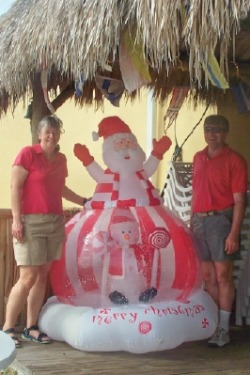
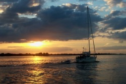
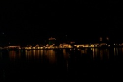
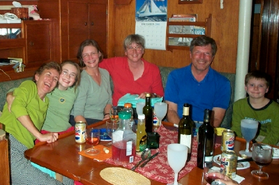
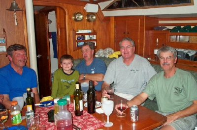
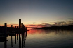
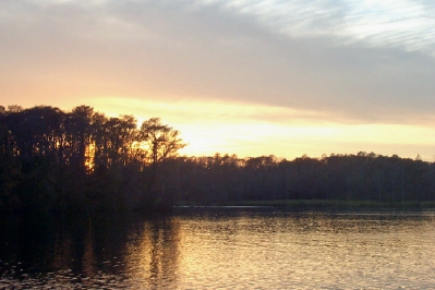
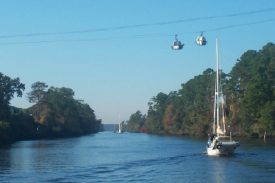
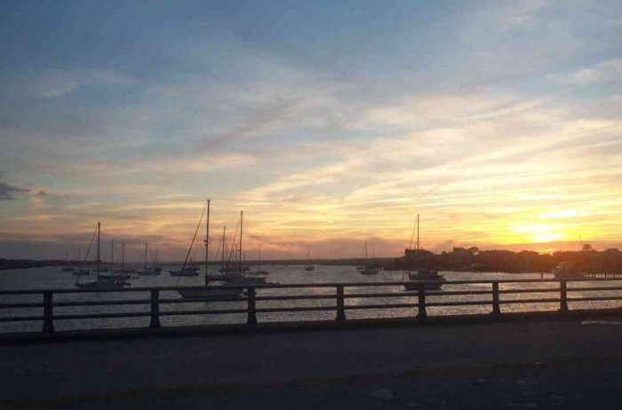
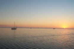
We traveled almost 3000 miles in the last 2 weeks of 2006, visiting family and friends in New York, Virginia, and North Carolina before returning to Florida just before New Year’s Eve. Pat and Fred, our friends (and currently neighbors) on Marianna, flew back to New Hampshire for the holidays and were back just in time to celebrate New Year’s eve at Nettles Island. We were delighted to find that Donna and Dave on Merlin came to Nettles Island from Vero Beach on New Year’s eve, so that we could bring in 2007 together.  

Preparing to Leave
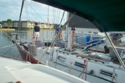
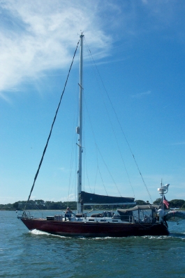
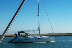
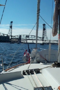
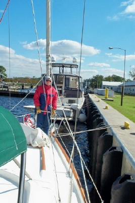
We were told when we pulled into Nettles Island Marina that we were not in our permanent slip and would have to move Orion before we left for the holidays. This was becoming problematic, since the wind refused to die down enough for us to feel a move could be done safely. Also, it wasn’t apparent that the marina knew where we were to go.  

We ended up moving to a slip much too big for us that was up against the inside corner of the fairway. This can be a particularly tricky maneuver, since we needed to back into the slip to ensure our electric lines would reach, but stay off the dock in the process of turning. We finally were able to move in lighter winds the morning before we planned to depart to points north. We were thankful for many helpful hands on the dock to ease Orion into her slip.  

Given the roomy slip, Dave spent a long time working on the lines to ensure Orion was centered in the slip, and therefore unlikely to bounce against either pier or piling during the weeks we would be away. When he proudly displayed his accomplishment, Cathy viewed the 5 foot gap between the boat and pier, with much less than the enthusiastic praise he was expecting.  

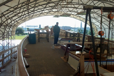
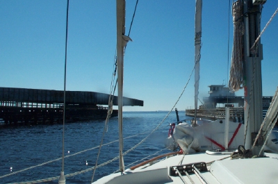
Given the fixed docks at Nettles, the difficulty of hanging fenders in exactly the right position to protect from bashing into the vertical pilings is tricky. Getting it wrong means you can end up with some big gouges in the hull. A fellow slipholder at Nettles was making a fender board for himself and asked if we wanted one as well. How could we refuse? The fender board is placed on the outside of 2 fenders, and takes the impact with the piling, distributing the force to both fenders. It expands the horizontal coverage of the fenders to several feet, ensuring they will take the impact.  

Christmas Gifts  
Amidst all the shopping for Christmas gifts (which had to be crammed into the few days with access to the car or done online), we also continued to look at the requirements for an extended stay in the Bahamas, where almost everything, from food staples to spare parts are either difficult to find or very expensive or (more likely) both. The mantra for a trip to the Bahamas is, if you need it, take it with you.  

Dave consulted with Fred on Marianna and Dave on Merlin to come up with some additions to the engine spare parts that we already carried. The likelihood of needing to replace a clogged fuel filter or impeller while underway on the ocean is high, due to the stirring up of the fuel tanks by a rough passage. The difficulty of doing anything in rough weather at sea was brought home by our most recent trip on the ocean.   To make this easier, it was recommended that we get a spare water pump, complete with a bracket and impeller to simplify the replacing of an impeller. Similarly, we needed a fuel filter bowl for our Racor fuel filter. This could be assembled with the filter in advance and simply swapped for the clogged engine filter when underway. Fuel problems could clog the injector, which prompted us to order one of these as well.  

Ongoing maintenance required us to order additional Racor fuel filters (we carry 5 spare on board now, 1 assembled) and oil filters (we have 5 spare).   When ordering these from Bayshore Marine, they recommended a spare bleed screw as well, which, of course, we ordered.  

We were starting to have some more problems with the engine starting on the starter battery, which we had suspected might be due to the rebuilt starter installed in May. So, Dave ordered a new starter to eliminate this as a possible reason for the problems, which would also give us a spare.  

Fuel and water are harder to get in the Bahamas, so it makes sense to carry more on board. We had enough gas cans for this purpose (to fuel the generator and dinghy), but lacked the number we felt we needed for diesel and water. Although we could find the diesel cans many places, they were often outrageously expensive. We finally found some at a small auto parts store in Emporia, VA. The water cans are hard to find, but we stumbled across a K-mart that carried them in Pennsylvania, as we traveled back from NY.  

Our computer is a critical tool on the boat, since we do all our route planning, e-mail, boat inventories, website updates, DVD watching, etc. on it. It has needed a new battery since late October, but we didn’t actually receive the replacement until just before Christmas. That was the best gift we could have gotten.   

Finally, we knew that we needed to order the Explorer Charts for the Bahamas, which cruisers swear by.  

Luckily, all of our purchases arrived before we headed back to the boat for Christmas.  

Autopilot Woes
A few weeks after installing the autopilot, we noticed that the autopilot’s compass was varying widely from the actual compass, sometimes by as much as 70 degrees! We finally contacted Raymarine about this, who suggested we send them the computer for a software upgrade. We disconnected this, realizing that now none of our Raymarine instruments (wind speed/direction, depth, boat speed, etc.) would work with it gone. The Raymarine tech looked at the computer, but found nothing wrong with it. So, although we have it safely back in our hands, we’re not sure what to do next.  

The odd thing was that the last trip from Vero Beach to Nettles showed very little deviation between the compass and the Autopilot. Cathy is speculating that this is because there were some electrical cords that had been left in the compartment next to the compass, which were removed at Vero Beach. We’ll have to see whether this theory holds true.    

Doctor, Doctor

We made one more trip to the doctor to get a 2nd round of immunization shots and to have Cathy’s often-irritated eyes looked at. Her allergies have been unrelenting and it has taken a toll on her eyes. The doctor prescribed some drops, which helped tremendously.  

Based on the recommendation of an experienced sailor who was also a doctor, we had asked for and received prescriptions for a small number of medications that would be critical for survival if help was several days away. However, based on the recommendations of this sailor-doctor, we had them made out in the name of the boat. The logic was that this would be the boat’s medical supplies and they would be dispensed only if needed and prescribed by contact with a physician. By not having them in one person’s name, they could legally be used for either of us. The problem came in trying to fill the prescriptions. We tried in several states and were told that it was actually illegal for the pharmacy to fill the prescriptions as written. We therefore asked our doctor to make out the prescriptions to each of us.  

Christmas Celebrations
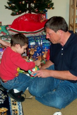
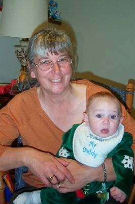
We enjoyed spending time with our son’s family and Dave’s family in New York, getting to see our older grandson, Droz, in his first school concert and getting to hold our younger grandson, Jayden, while he’ll still let us. 
Picture
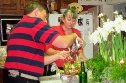
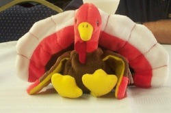
Christmas Day brought an unwelcome discovery of a bad tire on our rental car and the lack of available options to remedy it for another couple of days. We negotiated additional rental days to be added to the contract for the trouble (we had to have 2 new tires added, a puncture fixed in a 3rd and get it aligned). It didn’t stop us from moving onto NC to celebrate Christmas with Cathy’s family (thanks to Bonnie and Troy who drove). Cathy’s older sister even roped the 2 of us into making a dessert trifle, from scratch no less. It was an amazing thing to see the number of steps and ingredients involved in making something like this. It did taste good, though.

We were also welcome guests with our friend Cookie in our old neighborhood in Virginia, whose hospitality we enjoyed for an evening on our way to Rochester.  

Happy New Year
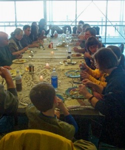
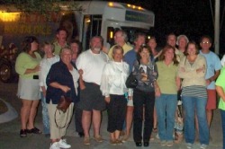
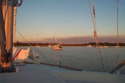
So we managed to stay up to midnight and bring in the New Year with our boating friends in Nettles Island. We now turn our attention to getting ready for the next leg of our journey as we head south and (probably) east.    

1 Comment

Dec. 6-12 - Christmas on Nettles Island

12/12/2006

1 Comment

 
Picture
As expected, we are at Nettles Island Marina, just south of Fort Pierce, where Orion will spend the next month, as we travel to see family. After spending several days in Vero Beach, we traveled here on Monday and plan to leave later this week to drive north.  

“Velcro” Beach

Vero Beach has a city marina with several dozen mooring balls that are popular stopping spots for cruisers headed to the Bahamas or just further south in Florida. With a free bus service that picks up right at the marina, boaters have an easy trip to a variety of stores that make provisioning easy. The marina is so popular, that they “raft” boats on a mooring ball, meaning that there can be 2, 3 or even 4 boats lashed to each other and with a pennant attached to the mooring ball. Each Wednesday, there is also a “Cruisers Breakfast”, which is attended by the boaters in the marina and local boaters as well. The friendly community makes many cruisers stay for longer than they originally intended, earning Vero Beach the nickname “Velcro” Beach.  

We took advantage of the bus to go grocery shopping, with some side trips to the Dollar Store and West Marine. Cathy joined Pat from Marianna to tour the Vero Beach Art Museum, which was a short walk from the marina as well. We could easily have become one more of the “stuckees”.

Picture
Rafting up to Merlin in Vero Beach
Rafting Up

Since we were still traveling with Marianna and Merlin (2 of the 3 traveling companions from the previous weeks), we planned to raft together on one of the mooring balls. This was the first time we had rafted, so we were grateful to be sharing the mooring with friends.   Merlin was chosen to be the center boat, with Orion to her port and Marianna to starboard. Both boats put out fenders to ensure both boats were well protected from each other. We also had to ensure our masts were not lined up so that any rocking would not cause the shrouds (metal wires holding the mast from the side) to get tangled with those of another boat. The approach of the 2nd and 3rd boats requires delicate handling, since the middle boat will tend to move away as you approach from the push of your bow wave. With Donna and Dave on Merlin assisting us, we had no trouble hooking up. Due to our experience back in Georgetown, Md in the summer, we were also prepared with our own pennant to attach to the mooring ball, which Dave attached using the dinghy. 

Picture
Liddy sits on Merlin
Being so close to each other requires some “rafting etiquette” to ensure you don’t intrude on the privacy of your neighbors. This was less of problem for us, since we were rafted with friends. The poor folks on Merlin also had to endure traffic across their bow as we traipsed back and forth to visit with Marianna and vice versa. Merlin’s cat took advantage of the proximity to explore the other boats. 

We had planned to stay at Vero Beach for several days, which turned out to be a good idea, since the weather turned nasty after we arrived and just about the time the shuttle launch was originally planned (more about that later). This gave us time for the guys to share expertise between them on engine maintenance, power systems, computer software and eBay shopping (guess who was the expert on that!). We also managed one dinner with all 6 of us, hosted by Merlin.  

Catching Up
We were thrilled to catch up with 2 couples in Vero Beach that we had met much earlier in our trip. Doris and Russ from Ragtime who had helped us with docking Orion back in Solomons were staying at the pier in Vero Beach. We joined them for lunch one day. Also, Betty and Gary from Pumpkin, who had been in Coinjock, NC with us and who had been sharing information about the “road ahead” as they traveled a few days ahead of us, were there on a mooring. They invited us over for dinner our first night there, which was a real treat. Milano Myst finally arrived on Sunday, so we got to see them for a little bit before our Monday departure.  

Lift-off
The space shuttle launch, delayed from Thursday for bad weather was rescheduled for Saturday evening, but the weather forecast was giving only a 30% chance of a successful launch. We were enjoying a game of dominos on Merlin, when we suddenly realized that launch time had arrived. We dashed on deck to see the sky lit up in the north behind the low clouds as if the sun was setting all over again. The folks on Milano Myst described a more spectacular sight from their vantage point in Cocoa Beach. It was as if it was daytime all over again, as the shuttle rockets fired and it lifted off. They were glad they had waited for the 2nd try.  

Boat Stuff
We were delayed a day leaving Vero Beach when Cathy found the transmission oil dipstick had come apart in her hands the night before our planned departure. (Dave, it just happened.) As happens with all things of this nature, it was a Saturday night, so there was little we were going to do before Monday. Dave managed to find a local Yanmar dealer and did get a response from Karl, our mechanic back in Annapolis, who suggested some ways to close the hole if we couldn’t find the part immediately. He also had one in stock and was willing to ship it to us if we couldn’t find one locally. We even heard from another individual who had reported the same problem on a website, who described how to temporarily fix the existing one and where to look for a new one. Luckily the Vero Beach dealer had one in stock (although they didn’t have any of the other spare parts Dave was looking for), so we still managed to get away early enough to get to Nettles by mid-afternoon.  

A more persistent problem had begun back in Georgetown, SC, when the oven stopped working. It would light, but wouldn’t come up to temperature. With some time available at Nettles, we managed to disassemble the oven, reset the air vent and clean out the burner. It now works better than it ever did. (And Cathy was able to finally clean all around it. Boy, did it need it!)

Picture
Merry Christmas
Here at Nettles Island Marina, there is a “Tiki Bar”, where the residents gather each evening to socialize and enjoy a cocktail. It is decorated for Christmas, complete with a snowglobe Santa. It seems that in Florida, they’re dreaming of snow. While in Rochester, where they get the snow, they’re dreaming of warm weather in Florida. Sigh! We’ll be experiencing some of both before we return from our holiday travels in the new year.  

Happy Holidays to you and yours.

1 Comment

Nov. 29 - Dec. 5 - Fernandina Beach to Cocoa Beach

12/5/2006

0 Comments

 
Picture
Marianna leaving Cocoa Beach at sunrise
Fernandina Beach to Cocoa Beach  

We were back on the ICW all of this week traveling south in Florida, as the weather continued its warming trend. We still haven’t ditched the sweatshirts and jeans, but our shorts and T-shirts are starting to see more use.

Picture
Nights at Anchor
We’ve done far more anchoring in the 2 weeks since we left Charleston than we have ever done at a single stretch. We’ve been relieved that all of it has been without another anchor drag incident. However, our traveling companions have not been so lucky.  

We left Fernandina Beach on Thursday, planning to travel only to Pine Island, 10 miles short of St. Augustine. However, the group was buoyed by the time made in the morning under a favorable current and decided to push on to St. Augustine. This was against Cathy’s better judgment, since the guidebooks said the anchorage was usually full, and the holding could be a problem. We had already had problems in the crowded Fernandina Beach anchorage finding a spot to anchor with enough swing room and the right depth.  The St. Augustine anchorage is also right in front of the inlet and has a 5 foot tidal range, so the current was going to be impressive. Sure enough, the 2nd half of our trip was slowed by the current, delaying our arrival in St. Augustine until just before sunset. The anchorage was already crowded with boats (as we feared) and there was a strong 15+ knot wind from the South. So, there was little time before dark to find a spot to drop the hook where we would not swing into something.   

We were one of only 2 of our group of boats to find a spot in the anchorage on the north side of the opening bridge at St. Augustine. (The others waited for the 5:30 opening, with one anchoring on the south side and one taking a slip at the marina.) We hastily circled our spot before another boat could take it, and set the anchor with enough swing room to keep us out of the next boat over, the daymark to the south and the shallow water to the north. However, in the frenzy of anchoring, Cathy didn’t set the anchor alarm on the GPS at the right location of the anchor. (Once set, it can’t be reset without pulling up and dropping the anchor a second time.) This meant that the anchor alarm was likely to go off when we swung with the change in current. When we set anchor, the current and winds were both from the south. The tidal change was around 10:30, with the current shift about an hour and a half later. We were relieved when the shift came and went and we barely moved at all, meaning we were being held by our chain, not the anchor. Good news.! This gave us the confidence to leave the boat to explore St. Augustine the next day.   

After touring St. Augustine on Friday, as we were preparing to return to the boat in early afternoon, Fred on Marianna learned from his friend on Windfall, that their two boats had swung wildly during the last tide change and that Marianna was now bow into Windfall. We scurried back to the anchorage to find 2 dinghies towing Marianna away from Windfall. Fred and Pat worked for the next hour setting and re-setting the anchor, but were not completely satisfied that it was holding. With a storm approaching, they wanted to be sure. Dave had driven their dinghy back to our boat with the plan that he would return it once the anchor was set. Just as the storm loomed on the horizon, Fred called Dave to bring the dinghy back so he could set a 2nd anchor. Dave stayed and helped set the anchor (a learning experience for Dave) and then Fred returned him back to Orion. The storm passed us by without much impact and everything continued to hold. 
  

We stayed in St. Augustine for another day and half, but never regained the confidence to leave the boats at anchor to go into town. The changing winds and erratic current were not having predictable effects on the boat swing pattern. For example, when the winds shifted to the North, the same direction as the flood tide current, Orion dropped back dramatically on the full length of its chain, setting off the anchor alarm as Cathy expected it would.. The combined effect of tide and wind made the many boats in the anchorage swing in unusual directions, and not always in the same direction. As a result, later on Saturday another boat swung into Windfall.   
 

We were grateful that Orion’s anchor held, and after setting the 2 anchors, so did Marianna’s, but we didn’t get much sleep Friday and Saturday night keeping watch over it. Tuesday night’s anchoring experience at Cocoa Beach was much more pleasant. We arrived earlier. There was lots of room, and the tidal current effect was negligible. We slept a lot better there.  

Going Ashore

We did enjoy our time in Fernandina, St. Augustine and Daytona Beach.  

Fernandina is a surprisingly quant little town on the water. Surprising because the waterfront on either end of town is dominated by 2 paper plants.   

We had visited St. Augustine by land before, so we didn’t spend time at the fort that is its major landmark this time. We strolled the streets up to the Sailor’s Exchange, a consignment store similar to Bacon Sails in Annapolis. We had fun exploring the rows of shelves, stuffed with everything you could imagine that a sailor would want.  St. Augustine was developed as a resort by Henry Flagler, who also brought the railroad along the full length of Florida (to enable guests to get to his resorts). Flagler College is one of the more distinctive buildings in St. Augustine’s historic district. We were sorry that the famous Bridge of Lions is currently under a serious multi-year renovation, so that we couldn’t see it from the water. A temporary lift bridge sits beside it (pretty substantial for a temporary bridge) that will serve until the reconstruction is complete.

We managed to find more than race cars in Daytona, when we stopped at Angell and Phelp’s Chocolate Factory right on Beach St. downtown. They give a tour , showing the actual candy making in process. The tour was made all the more worthwhile by the free samples at the end. We, of course, purchased more to eat. The chocolate-covered cherries were especially good. We also found Indian River Fruits, also on Beach St., to buy some sweet, fresh Florida oranges that we will enjoy for a while.
Picture
Motorailing on the Mosquito Lagoon north of the shuttle launch site.
On our way to Cocoa Beach, we passed closest to the shuttle launch site at Cape Canaveral. The shuttle Discovery was already on the launch pad, readied for its Dec. 7th nighttime launch. A 72-hour ban on water traffic around the launch site was in effect when we passed by, but did not affect the Intracoastal Waterway itself. We actually had the first good winds and course for sailing that day, which allowed us to deploy our headsail to pick us some speed. (Plus it looks so good.)

Picture
 It’s definitely the holiday season in Florida, with lots of Christmas lights on both buildings and boats. St. Augustine had a particularly pretty display on the historic buildings near the anchorage.

Goodbye Dinner
Tuesday night was going to be the last night that all four boats in our group would be together. Rob and Carole (and the children Dayla and Daniel) on Milano Myst would be remaining in Cocoa Beach to see the shuttle launch close up. The rest of us were traveling on to Vero Beach on Wednesday. The group all had a sense of humor and the chatter on the radio broke up the long stretches under way.   We got together with everyone on Marianna for a meal together. It had been a good 2 weeks traveling together.
900 miles
We’re approaching the 900 mile mark on the ICW, which is a long way to travel, especially at 6 knots. It took almost 2 months for the temperatures to approach what they were when we left Solomons back on Oct. 18th. As Christmas approaches we will be headed to Nettles Island Marina in Fort Pierce, where Orion will rest for a month as we go north to visit family for the holidays. Our next entry should find us there.
0 Comments

Nov. 22-28 - Outside

11/28/2006

0 Comments

 
Picture
Merlin sails at sunset on the ocean
Going “Outside”  
It’s been an eventful week, starting with a bountiful Thanksgiving dinner in Charleston and ending with our first ocean voyage from the Savannah River to Fernandina Beach, where we dropped anchor shortly after coming in from the all night ocean trip. 

Picture
We originally had a little confusion about where we would be for Thanksgiving -- not just because it’s hard to plan very far ahead, but also because we hadn’t looked at a calendar in weeks. The effect was that we were well into November before we realized that Thanksgiving was a week earlier than we had thought. That put us in Charleston at the Maritime Center where a number of other boats had decided to wait out the nasty weather blowing through as Thanksgiving approached. We got together to organize a Thanksgiving potluck of all the boats who had no other plans for Thanksgiving. We ended up with 19 people attending. This might have been a problem, since no boat could accommodate that many people, but the dockmaster made the Maritime Center’s large meeting room and adjacent kitchen available to us (coming in on his day off to unlock it), which solved that problem. We cooked an 18 lb turkey, complete with stuffing and gravy and enjoyed a table full of side dishes and desserts along with the bird.   Just as we were about to eat, the sun came out, giving us a beautiful view of Charleston Harbor to enjoy as a backdrop to our meal. We all hung around for several hours, enjoying the food and good company.

Picture
We continued to enjoy touring Charleston, taking advantage of a bus tour of the city on one of the messier weather days and then taking the water taxi over to Mt. Pleasant to tour the USS Yorktown as par t of the Naval Museum at Patriot’s Point.
One surprise on Thanksgiving day was the activity at the busy commercial docks near the marina. The large ships docked and loaded and unloaded all day. It never ceased to amaze us as these huge vessels pivoted only feet off the pier of the Maritime Center. 
Traveling Companions
One of the benefits of sharing our Thanksgiving with fellow boaters was the ability to talk about plans for the remaining trip south. Several boats wanted to go “outside” to the ocean, especially to go around Georgia, which has long stretches of extremely low water. (Georgia has not funded the ICW maintenance and the resulting shoaling makes it a treacherous trip for keel boats like ours.) This is how we came to join 3 other boats – Marianna, Merlin, and Milano Myst – for this leg of our journey into Florida.   

After reviewing the winds and waves for a Charleston to St. Mary’s run (about 24 hours travel time) for several days running, we were disappointed with the high winds and waves that we would face at the Florida end of the journey. So, the group of us motored south through the waterway a little further. First, to an anchorage in the Bull River, north of Beaufort, SC and then to an anchorage south of Hilton Head in Bull Creek (must be like “Mill Creek” in the Chesapeake area – a popular name). We finally decided that we had the right weather window to leave Tuesday am for a Wednesday arrival in St. Mary’s. We would head out the Tybee Roads inlet, approaching it from Calibogue Sound (after a call to Boat US to confirm this approach). Leaving at noon, we expected to arrive around 8am in the Fernandina Beach anchorage.   
Getting Ready
Having never gone offshore before, we were grateful for the guidance of the more experienced sailors we were now traveling with.   

First there was a constant check of the weather and sea conditions along the entire route. We used NOAA, some information from the buoys about wind and waves in the ocean and the additional weather information that the other cruisers had access to via paid services.   

Once we had to decided to make the run, we ran through a checklist of things to do to prepare for the trip, which included running jacklines, securing anything on deck that might come loose (to remove any need to go forward during the trip), having food prepared for snacks and meals and to have PFD’s and tethers out and ready to wear once we passed the inlet.   

We found out we were unprepared in one aspect, which was lighting. It’s important to restrict the amount of white light shining at night, so that your night vision isn’t restricted. This means having red light flashlights and red covers for dome lights. We scrambled around the boat looking for ways of covering the lights. We discovered some plastic lids in the galley that looked like they might work. We taped them over the lights and hoped it would hold. Our only red flashlight was a head light that had a red setting. It would have to do.  

So, what was it like?  

We were grateful that the weather warmed up considerably for our trip into the ocean. With only a bimini over our cockpit, we are very exposed to the elements. Cold, rain and wind can make our lives miserable. Although it rained a little throughout the night, it was only a light rain, and therefore manageable. We did have to be careful keeping any item on deck covered with plastic.   
After some discussions with other boaters, Dave decided to increase our engine rpm’s to allow our speed to better match that of the other boats in our group. We had been holding to 2400rpm’s at the advice of our other boaters, but this seemed to be slowing down the whole group.   He raised it to 2600 rpm’s.  Having made this change, we realized soon after we made it out past the effects of the tidal current, that we were on track for a 1:30am arrival at Fernandina Beach. Since no one wanted to enter an inlet at night, we decided to change our destination to St. Augustine. This would make for a noon arrival, putting us 60 more miles down the coast. Dave redid our route for the new destination, so we were set.
  

The wave action was not “ideal” according to our fellow cruisers, who would have preferred a Northeast wind and associated waves. The winds had shifted to the east, causing the waves to approach on our side, magnifying the rolling effect. This first affected Dave, who took a pill early on to counter the effects of spending too much time below on some tasks, such as adjusting the route. After a couple of hours, he was fine. However, Cathy woke from an early nap to find she was getting overwhelmed by the rolling. Too late, she realized she needed to take some medicine too. However, it took 2 episodes of losing her stomach before the medicine had any effect. This forced Dave to stay up all night. By 2 or 3am, the medicine took effect and Cathy was able to take the helm.  

Part of the reason for the seasickness was the increasing wind intensity and wave height as day turned to night. We lacked the radar to see the weather, but we were told by our traveling companions about 30 knot squalls surrounding us as we traveled. About midnight, the call came out to consider returning to our original destination of Fernandina Beach. Although this meant a nighttime arrival, it seemed preferable to the alternative of an additional 12 hours of turmoil on the ocean. We carefully lined up behind Merlin to head into the inlet. The St. Mary’s channel is well lit and therefore better than many for a nighttime transit. However, that’s not to say it wasn’t confusing, distinguishing one set of marks from another and ensuring which were the lights of the boats ahead.   We carefully used the GPS and radio communication to each other as we navigated up the inlet. The waves refused to calm down until we were well inside the breakwater. We had to contend with shrimp boats leaving the inlet to begin their day around 5:30am, and a dredger positioned to the right of a critical turn with a bright light on. Then, the well-lit paper plant in Fernandina beach nearly obliterated the lights of the buoys and other boats at a point where we had to make some critical turns.   We finally reached the anchorage around 6am, still before sunup, but, unlike our companions, we couldn’t find a spot to anchor with enough swing room and the right depth, until about 7am, when other boats started leaving the anchorage to start their day. We collapsed shortly after setting anchor, grateful to be at the end of the voyage and safe.  

Florida

So we are enjoying the warmer weather here in Florida and plan to enjoy some more time with the folks from Merlin, Marianna, and Milano Myst as we continue south before we go our separate ways.  
0 Comments

Nov. 15-21 - Charleston and Georgetown

11/21/2006

0 Comments

 
Picture
We’re now in Charleston, after having spent 2 nights in Georgetown, SC and one in Isle of Palms on the way. We’ve had some weather extremes this past week with high’s in the 70’s and lows in the 30’s, winds up to 49 knots. And then there was “thundersnow” (?!) in Charleston. (A little different from “lake effect” from our Rochester days.) Apparently, this was a first. Charleston’s never had snow this early. Lucky us. We’ve been able to spend some time with family and have started up new friendships as we blend in with another wave of southbound cruisers.

Picture
Entering Charleston with the NCL Cruise ship at dock
Picture
Harborwalk at Georgetown
Georgetown
We had one nice warm day to tour in Georgetown before the winds blew. We had heard good things about this small town and were not disappointed. After an easy docking at Hazzard Marine, a few blocks from downtown Georgetown, we took a walk and explored the town. So many of the town’s historic houses have been preserved, that almost every house has a historic marker. Along Front Street, the main street along the harbor, are shops, restaurants and marinas, many of which are directly off the Harborwalk, a boardwalk along the river. 

Picture
Fish being packed for market
Georgetown is also a working port, with fisherman coming and going from the town’s harbor, as well as large ships and barges serving the 2 main industrial plants – a steel mill and a paper plant.  (One of the barges we passed on our first day on the waterway was on its way here with scrap metal.) The fishing boats mean fresh seafood. We purchased some wonderful local shrimp from a store right next to our marina. It was delicious! 

Our second day at Georgetown, the wind blew the balmy temperatures away and churned up the harbor, causing some problems for a few of the many boats anchored in the harbor. We just had to deal with the waves churned up in the harbor by the 45+ knot winds. We decided to use the time to get some chores done. We changed the oil, since we had motored almost 100 hours (!) since we last changed it in Solomons. We had also started having problems with the oven, which would no longer come up to temperature. David spent time adjusting the air flow on the oven, which improved its performance, but hasn’t fixed the problem. 

Picture
Sunrise from our slip on the ICW
Isle of Palms  
We decided to stop just short of Charleston on our trip south after leaving Georgetown. It’s a 60 mile trip, which ends in the busy Charleston harbor. We weren’t interested in doing that at night. The trip along the Winyah Bay and along the marshes of the Frances Marion National Park was a beautiful one, albeit a little chilly. We were glad that we decided to leave Georgetown on a rising tide, since the water along this stretch would have been very shallow at low tide.

We arrived in Isle of Palms by mid-afternoon, in time to take a walk on the beach and enjoy some good food at Morgan Creek Grill, next to our marina.

Picture
NCL Majesty at the dock in Charleston
Charleston
We left early Saturday morning from Isle of Palms for the short (2 hour) trip to Charleston, since the opening Ben Sawyer Swing Bridge was on request if we made it before 9am. We were in good company as we entered the Charleston harbor, following a cruise ship which docked just south of our marina. 

When we turned from the ICW north up the Cooper River, we faced the impressive 3+ knots of current of the ebb tide. We chugged up the river, closing in on the marina and facing some impressively large container ships headed out to sea (luckily in the other channel). As Cathy turned into the marina, she quickly realized the current was overpowering her steering and forcing the boat too close to the south side of the opening. She gunned it (as much as you can do that in a sailboat) and went into the marina at near full speed, only to have to turn into the slip shortly after entering. We did it, but it’s always good to have help on the dock, which came in the form of Grant, the dockmaster, a gracious host with a dry humor.

Picture
New Ravenel Bridge over the Cooper River
The Charleston Maritime Center is just south of the new Ravenel suspension bridge and close to much of the Charleston downtown as well as right beside the Fort Sumter terminal and the SC Aquarium. It is also wedged between 2 commercial docks where large container ships load and unload their cargo. It was an amazing sight to see them pull in and out so close to the end of our pier.

Picture
Cargo ship makes its way down the Cooper River
Picture
As we headed out to explore the first day, we were delighted to discover a ship-building project of the SC Maritime Museum, the schooner Spirit of South Carolina, right across the street. We were encouraged to explore the project by climbing aboard and below the boat under construction. It is scheduled to be launched in February and (hopefully) rigged and ready for sail when the tall ships arrive in May. 

Picture
We spent one afternoon touring Fort Sumter, which was an interesting tour. Both the ranger talks and the museum exhibits were fascinating descriptions of the events leading up to the firing upon Fort Sumter and the thinking of both sides as they made the final moves that embroiled the nation in a Civil War.

Picture
Family and Friends  
Cathy has 2 cousins living in Charleston and it was a joy to be able to spend time with them and their families. (Their arrival at the Maritime Center was made all the more exciting by a large 150foot fishing boat crashing into the marina’s fuel dock in a fumbled attempt to dock. It ended up splitting a giant piling in 2.)   One of her second cousins sings in the choir at St. Phillips Episcopal in downtown Charleston. We decided to join him for the services on Sunday morning.

Picture
St. Phillips Cemetery sign has an amusing reference to the many ghost tours in the city.
Picture
Bum's Rest passing us on the ICW
We were pleased to find that our Charleston neighbors would be the sailboat Whim, a couple cruising from Camden, Maine. We had originally met them in Myrtle Beach and then kept running into them along the way -- at Wacca Wache, Georgetown and, now, Charleston.  They had to head north to attend to some business at home, so while the winds blew in the cold front for several days, we watched over their boat.  It was also a surprise to hear from Lunasea (aka Chris and Margaret from Solomons Island) on the radio as we entered Charleston harbor. They were headed out from Charleston to the ocean as we headed into the harbor. When they heard us hailing the marina on the radio, they hailed us and we caught up with their plans. They headed south to St. Mary’s.  In Georgetown, we met a couple from New Jersey on another Beneteau, Bum's Rest.  Their boat had been fitted with a swing keel which allowed them to reduce their draft to just under 3 feet, a big plus on the waterway. 

So, we are weathering yet another storm, but are once again tied up safely in a slip as we wait for the weather to clear for our further journey south.

0 Comments

Nov. 8-14 - Gamblin on the High Seas

11/14/2006

0 Comments

 
Picture
Casino Boat
We finally made it “outside” into the ocean for the first time this past week.   Of course, it wasn’t in our boat, but rather a SunCruz casino boat that operates in Little River, SC. We were probably more fascinated by the navigation of the Little River inlet than the splendors of the gambling casinos inside the boat. How we ended up on this boat is a bit of a story in itself.     

Read on.    

Cape Fear Yacht Club Weekend
After we left Wrightsville Beach, we spent a night in Southport, NC at South Harbor Village Marina. While there, we met a couple of boaters who invited us to join them as their yacht club traveled to Little River for the weekend.   At first, we thought they were just being friendly, but after they repeated their invitation a couple of times, we took them seriously, and decided to join them. There was a group of both power boats and sailboats – 18 in total – traveling south. We realized too late that they were all taking the outside route from Cape Fear Inlet to Little River Inlet. We had wanted to go out to the ocean with some company for a while now, and were kicking ourselves for missing the opportunity. At any rate, we joined them at the Myrtle Beach Yacht Club in Coquina Harbor that evening, after traveling the ICW past the last of the NC beaches – Ocean Isle, Holden, and Sunset Beach.   

Picture
Triumphant Gamblers Return
The weather was perfect for the Veterans Day weekend – unseasonably warm and sunny, light winds. We spent the evening getting to know some of the other members of the Yacht Club and then enjoying a bountiful pot luck dinner along with the fellowship. On Saturday, we joined them for a gambling cruise aboard a casino boat that went out the Little River Inlet to the ocean (past the 3 mile limit) for a few hours of gambling. The boat ride and lunch were free, along with $10 a piece to gamble. (Since we’re not big gamblers, we left with much of the $20.) It was fascinating watching this huge vessel transit the inlet to the ocean, which it did with ease. (We learned that it had gone aground in the inlet only a week before.) We decided that we could have navigated this inlet, after having seen it done.  

After returning to our marina, we shared some pizza, snacks and wine with many of the club members, who had included us so graciously. We said goodbye the next morning as they left to brave a windy Sunday trip back to Southport, promising to stay in touch. It was a truly generous group of people that included us in their circle for the weekend.

Moving on
We decided to aim for Charleston by the end of the week, so our route was planned to cover this distance and to avoid bad weather in the process.   With time taken out to let weather pass, we made a short hop to Barefoot Landing Marina, which is attached to a wonderful shopping park in Myrtle Beach. We even found a breakfast buffet with a buy-one –get-one free coupon at House of Blues. Cool!  

Then it was on to Wacca Wache Marina on the Waccamaw River near Pawley’s Island, a relatively isolated spot, followed by another short day into Georgetown, SC.

The more notable “challenges” on the ICW this week varied from the last remaining Pontoon Bridge at Sunset Beach to the “Rock Pile”, a narrow, rocky section near Myrtle Beach and the currents and shoaling at the various inlets in NC. None were as scary as the many guides made them out to be. 
The trip wasn’t without some humor as well. Such as the trawler still celebrating Halloween with a huge jack-o-lantern on its deck and the golfers crossing the waterway in cablecars near Myrtle Beach.
And some astonishing beauty as well – the fall foliage, rare for this part of the coast – and a sailboat snatching the last winds of a beautiful Indian summer day.
0 Comments

Nov. 1-7 - Full Moon

11/7/2006

0 Comments

 
Picture
Boats anchored at Mile Hammock on Camp Lejeune
We have had a full moon most of the last week. You might think that's interesting to us because it makes for beautiful pictures. Or maybe because Halloween has just come and gone and the eerie behavior one associates with it. Or maybe because it makes the night so much brighter so that we can see to navigate.

No. None of those.

It's interesting to us because a full moon makes for much higher -- and lower -- tides. With these higher tides also come stronger ebb and flood currents, which we got to experience firsthand as we anchored near the inlet at Wrightsville Beach.  

Picture
South River Sunset
Civilization
We moved further south in NC this week, back into cell phone range and therefore closer to the hum of civilization. After anchoring near Oriental, NC on South River (a tributary of the Neuse River where Oriental sits), we headed toward Beaufort, which is on the coast, just south of the Outer Banks.   (The ferry to Ocracoke departs from the mainland a short distance from Beaufort). Beaufort and Morehead City face each other across the Newport River. The Morehead City side is a commercial port with its large ocean-going ships arriving via the Beaufort Inlet. Beaufort is more of a sailor's town, with its popular waterfront shops and docks. We stayed at the Beaufort Town Docks, which allowed us easy access to the Front Street attractions, including the NC Maritime Museum and Clawson's 10 cent shrimp on Friday night.


Picture
Mile Hammock anchorage: It doesn't convey the closeness we felt with 25 boats.
The trip from Beaufort to Wrightsville Beach is another long narrow stretch, with limited places to stop along the way. That found us Sunday night in Mile Hammock, an anchorage in the middle of the Marine's Camp Lejeune. We had spoken to a boater one day ahead of us who had stayed there with 13 boats, and thought it crowded, but manageable. We were joined by 24 other boats, one of which was anchored between us and our anchor. Luckily the high winds of the day died down to reduce the potential for any of us to swing or drag into each other.

We finished the week at Wrightsville Beach, where we sat one night at anchor and the rest at Seapath Marina. We are within walking distance from the beach, which allowed us to take a walk just before sunset on one of the warmer evenings.

Tides - Gotta love 'em
Of the 2 days we spent in Beaufort (waiting out some high winds associated with an approaching cold front -- And I mean cold) -- we spent most of the time re-provisioning and trying to lay out the next leg of our route. This is becoming very time-consuming, because as we talk to other boaters and read the various publications about the current condition of the waterway. There are numerous areas of shallow water, which need to be carefully navigated. For a period of time, we weren't sure whether we could clear some of the shallower sections that we would pass as we left Beaufort. David spent hours mapping out the trickier sections, usually near ocean inlets, trying to map a safe course through them.   That brings us back to tides.    Once we passed from the Neuse River through the Adams Creek Canal into the Newport River near Beaufort, the tides on the waterway were once again being driven by the ocean, rather than the wind (which had been the case since we left Norfolk). We went from less than a foot of tidal variation, to over 4 feet, as the water surges in and out of the ocean inlets. This would help us in some of the shallow spots and make others unnervingly thin.    The tidal currents also had to be factored into the timing of our overall journey as well as the approaches to the 4 opening bridges between Beaufort and Wrightsville Beach. The tidal currents could add or subtract 3 knots from our speed. You didn't want to be too close to a bridge that wouldn't open soon, with the current pushing you toward it.     Our poorest planning happened as we approached the Wrightsville Beach bridge, which opens only on the hour. We cleared the prior bridge at its 12:30 opening. We thought it ludicrous to think we could cover 4.5 nautical miles (the distance to Wrightsville) in a half hour for the 1pm opening, so we cut back our speed to try for the 2pm opening. Too late, we discovered, we were being pushed by 3.5knots of current. Many of the sailboats who were with us made the 1pm opening. We, on the other hand, had to actually turn around and travel north bound for 20 minutes to counter the effects of the current.    It could have been worse however. We passed another boat that had to sail all the way from Beaufort to Wrightsville, because their engine kept overheating. That meant fighting the current and managing the narrow channels under sail. Ouch!
Picture
Anchor track from Fugawi
Holding Our Ground
Our worst experience with the tidal currents happened while we were at anchor in Wrightsville Beach.   The glut of boats that left Beaufort with us were mostly headed to the popular anchorage near the bridge in Wrightsville Beach. We decided that it was too tight for us to anchor safely in this spot, so we moved further down the channel nearer the ocean inlet. There were only 2 boats anchored here, making it much roomier. But the water was much deeper (22 to 25 feet), so we would be required to deploy all of our 130 feet of anchor chain plus 80 feet of line to achieve the right anchoring ratio. We had not anchored on anything but all chain the entire year, so this would be a little different. Also, tidal current appeared to be having more of an effect in determining which way the boat would point, than the wind, which usually controls this in the Chesapeake.   After setting the anchor and confirming it was holding, we decided to keep a close watch. The strength of the current was unsettling, and the boat didn't "feel" right. It wasn't long before we noticed also that we had never settled in to the same swing pattern as our neighbors. David was up most of the night (and Cathy to a lesser degree) trying to ensure we didn't move beyond a reasonable swing radius. Sometime around 10pm, another boat came in and anchored very near us, so near that David could talk to him from the deck. He encouraged him to move further away, given our long scope. The boat moved a little, but the tired crew obviously had no energy for a complete re-setting of the anchor. Apparently, though, they came to the same conclusion the next morning when, just before 5am, they pulled their anchor and re-set it further away.    Once daylight came, we spent time fixing breakfast and working on various projects until we could move to the marina around 10am. But something was wrong. We were uncomfortably close now to the sailboat that had moved further from us the night before. Also, we were at 90 or 180 degree angles to the other boats. It made no sense. When Cathy went on deck to start the engine to pull anchor, it became more apparent that something was very wrong. The anchor line was extremely tight and was angled from the bow backwards. David couldn't move it at all. Cathy tried edging the boat forward and then backward to release the tension. Nothing. Dave then tried releasing more line. It only had the effect of allowing us to slip closer to the boat behind us.    The current was now so strong coming at our beam (side), that we were actually heeling under its pressure, but we were powerless to move at all. We were a couple of hours beyond high tide. It seemed likely that the line was caught around the keel of the boat. But, how tangled was it? What options did we have to free ourselves? There was the unsettling thought that we might have to cut the line to free ourselves, but that would mean sacrificing all of our primary ground tackle (anchor, chain and line). Also, could we gain control of the boat fast enough if we did that with all this current?    The Wrightsville Beach Coast Guard was close by, so we hailed them and asked for advice. They directed us to call "commercial maritime assistance", so we called TowBoat US. At about this time, we saw our friends on the sailboat Jade leaving for the day. We waved to them to get their attention. It took a second for them to realize, we weren't just waving to be friendly. They immediately guessed the same thing we had suspected -- that the anchor line was wrapped around the keel. They eased our minds greatly by saying that TowBoat US would likely be able to push us around and free us. Also, they said we weren't as close as to the neighboring boat as it felt.   The TowBoat US operator expertly assessed and handled the situation. David showed him the track that the Fugawi software had plotted over the course of the night. We had never gone 360 degrees around, which meant it was likely that we were not wrapped more than once around the keel. The question was which way to spin us. He chose correctly with the first spin and we were free. He said he had only seen one other boat that had this happen in the 5 years he was with TowBoat US. However, we have since heard others who have experienced it firsthand. He also said that it would have been less likely to happen if we had been on all chain. Needless to say, David now has renewed interest in acquiring more chain. 

Picture
Along the waterway near Mile Hammock
It's Always Something
Whether it's docking against current or dodging traffic at bridges or getting unstuck at anchor, there's always something to keep us from getting bored. We take time off every few days to take a breather from the long days, to chat with other boaters and to stretch our legs on land.

0 Comments

October 25-31 - Mile Zero

10/31/2006

1 Comment

 
Picture
Mile Zero is located at this buoy in the Elizabeth River
Going to Carolina . . .

As we left Solomons 2 weeks ago, we hoped to be able to make enough progress along the Intra-coastal Waterway(ICW) to be in NC by October’s end. Well, we managed to make it over 100 miles south of the VA-NC border to a spot near the small coastal town of Belhaven in the Pungo River, where we sit on Halloween night. After staying put for so long in Solomons, we are adjusting to the different rhythm of moving frequently and going to places we have never visited before (or, at least, never by sea). 

Picture
The cruise ship American Spirit passes.
Cruising

We quickly discovered that we are not the only ones traveling the ICW. It is an amazing flood of people on boats heading south – sailboats, trawlers, single-handers, couples, professional “delivery” captains. There are even cruise ships, and, of course, working boats: tugs with barges, ferries, fishermen.

Picture
Sunset at Pungo Ferry
The ICW is a combination of natural waterways: rivers, sounds, bays, etc. and manmade canals or “land cuts” that can be narrow channels of shallow water that all of these boats must share. With the volume of boat traffic, there is a little tension between the faster power boats and the more plodding sailboats (who must spend most of the trip under power, rather than sail). The faster boats generate huge wakes, which sends the overtaken boat rocking violently when passed. However, many long timer cruisers are very polite to each other, following a protocol for passing that makes it a little easier. The overtaking vessel usually hails the slower boat on the radio, declares his intention to pass to port or starboard, and offers to “go slow” for the pass. Those who don’t offer this courtesy or at least don’t slow down and rock the waterway with their wakes are roundly criticized on the VHF radio chatter. Those sailboats that don’t want to deal with the tight quarters and the long hours of motoring can choose to “go outside”, i.e., take the ocean route south, which is something we are seriously considering for a portion of the trip.

As first-time cruisers, our trip involves a lot of research and trip planning, almost every day. We study the charts, the guides, the weather and weave together a trip plan that David then turns into a route to load into the chart plotter. On some sections of the ICW, there are very few places to stay, which increases the competition for space in these few places. We encountered this problem on our first day out, when our planned stopover in Great Bridge, VA was full. As we studied the guides, we realized that we had only 1 or 2 options with enough depth for our boat. We had to travel until late in the day to reach them, with no assurance of there being any space for us. The anchorages listed all seemed to be too shallow to accommodate us. There were only 2 marinas on the route, the first didn’t appear to have the depth for us. The 2nd was not staffed regularly, and could not be raised by phone. We called all day, and never connected to the dockmaster. Cathy finally tried a round-about way of getting information. She contacted another restaurant in the same chain in Hampton that had, until last year, operated the restaurant next to the Pungo Ferry marina. The person at the Hampton restaurant actually knew about the marina, and told us that we could stay there, even if the manager didn’t appear, and that it had the depth we would need.   This confirmation came just as the marina came into view. We docked in an 18 knot wind, but we managed to tie up for the night. Of course, the manager had arrived by now, so he was available to collect the slip fees. (Funny, how that works, isn’t it?) We swore we wouldn’t be caught again if we could help it and plan our routes much more carefully, making reservations at a marina before we leave for the day, if that is our destination.

Picture
The first bridge opens on the Elizabeth River
Another thing we had to learn quickly was the process for passing through various styles of opening bridges and even a canal lock. 

Each bridge has its own procedures for opening and the bridge tenders are managing the demands of the boat traffic vs. the car or rail traffic in determining when to open. On the first day, in the Norfolk, VA area, we had to go through 6 opening bridges, which had the effect of clustering the boats that go through on an opening. Since we also had winds over 15 knots for most of the day, we had to carefully manage to stay close to the bridges (or lock) without running aground or into another vessel while waiting for a scheduled opening. At the Great Bridge lock, the opening for our southbound trip was delayed due to some tug boats carrying half a mile of dredge pipe headed northbound.   This meant that we had even more time jockeying in the narrow space before the canal, and then we had to squeeze to the side to let the large load through as it left the canal. The actual “locking through” on the canal was done easily, thanks to skilled lock tenders assisting the boats.

Picture
Entrance to the Moving Wall exhibit in Coinjock
What to see?
So, the trip is not all about the work. 

There is much beauty in the marshes, woodlands, and waterways that we are passing as we travel the ICW. We’ve also enjoyed our ability to explore the area along the way. 

Our longest stay so far was at the little town of Coinjock, NC, which appears to be the town that the ICW built. It sits on a land cut between the Currituck and Albemarle sounds and its primary businesses are 2 marinas – one on each side of the waterway. To our surprise, when we pulled into the marina, we were told that there was a big event in town through Sunday. The Vietnam Veterans memorial “Moving Wall” was at the nearby Veterans park, only a half mile from the marina. With bad weather headed our way – high winds for several day – we decided to stay for a few days, allowing us to see the Moving Wall, try some fresh NC shrimp and crab cakes, take a few bike rides with our neighbors on the dock and even enjoy the hot tub in the chilly fall air. 

Picture
Alligator River Anchorage - Oct. 30
Since then we have spent a couple of nights in anchorages – one on the Alligator River and one on the Pungo River (not to be confused with Pungo Ferry 100 miles north) – which have allowed us to enjoy some beautiful sunsets and sunrises. 

Picture
Slade Creek Anchorage - Oct. 31
Hello again

Another aspect of cruising is the familiar faces (and their boats) that you start to see again and again as you travel. We enjoyed some fellowship with a couple from Webster, NY (near Rochester), who were traveling on a “trawlercat” a multi-hulled trawler. They graciously shared their insights into traveling the ICW, having been doing it for 10 years. We initially met them in Hampton, and struck up a friendship over our several days in Coinjock. We hope to see them more as we leapfrog our way down the waterway. (Trawlers move much faster than sailboats.)
Picture
Baby, it’s cold outside

The week started out cold and very windy. We left Hampton in 30 knot winds which generated huge waves crossing Hampton Roads and, with the low temperatures, generated an amazing wind chill. Luckily the waves and winds reduced as we entered the Elizabeth River, although (as mentioned above) they still were higher than we would have liked for the tight quarters of bridge openings. However, we kept our many layers on while underway to stay warm. Cathy was motivated to do a lot of baking to take the chill off the cabin in the evening, and hot oatmeal replaced cold cereal for breakfast. Since last Tuesday, the temperatures have steadily climbed to the low 70’s, which makes for much more comfortable cruising. As temperatures inevitably decline again, we will want to make more progress south in search of warmer weather.

So, we’re waiting for our first Trick or Treater on board Orion, but we’ve been disappointed so far. We have our candy ready, just in case . . .

1 Comment

October 16-24 - Southern Migration

10/15/2006

0 Comments

 
Picture
Orion sits at the Hampton Public Pier
Another year older
Cathy’s birthday was supposed to be the day we were to start our trip down the bay to the Intra-Coastal Waterway (ICW), but the weather didn’t cooperate. It was a rainy, cold day, so we instead celebrated by installing her birthday gift from David – a new JVC radio/CD unit to replace our existing one. (The unit being replaced kept refusing to play any of Cathy’s CD’s, spitting them out as soon as they were inserted. It was hard not to take this personally as criticism of her taste in music.   A calmer assessment revealed that the problem was more likely moisture in the circuitry, which could be resolved by simply using the unit for a period of time. This meant that we had to listen to the radio. With Solomons’ poor radio reception, that meant listening to WKIK Country, not the first choice of music options for either of us. We listened so long that Cathy was learning the words to the songs, but still the CD’s were being unceremoniously rejected. So the new player was a welcome gift and the old was gleefully tossed.) We finished the evening with a nice dinner at a nearby seafood restaurant, and then said goodbye to Chris and Margaret one more time, whom we hoped to see again soon after they started their trip down the ICW in a couple of weeks.

Into the Fog
We had a long trip ahead on our first day, since the nearest harbor south of Solomons was over 50 nautical miles away – a long trip at 6 knots. And we didn’t want to be arriving at or near dark. With the shorter fall days, this meant we had to leave before sunrise.  We pulled out of Solomons in a foggy darkness (could this be a metaphor?) as we headed south on the first day of our southern migration. Relying heavily on our chartplotter’s many tracks in and out of Solomons and the Patuxent River, we crept out of our slip at Hospitality Harbor. Visibility was limited to half a mile by the fog, even after sunrise, which made for an eerie departure as we closely watched our track and squinted into the distance to ensure we could see any vessels (or other objects) ahead of us. Just after we rounded Drum Point into the bay, the fog lifted and we could see to the horizon.   Whew!

With little wind, there would be no sailing today. However, it turned out to be a great opportunity to try out our new autopilot on the long, straight run. David started by choosing a bearing and set the autopilot to follow it. It worked like a charm. Then, he tried having it follow a route to a waypoint, which also worked great. (Except, of course for the time that Cathy turned off the instruments accidentally, just as we approached a waypoint. Ooops. Sorry about that.) 

As the trip progressed, we were averaging better than 6 knots, almost 6.5, so we decided to push further south to Fishing Bay on the Piankatank River near Deltaville. We made this easily by 4:30 and set our anchor again for the first time in 2 months with little trouble. The number of boats anchored around us gave us our first indication of the herd we would be following south. 

We planned to head on to Hampton the next day, weather-permitting. The next morning had predictions of fog again, but it was supposed to lift by 8 or 9am. We decided to get up, check the visibility and decide when to leave. At 7am, you couldn’t see the nearest boats at anchor. By 8am, it had lifted enough that we could see farther boats and just to shore. We decided to once again head out following our track, assuming the fog would lift before we cleared the Piankatank. 

Wrong.

The fog was so dense we couldn’t see the navigation marks only 1/10th of a mile away. We started sounding our horn to ensure other boats could hear us. Of course, who else was crazy enough to be out in this soup? Luckily, we encountered no one else. Nine o’clock came and went. Then ten o’clock. It was still dense fog. By 10:30, it finally lifted. We swore we would never do that again unless we installed radar first.

We motored much of the day, and then motor sailed a bit late morning. Our course kept heading straight into the wind, making true sailing impossible. By early afternoon, as we approached the mouth of the York River, the winds picked up and the angle was such that we could rely solely on sail power, reaching well over 6 knots. The winds kept rising along with the waves as we approached Hampton. The heeling from the winds and the waves caused a lot of motion down below, sending many items flying that normally stayed put while underway.

Picture
Towels flying at 15degrees of heel
As we closed in on Hampton Roads, we started to pass more commercial and Navy traffic, even a submarine. For Cathy, this was starting to look familiar, since she had visited her great aunt and uncle in Hampton several times as a child. We passed Fort Monroe, the Chamberlain hotel, crossed the Hampton Roads tunnel and turned into the channel for the Hampton River. 

0 Comments

    Archives

    December 2006
    November 2006
    October 2006

Powered by Create your own unique website with customizable templates.