 Camping at Jasper National Park
 After a couple of weeks on our own, we managed to connect again with Pat and Fred in Prince George, British Columbia before heading onto to Jasper National Park and down the Icefield Parkway to Banff National Park in Alberta. As we made our way further south, we went from traveling virtually alone to being the in middle of the thousands of vacationers in a couple of Canada’s most popular parks.
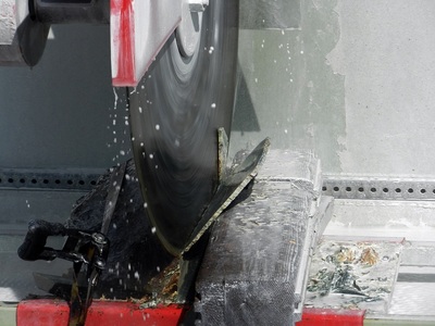
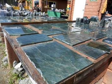 Slices of jade at Jade City
 Cassiar Highway
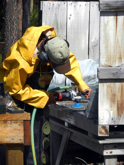
Over the course of a week, we took a leisurely trip down northwest British Columbia’s Cassiar Highway. Our next stop after Boya Lake was Jade City, a retail outlet for the area’s jade mines. Over 90% of the world’s jade comes from this area of British Columbia. We watched the cutter slice a thin wedge from a large stone, and then polish it to a gleaming shine using a dozen different grades of wet sanding disks. We learned a bit about how to judge the quality of the stone as well.
Over the course of a week, we took a leisurely trip down northwest British Columbia’s Cassiar Highway. Our next stop after Boya Lake was Jade City, a retail outlet for the area’s jade mines. Over 90% of the world’s jade comes from this area of British Columbia. We watched the cutter slice a thin wedge from a large stone, and then polish it to a gleaming shine using a dozen different grades of wet sanding disks. We learned a bit about how to judge the quality of the stone as well.
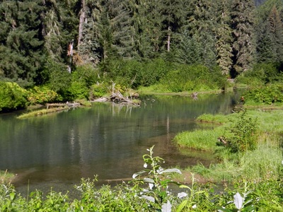
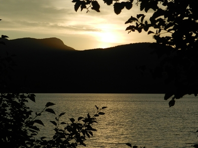 View from our window at Kinaskan Lake
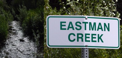
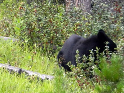
 Moving down the road, we crossed the Arctic-Pacific Continental Divide in Dease Lake, and found another beautiful campsite next to Kinaskan Lake in a provincial park. We were a minor irritant to a black bear eating by the side of the road, who returned to his spot as soon as we passed. And we had to stop and take a picture at Eastman Creek, named for George Eastman of Kodak fame, who had hunted in this part of Canada.
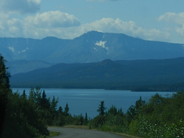
By the time we reached the Bell 2 Lodge (so named because it sits beside the 2nd bridge across the Bell River), we were at least 150 miles or more from a town in any direction. We took advantage of the amenities at the lodge, which included free hot showers, a hot tub and a fitness center. We even splurged and ate an excellent meal in their small restaurant. It was pretty busy for such a remote location.
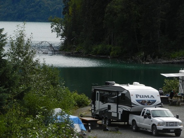 Meziadin Lake
 Our last stop on the highway was at Mediazin Lake. This was the most popular of the provincial campgrounds we tried, and had the luxury of offering electric sites. We even found one right on the water. Mediazin Lake sits at the intersection of the Cassiar Highway and the road to Stewart BC and Hyder, AK on the coast. We knew that Pat and Fred were heading there and might be close behind. But we had no way to communicate. Neither us nor Pat and Fred had cell service since shortly after leaving Whitehorse, and internet was not available since we left Dease Lake, where we had spoken to them briefly using Skype. We hiked up to the only business in Mediazin Lake, a mile from the campground and paid a small fee to get some internet. No word at all from Pat and Fred. Where were they?
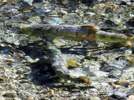 Salmon spawning in Fish Creek
 With no new information to go by, we decided to disconnect the truck and take a trip to Hyder, AK. A 40-mile side trip would take us down through the Coast Mountains to the Tongass National Forest, where the bears were supposed to gather at Fish Creek and catch salmon. We headed out the next morning on a beautiful day for the drive, arriving at Fish Creek around 10:30 (which was actually 11:30a Alaska time). Apparently most of the bear sightings were early in the morning or in the evening. And there were only three bears likely to come through. There were hundreds of spawning salmon in the crystal clear water. We watched them for a while, as they jockeyed for their spot and fought off any interloper that dared try to take it from them. But we weren’t willing to wait that many hours to see a bear.
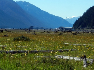 Coast Mountains west of Stewart BC
Although Stewart and Hyder are close together, compared to Hyder, Stewart is a major metropolis. We returned across the border and spent some time walking the estuary boardwalk and wondering the small business district. We thought it might be possible that Pat and Fred were here, so we toured the 2 RV parks, but didn’t see them. We then headed out of town, and shortly afterward, a black bear scrambled up onto the road, moseyed up a bit and headed off the other side. Maybe he was on his way to Fish Creek . . .
Although Stewart and Hyder are close together, compared to Hyder, Stewart is a major metropolis. We returned across the border and spent some time walking the estuary boardwalk and wondering the small business district. We thought it might be possible that Pat and Fred were here, so we toured the 2 RV parks, but didn’t see them. We then headed out of town, and shortly afterward, a black bear scrambled up onto the road, moseyed up a bit and headed off the other side. Maybe he was on his way to Fish Creek . . .
With no new info from Pat and Fred, we headed out the next morning for the last 100 miles of the Cassiar Our next turn would take us east on highway 16, also know as the Yellowhead Highway.
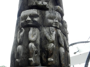 Totem pole carving detail at Ksan
 Yellowhead Highway
The Yellowhead Highway runs east-west from Prince Rupert on the Pacific Coast to Edmonton Alberta. We were going to join it about 150 east of Prince Rupert and continue east to Jasper Alberta. Our first stop was at the New Hazelton Visitor Center where we managed to get the first communication from Pat and Fred in a week. They had been in Stewart when we were there, but we missed them. They were planning to leave the next day. That settled, we took the advice of the Visitor Center’s recommendation and took a turn up into Old Hazelton and the First Nations’ Ksan Campground and Museum. Sitting on the banks of the Skeena River, Hazelton’s position as the northernmost port on the sternwheeler’s route made it a major hub of activity before the railroads and highways took over as freight carriers.
The Yellowhead Highway runs east-west from Prince Rupert on the Pacific Coast to Edmonton Alberta. We were going to join it about 150 east of Prince Rupert and continue east to Jasper Alberta. Our first stop was at the New Hazelton Visitor Center where we managed to get the first communication from Pat and Fred in a week. They had been in Stewart when we were there, but we missed them. They were planning to leave the next day. That settled, we took the advice of the Visitor Center’s recommendation and took a turn up into Old Hazelton and the First Nations’ Ksan Campground and Museum. Sitting on the banks of the Skeena River, Hazelton’s position as the northernmost port on the sternwheeler’s route made it a major hub of activity before the railroads and highways took over as freight carriers.
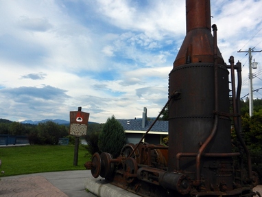 Steam Donkey used to haul logs
 After parking the rig, we wandered over to the Ksan Museum with its historic buildings, totems and exhibits. Stopping into the café, we sampled the best bannock (a fried dough prepare by First Nations people) we had had on our trip. In talking to the chef, she said the recipe was a family secret that she had just had the privilege to learn from her mother-in-law after 6 years of marriage. We moved over to the historic downtown, exploring the historic exhibits and buildings. After a quick supper at the RV, we returned for a movie night in town. We joined about a dozen other patrons to watch Star Trek – Into Darkness – in 3D. Who would have thought?
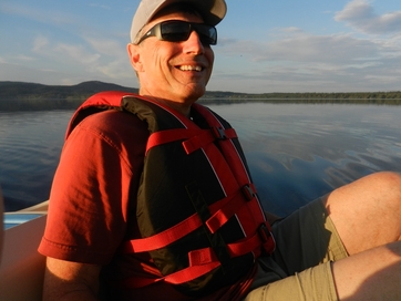 Dave in paddle boat on Fraser Lake
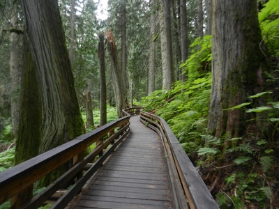
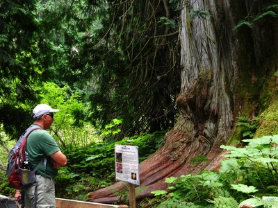
 After another night on the road at Fraser Lake, we met up with Pat and Fred in Prince George at the Wal-mart. Stocked up for our trip into the national park, we headed out the next morning east toward Mount Robson Provincial Park. An amazing side trip along the way was the Ancient Forest, a rare temperate rain forest in the middle of hundreds of miles of spruce forests. It had just been made a provincial park after years of being lovingly preserved and cared for by a local hiking club. We had our first taste of local raspberries along the hike and were rewarded again at our campsite that night, where the bushes were loaded with them.
The next day, it was a short trip into Jasper National Park, where we quickly realized we were entering one of the most popular parks in Canada -- along with several thousands of others.
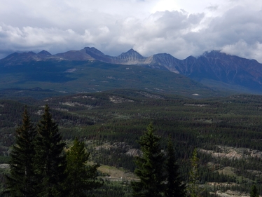 Mountains above Jasper
 Canada’s Oldest National Parks
Sitting on the border between southwestern Alberta and British Columbia are Canada’s first national parks, protecting a large swath of the Canadian Rockies. To the north is Jasper National Park which surrounds a town of the same name and extends south along the Icefields Parkway to the Columbia Icefields – dozens of glaciers radiating out of a central mass. Just south of the Columbia Icefields, Banff National Park begins and extends south to the towns of Banff and Lake Louise. These parks were begun to protect natural resources already heavily promoted as tourist destinations. The intervening century has only increased their popularity and the crush of tourists that come from all over the globe to see them.
Sitting on the border between southwestern Alberta and British Columbia are Canada’s first national parks, protecting a large swath of the Canadian Rockies. To the north is Jasper National Park which surrounds a town of the same name and extends south along the Icefields Parkway to the Columbia Icefields – dozens of glaciers radiating out of a central mass. Just south of the Columbia Icefields, Banff National Park begins and extends south to the towns of Banff and Lake Louise. These parks were begun to protect natural resources already heavily promoted as tourist destinations. The intervening century has only increased their popularity and the crush of tourists that come from all over the globe to see them.
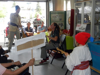
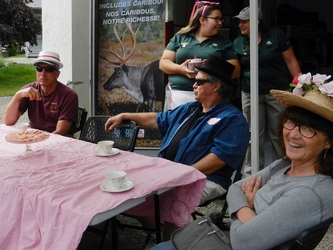 Attending a "Pink Tea" about the 100th anniversary of suffrage
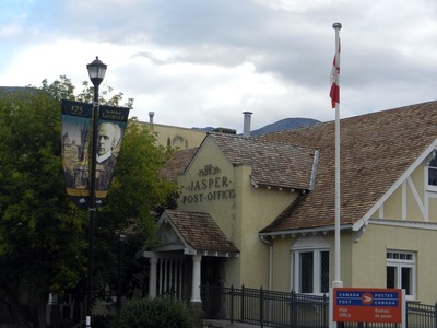
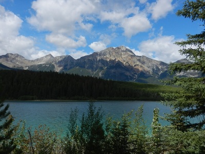
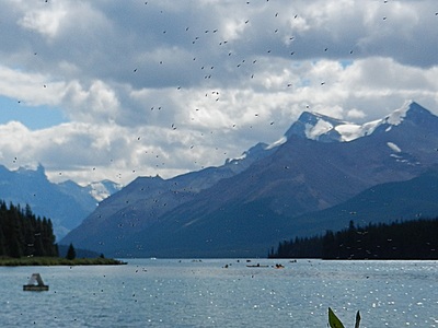
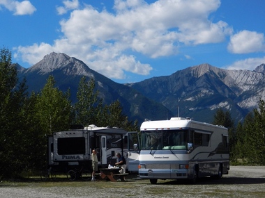
 We had our first rude awakening when we went to register for a campsite. All of the campgrounds were full, so we were sent to the overflow area. We were told to “park anywhere”. Really? Yes, really. In the sprawling overflow area, campers and tents found sites wherever they could. Twice someone parked within inches of the front of our truck. We made the best of it and spent a few days exploring the park near Jasper. We took some hikes and bike rides, drove down to Maligne Lake and up to the Skytram, and each night we took in the entertaining ranger programs at the firehall in downtown Jasper.
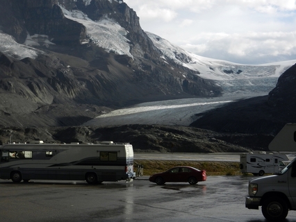 At Athabasca Glacier on the Icefield Parkway
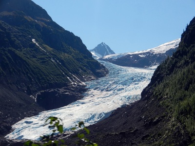
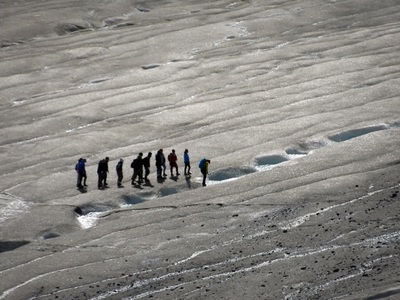
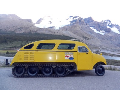
 Moving down the highway, we stopped next at the Glacier Discovery Center on a Sunday afternoon. This took the concept of “crowded” to a new level. We found a place to park for the night without too much trouble, but when we entered the center to learn more about what was available there, we couldn’t move for the press of people. Buses were picking up and dropping off hundreds of people. Glacier tours were running over the ice on the nearby Athabasca glacier in a constant flow. With luck, we arrived in time to join a ranger-led hike to the toe of the glacier, which was led with humor and skill by Spencer. One of the more interesting details he shared was the significance of the Snow Dome peak just beyond us. It is the hydrologic center of North America. From its slopes, water flows to three oceans – Pacific, Arctic and Atlantic.
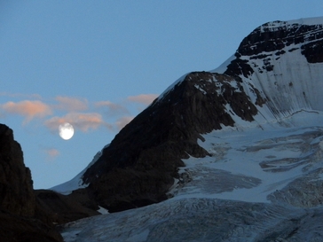
Although we were sitting in a parking lot on a warm, sunny day, the glaciers kept a cool breeze blowing to keep it from getting too hot. However, by late afternoon as the Center was closing and the tourists departing, a violent thunderstorm moved through, as if the mountains were taking control again. By nightfall, all was calm and clear as the moon rose over the nearby mountains.
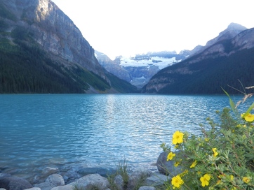 Lake Louise
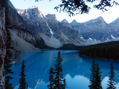
 The next morning, we left Jasper NP and entered Banff NP. It was a beautiful day to drive the rest of the way through the mountains to Lake Louise. Jasper was wide open compared to the press of tourists heading to Lake Louise. Cars are parked for miles approaching the lake. We took a spot at the overflow campground outside of town and decided to wait until evening and head in to see it after dinner. It is beautiful, but is it really worth all the press? Not quite as busy, and equally beautiful was nearby Moraine Lake. However, it didn’t have the same reputation or the same crowds.
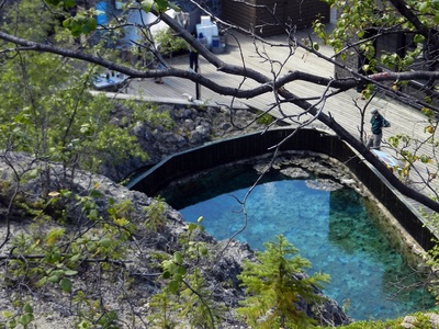
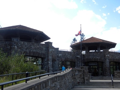
We took a trip to Banff the next day to understand what the campground looked like there before we took the rigs there. It was more expensive and more crowded, so we decided to stay another couple of nights at Lake Louise and use that as the base for our sightseeing in Banff. The hot springs in Banff were the impetus to create Canada’s first national park, and although the original springs are no longer used by tourists, there is a very good interpretive sight there. Considering the crowds in town, this was also not nearly as crowded as the other sites in town. We happened to arrive as a tour was beginning that was excellent and saved the day – much more of the experience we had hoped to find in a National Park.
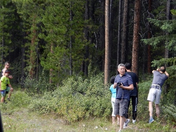 A bear jam
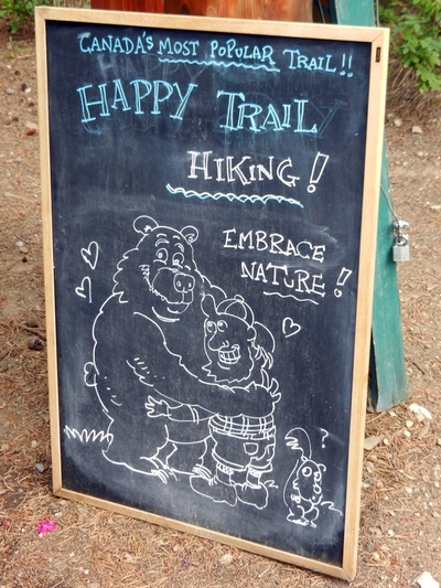
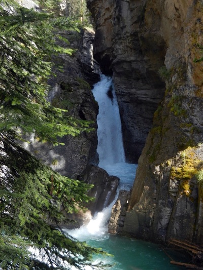
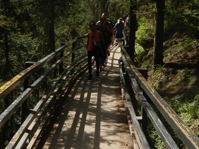
 We took a drive on the Bow Valley Parkway, which runs between Banff and Lake Louise paralleling the much busier Trans-Canada 1. Along the way, we saw a bear jam. A black bear cub and its mother were eating in the woods. People were getting frighteningly close – with 30 feet – to take pictures. The ranger finally managed to get them to back off and get back in their cars. Further down the road we took a short walk along Johnston Canyon to its Lower Falls. Billed as “Canada’s most popular hike”, Pat described it as walking at the mall at Christmas. To make the hike easy, catwalks had been installed along the rock wall, suspended over the river below. It was pretty amazing
By Thursday, we were ready to move on. We were only a couple of hundred miles from the US and our next major destination – Glacier National Park.
