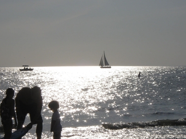
Late afternoon on Fort Myers Beach
We finally stopped talking about heading west across Florida and actually did it. After a stop at Vero Beach for repairs and to pick up some mail, we made our way up the St. Lucie River and into the Okeechobee Waterway. It took us 5 days to cross the state, emerging at Fort Myers on the west coast. We were now further west than we’ve been before by boat. After a week at Fort Myers Beach, we made ready to move south along Florida’s west coast.
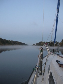
Leaving Indiantown in the early morning mist
Okeechobee Waterway
Compared to the busy waters on either end, the Okeechobee Waterway (OWW) is a quiet passageway across the middle of the state. It connects 3 natural bodies of water – St. Lucie River on the eastern side, Lake Okeechobee in the center, and the Caloosahatchee River on the western side – via 2 manmade canals and the locks necessary to raise boats up approximately 12.5 feet to the lake’s normal level and then back down again. We had left Vero Beach on a Friday, making it as far south as Jensen Beach (after a stop for lunch at Fort Pierce with Tom and Dau) before daylight was fading. So, Saturday morning, we were up early to begin our trip west. The entrance to the waterway is at the intersection of the St. Lucie River and the ICW. This is a popular outlet to the ocean, which was in evidence on this pleasant Saturday morning. However, we turned west, away from the activity and made our way upriver toward the first of the locks just past Stuart on the St. Lucie River.
Compared to the busy waters on either end, the Okeechobee Waterway (OWW) is a quiet passageway across the middle of the state. It connects 3 natural bodies of water – St. Lucie River on the eastern side, Lake Okeechobee in the center, and the Caloosahatchee River on the western side – via 2 manmade canals and the locks necessary to raise boats up approximately 12.5 feet to the lake’s normal level and then back down again. We had left Vero Beach on a Friday, making it as far south as Jensen Beach (after a stop for lunch at Fort Pierce with Tom and Dau) before daylight was fading. So, Saturday morning, we were up early to begin our trip west. The entrance to the waterway is at the intersection of the St. Lucie River and the ICW. This is a popular outlet to the ocean, which was in evidence on this pleasant Saturday morning. However, we turned west, away from the activity and made our way upriver toward the first of the locks just past Stuart on the St. Lucie River.
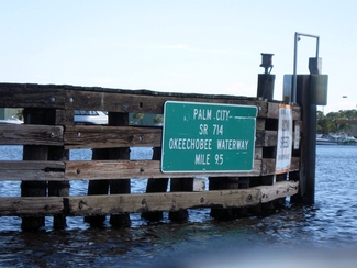
Our first day’s destination was Indiantown Marina, only 25 miles away. It should be a relatively easy travel day. We just had one opening bridge (Roosevelt Bridge at Stuart) and one lock (St. Lucie Lock) to negotiate in between. The Roosevelt Bridge is just east of downtown Stuart and is on request, so we didn’t need to time our arrival very carefully. However, it is positioned on a bend in the river, just west of an older opening RR bridge with a narrow opening and not much room between the 2 bridges. So, we were grateful that the bridge tender held us up while 2 eastbound boats passed through, so we didn’t have to maneuver past them in the narrow opening
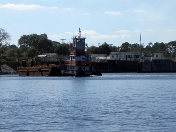
Tug and barge re-entering St Lucie Lock
The St. Lucie lock is the entrance to the eastern canal on the OWW. It also has the highest rise, raising us 13 feet from sea level to the current lake level. The locktender gave us instructions for positioning our fenders and said that the lock had the lines we needed. However, just before arriving at the lock, we heard a tug call the lock for passage. We followed up with the lockmaster, who said we would need to wait for the tug to clear the lock before we could enter. It wasn’t until we arrived at the lock, though that the logistics became clear. The tug was eastbound and was in the lock when we arrived. However, what we came to understand was that, upon exiting, he was going to pick up a barge tied to the pilings just outside the lock and then turn around and go back westbound into the canal. That meant we had to wait for the lock to empty for the eastbound tug, for the tug to pick up the barge and re-enter the lock, for the water to rise for the now-westbound tug, for the water to lower for us, and then we could enter. With all that water to raise and lower, this lock takes about 30 minutes to pass through. So, you can do the math. It took us 1 hour and 45 minutes before we had cleared the lock and were headed further west. Good thing we had planned a short day!
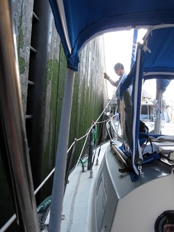
Tending lines in St Lucie Lock
Actually navigating the lock was pretty easy. We just rigged our fenders on the port side, and slowed down to catch lines from the lock tender once in position on the wall. We had a stiff tailwind that made it a little more interesting, but once we’d grabbed the lines it was just a matter of maintaining some tension as the water rose. As the doors opened, we were now in fresh water, which would be the case until we exited the final lock on the western side. We headed out toward Indiantown for a later arrival than planned, but managed to make it in time for a potluck barbecue that was held outside in a beautiful courtyard. Before leaving, we took a tour of the marina’s boatyard, as we were beginning to look at options for leaving Orion Jr for the spring while we headed back up to Hampton. This relatively protected marina was one option that we were considering.
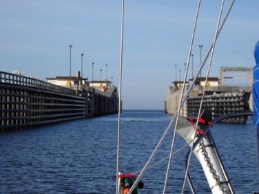
Port Mayaca Lock open to Lake Okeechobee
The next morning we left at first light to head across Lake Okeechobee. The winds on Sunday were forecast to be the lightest for the next several days, and we wanted benign conditions to cross this large body of water. (The guidebooks tell you it’s the 2nd freshwater largest lake, behind Lake Michigan, fully inside the US.) We discovered that the lake’s slightly higher than normal level had an advantage. As we approached the Port Mayaca Lock, which guards the eastern entrance to the lake, the lock tender’s response to our question about fenders seemed odd. He told us we wouldn’t need them. We were wondering what he meant, when the lock came into view and our questions were answered. The lock was open at both ends. Since the lock only raises and lowers a foot, the higher lake level meant that there was no need to operate the lock. So, we moved on through, waving hello to the lock tender as we made our way out into the lake.
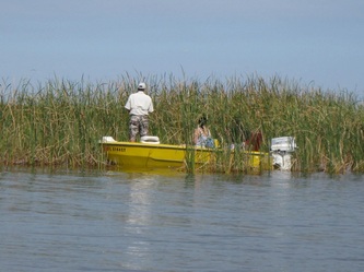
We had heard all sorts of stories about wildlife -- alligators, manatees, white pelicans – and a profusion of little fishing boats out on the lake. For most of our run, we saw little of anything. A few sailboats passed us heading east. A couple of trawlers passed us heading west, but until we reached the last mile on the western side, we saw almost no one. And very little of the more exotic wildlife. What we did see was water, as far as the eye could see, looking north and west. On the western edge, we began to see lots of activity at a series of spoil islands, which offered lots of fisherman places to find their favorite catch.
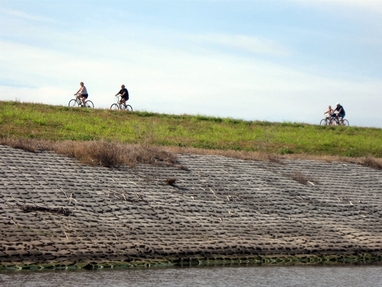
Bikers on levee north of Clewiston
On the western side of the lake, the character of the waterway changes. All along the southern rim, a dike was built back in the 30’s to protect the towns along the lake’s edge from flooding, after devastating loss of life during a major hurricane in the 20’s. That is why the canal system was built in the first place. As you re-join the canal at Clewiston, you can see this impressive structure, which now has a bike path, picnic areas and boat ramps along its length. Also, we were now in the agricultural part of Florida, with crops of sugar cane and citrus and fields with cattle lining the banks of the canal. The skies frequently were filled with dramatic fires burning in the distance as the sugar cane was being harvested.
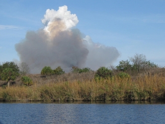
Sugar cane burning before harvest
We made our way around the rim to Moore Haven, where we turned back to the southwest and re-entered the canal system via another lock. Moore Haven is a small town that was friendly to boaters with a town dock which we took advantage of. Dave went looking for a place to buy gas, only to learn it was much too far to walk. Before he turned around though, someone drove up on a golf cart and offered to take him there. It turned out he was the mayor’s father. On the trip, Dave learned that the town had recently lost its grocery store, and the closer of 2 gas stations had closed. We learned from a local radio station that the town had not had a doctor in residence since the 50’s. It is very rural and very remote. On the dock, we met Jack and Diane, a couple of our few fellow travelers on the waterway. We joined them for cocktails after dinner to share stories about our travels.
The next morning we left a little later, since we needed to wait for the City Hall to open to pay for our dockage. (The dockmaster didn’t manage to get there the night before.) We were headed for LaBelle, which was not too far away, but we wanted to make a stop at Glades Boatyard on the way, another potential storage location for Orion Jr. The winds were up, making us grateful we had crossed the lake the day before. We got a look at Glades, an inexpensive do-it-yourself boatyard, before moving on to LaBelle. Just before the LaBelle bridge and just after Port LaBelle Marina, Dave had found a free dock that he thought we could use. As we approached, a sunbather was enjoying the solitude and fishing there. We disturbed her tranquility and asked about the availability of the dock, which she said we could use. We pulled in and chatted for a bit, but we scared her off. It just wasn’t the same as before.
The next morning we left a little later, since we needed to wait for the City Hall to open to pay for our dockage. (The dockmaster didn’t manage to get there the night before.) We were headed for LaBelle, which was not too far away, but we wanted to make a stop at Glades Boatyard on the way, another potential storage location for Orion Jr. The winds were up, making us grateful we had crossed the lake the day before. We got a look at Glades, an inexpensive do-it-yourself boatyard, before moving on to LaBelle. Just before the LaBelle bridge and just after Port LaBelle Marina, Dave had found a free dock that he thought we could use. As we approached, a sunbather was enjoying the solitude and fishing there. We disturbed her tranquility and asked about the availability of the dock, which she said we could use. We pulled in and chatted for a bit, but we scared her off. It just wasn’t the same as before.
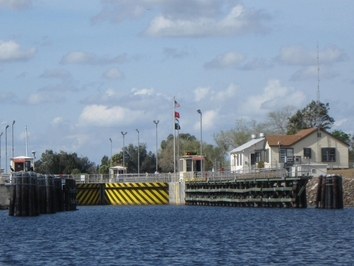
The westernmost lock on the canal - Franklin lock
It was now getting pretty hot during the day, and the calm conditions overnight created some impressive fog in the morning. We couldn’t clear the La Belle bridge until after 9am anyway, so we took our time getting underway. We weren’t sure where we were headed for the day. The Riverview Hotel in LaBelle was full, so we moved on to Franklin Lock, which has 8 slips managed by the Corps of Engineers. In between were 3 opening bridges (one of which required the bridge tender to walk from shore to the center of the bridge to do the opening) and the Ortona lock. With only a 3 foot change in water level, the locking was uneventful. Even with the bridges and locks, we arrived at Franklin Lock by early afternoon. This turned out to be a great place to stop. The slips were associated with a campground, and the facilities included showers and laundry for both the boaters and campers. There were also picnic shelters, grills, and a boat ramp, that we used to pull our dinghy out of the water to clean it. (It turned out not to need it.) Although it would have been great to stay another day, the weather for the trip to Fort Myers was going to be better if we didn’t wait. So, we headed out for the last leg of our cross-Florida trip on Friday morning.
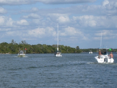
Boats rounding Shell Point near Ft Myers
We first had to transit the final lock of the canal, which was another 3 foot drop. Although we weren’t immediately entering salt water, the water would gradually shift from fresh to saltwater over the next 20 miles as started down the Caloosahatchee River. We emerged from the tranquil wilderness into the busy Fort Myers waters in late morning. The contrast was not surprising, but a little wearying. As the waterway narrowed to round Shell Point, a strictly enforced no wake zone had a dozen or more of us in single file putting along. What a difference a few hours make. Our destination for the night was Fort Myers Beach and their town moorings. We had to cross between the mainland and Sanibel Island, across the inlet to the Gulf to reach it. The gusty winds from the river actually mellowed out as we passed the open water, so we had an easy transit over to Estero Island, the home of Fort Myers Beach. We had our choice of mooring balls in the largely open field. That situation would change over the next few days, but we were glad to be tucked in for a few days, while the winds blew. And we had one other problem. We had gone off the edge of our charts.
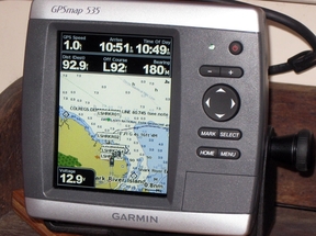
Garmin 535 Chartplotter
“Beyond this place, there be dragons . . .”
The old mapmakers warning about all sorts of calamities befalling those who traveled off the edge of the known world really didn’t apply to us, but we were not going to go far without maps of the west coast of Florida for our chartplotter. It’s not that Dave hadn’t been working on getting them for quite a while. Things had just not been going our way. When we switched to the little boat, we went back to using our Garmin 172C chartplotter. As far as we were concerned, it was “old faithful”, having taken us thousands of miles before we upgraded Orion back in 2009. But the older chartplotters require you to unlock regions to get maps for new cruising grounds. Although Dave had purchased an unlock code a couple of years back, he found that he couldn’t use it when he went to unlock the west coast of Florida. After several discussions with Cathy and with Garmin, we developed a plan.
We would buy a refurbished Garmin 535 chartplotter, which came with the inland US charts. These would allow us to travel much of the Great Loop and other potential future destinations. We would then use a credit Garmin was giving us to partially offset the cost of the coast US charts, which would give us the west coast of Florida. Since all of this came together shortly after leaving Palm Coast, we had to find a place to send the chartplotter and chip. That place turned out to be Fort Pierce and our friends Tom and Dau. Since the weather for crossing Lake Okeechobee arrived before the chartplotter and chip, we had to rent a car once we made it across Florida and travel back to pick them up. In a marathon trip across the terrain we had just painstakingly traveled by boat, we drove over and back in a day with the prized possessions in hand.
Dave quickly installed the new chartplotter and had it operational. The bigger task was to start planning routes for our travels on the west coast. We spent all of one day just planning the route from Fort Myers Beach to Marathon. This wasn’t just about creating the waypoints, it was researching where to go, which anchorages are options, which alternate routes should we allow for. Also, Dave had to switch from the more familiar Mapsource software to Homeport, Garmin’s new route-planning solution for the PC. But we managed to work through the changes and are now getting re-accustomed to the new chartplotter, whose user interface is very similar to the one we left behind on Orion.
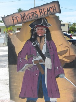
Fort Myers Beach
1116 Cathy as pirate on Ft Myers Beach
OK, let’s face it. Fort Myers Beach is a tourist town. It has miles of beautiful beaches and the associated stores selling everything from ice cream to sunglasses. Needless to say this attracts lots of people. As we made our way around discovering this beach town, we found much to recommend it, despite the crowds. With some chores to do and the weather kicking up, we settled into a routine for about a week on our mooring ball. We had easy access to a trolley that took us up and down the island for 50 cents. And this connected to a bus system on the mainland that would take us to a number of points in the greater Fort Myers area.
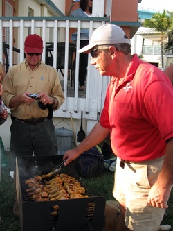
Dave supervises the chicken at the cruisers BBQ
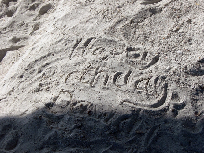
We took a number of walks around town, on the beach, around the western point of the island at Bowditch Point Park, and at the far eastern end of the trolley run at Lovers Key state park. Our second night, we joined a local boater on his cat to pick his brain about traveling north of Fort Myers. On Saturday, the cruisers got together on shore and shucked oysters and grilled tandoori chicken. Dave of course found his talents put to good use. We spent our last night on the beach watching the crowds from the shade of the fishing pier before returning to Orion Jr for Dave’s birthday dinner of some fresh local shrimp. Yep. That’s right. One more birthday down.
