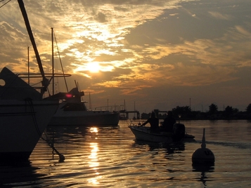
Boot Key Harbor mooring field at sunset
We arrived in Marathon on the first Sunday in February, having taken a much different route to get here. We left Fort Myers Beach 5 days earlier and worked our way south down the west coast of Florida past the highly-developed areas of Naples and Marco Island to the other extreme of wilderness in the Everglades. Since our arrival, we’ve taken care of some boat chores and gotten re-acquainted with a community of boaters here in the Keys.
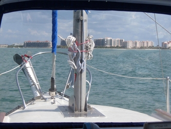
Approaching Marco Island from Capri Pass
From Fort Myers Beach South
After studying the charts and guidebooks for Florida’s southwest coast, we came up with a plan for traveling to the Florida Keys. Our first stop was going to be either Naples or Marco Island, a relatively short distance from each other and a reasonable day’s run from Fort Myers Beach. To ensure enough time on the other end to change our minds, we headed out shortly after sunrise on the 1st of February and made a slow trip around the northern tip of Estero Island before powering up for the run down the coast. There was little wind this day to help us boost our speed, so the outboard pushed us along in the flat seas.
By mid-afternoon, we were heading into Capri Pass, which would take us up to our anchorage in Factory Bay on Marco Island and the last access to fuel and fresh water for the next 5 days. After confirming our entrance to the anchorage by talking to another cruiser anchored there (there is a shoal in the middle of the bay with 2 entrances on either side), we set the hook and then took advantage of the local marina to top off both sets of tanks and remove trash in preparation for our foray into the Everglades.
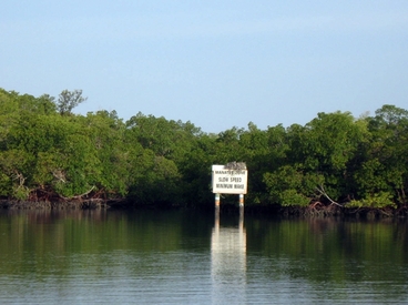
The Inside route from Marco Island to Coon Key Pass
Another first light departure took us around the northern side of Marco Island on the shallow “inside” route to Coon Key pass that Orion Jr’s shallower draft allowed us to travel. This cut out several miles of travel around Cape Romano for the next leg of our journey toward Russell Pass off Everglades City. Within minutes of pulling anchor, we had left the condos and high rises behind and were surrounded by mangroves. Apparently Marco Island’s intense development sits in isolation surrounded by the wilderness of Rookery Bay State Park. Other than a few fishing boats, we had this route to ourselves, until we passed the small town of Goodland, and began our transit of Coon Key Pass out to the Gulf.
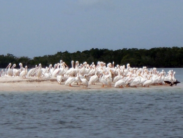
A flock of white pelicans guard the entrance to Indian Key Pass
It was a relatively short day and with little wind, we motored for only a few more hours to reach Indian Key Pass, the entrance to the long channel up to Everglades City, by early afternoon. The entrance is guarded by a flock of white pelicans that cluster on a sandy island near the entrance. As we made our way up to Russell Pass, we were guided by a dolphin who kept surfacing next to the cockpit to keep an eye on us. As we set anchor, we knew the light winds were going to make for a lot of unwelcome guests as the sun set. This is the Everglades after all, the natural home of mosquitos and no-seeums. So Cathy rigged up some finer netting over the forward hatch and the companionway, which kept us mostly free of the little critters.
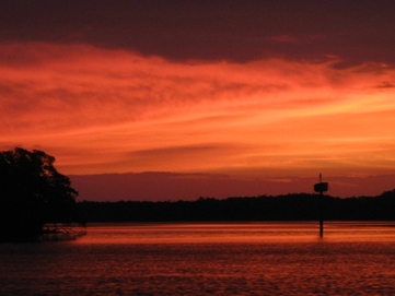
Sunrise leaving Russell Pass in the Everglades
The next day’s trip was going to be one of our longest in our trip to the Keys, so we were underway before sun-up to retrace our steps out Indian Key Pass to the gulf. Once outside, we had a choice to make. We could travel a straight line to the Little Shark River entrance, which would take us further offshore, as the coastline curved in to the east, but was the shorter route. Or we could stay closer to shore and inside the Everglades boundaries, avoiding both crab floats and the more significant waves. With the calm conditions of our early morning departure, we decided to take a chance on the direct route. The winds were supposed to build over the course of the day, but we were hoping we would be closer to shore by the time they did.
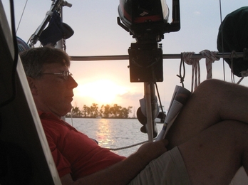
Dave relaxes in the Little Shark River
It didn’t take us long to deploy the headsail, which gave us a good boost and brought out ETA into an early afternoon arrival. We figured that was going to be too good to be true. And it was. As the morning hours passed, we found the easterly wind increasing in strength and along with it, the waves. At our furthest point, we were about 7 miles off shore. The waves were starting to take a toll on our speed, despite the advantage the wind was giving us. We changed our course to bring our route closer to shore. At first, we were just angled in a few degrees to port, but as the waves continued to build, we decided to make a more direct course toward the coast – and calmer seas. As we made our way closer to shore, the waves lessened somewhat, but the winds were still strong. Then the crab pots started to appear, requiring more than usual concentration in these rough seas. They didn’t disappear until we were well inside the park boundary line. Now, it was just a matter of holding our course until we made the Little Shark Entrance, which we did around 3pm. It was with some relief that we rounded the first bend in the river to get out of the wind and find shelter. We had 2 or 3 other boats for company, but there was plenty of room and we could finally relax from a long day’s trip.
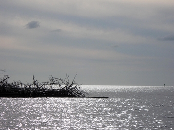
Looking west out the entrance to the Little Shark River
The final leg of the trip to Marathon from the Little Shark River was going to be another long day. And after being tossed around the day before, we were skeptical about the next day’s travel. The weather forecast was for more of the same, only a little worse. However, we decided to get up before dawn the next day and check the weather again before heading out. To our dismay, the NOAA weather channels that had given us the forecast the night before were silent in the early morning darkness. With no cell phone service since early the day before, we were not in an easy position to get weather. So, we tuned into the Waterway Net and asked for the weather forecast for our area. The Net Control was a little confused, since we should have been able to get that on VHF, but we explained we couldn’t hear anything. Another ham pulled the forecast and relayed it to us. As we suspected, the conditions were too rough to risk heading out. So, it would be a lay day for us and the one other sailboat in the anchorage. (The two power boats left, since it takes them only a couple of hours to make Marathon.)
It was a great place to take a breather from the past few days of travel. We took showers and tidied up the boat, then took time reading and doing some computer work. (Yes, that means the website.) We saw a manatee making a leisurely trip up the river and surfacing every few minutes with a snort to catch a breath before the next dive. And then there were lots of birds. But once again NO alligators.
It was a great place to take a breather from the past few days of travel. We took showers and tidied up the boat, then took time reading and doing some computer work. (Yes, that means the website.) We saw a manatee making a leisurely trip up the river and surfacing every few minutes with a snort to catch a breath before the next dive. And then there were lots of birds. But once again NO alligators.
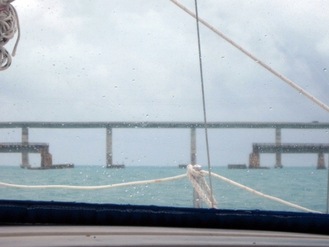
Approaching the 7-Mile bridge just west of Boot Key Harbor
Having learned our lesson, we pulled the weather at night for the following day. It was going to be less wind, but overcast and threat of showers and thunderstorms. We decided to head out despite the threat of rain, and our fellow sailboat, Visitor, joined us for the trip south. Once we passed Cape Sable and left the protection of the park, we spent most of the day dodging crab pots. But the wind was giving our speed a big boost. We were making good time, but not good enough apparently to arrive before the storms came through. In early afternoon, a weather alert sounded that was warning of high winds and heavy rain in our path. We stowed everything we could in the cockpit and readied ourselves for the storm. Luckily we made it through the 7-Mile Bridge spans before the storm hit, and then we just motored into it until it blew over.
There was a waiting list for mooring balls in Marathon, so we bypassed the main anchorage in Boot Key Harbor and found a spot in Sisters Creek that gave us all around protection and reasonable access to the marina. We were 23rd on the waiting list the afternoon of our arrival. By Wednesday, we had secured a mooring ball and settled in for a while at this comfortable port in the Middle Keys.
There was a waiting list for mooring balls in Marathon, so we bypassed the main anchorage in Boot Key Harbor and found a spot in Sisters Creek that gave us all around protection and reasonable access to the marina. We were 23rd on the waiting list the afternoon of our arrival. By Wednesday, we had secured a mooring ball and settled in for a while at this comfortable port in the Middle Keys.
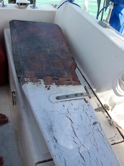
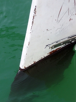
Rudder stripped of growth before sanding
Rudderless – for a bit
Orion Jr was already freshly bottom-painted when we bought her, which we knew at the time was a mixed blessing. No one likes to do bottom painting, so having her already done took that chore off the project list. However, since she was outfitted as a daysailer, not a cruising boat, we knew the waterline would need to be raised once she was fully loaded. We just didn’t know how high. While this was just a nuisance problem on the fiberglass hull, it was a little more worrisome on the wooden rudder. So, we took advantage of our time on the mooring ball in Marathon to pull the rudder, clean it and re-apply the bottom paint, moving the waterline up a few inches.
Orion Jr was already freshly bottom-painted when we bought her, which we knew at the time was a mixed blessing. No one likes to do bottom painting, so having her already done took that chore off the project list. However, since she was outfitted as a daysailer, not a cruising boat, we knew the waterline would need to be raised once she was fully loaded. We just didn’t know how high. While this was just a nuisance problem on the fiberglass hull, it was a little more worrisome on the wooden rudder. So, we took advantage of our time on the mooring ball in Marathon to pull the rudder, clean it and re-apply the bottom paint, moving the waterline up a few inches.
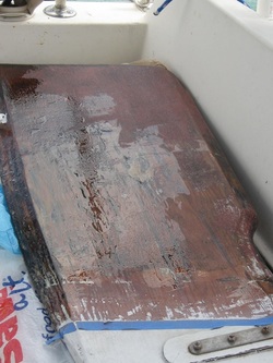
Pulling the rudder is relatively easy. We (i.e. Dave) just have to lift it up, removing the pins from their sleeves and then remove the tether that keeps it from falling completely off in the event of a problem. We used the deck washdown and some boat brushes to clean the growth and the little remaining bottom paint from each side of the rudder. What we found underneath was a bit of a surprise. There was a coating of epoxy over the wooden base. Also, in many places there were remnants of some hard bottom paint. The epoxy showed cracks in places, but was mostly in good condition. After sanding the rudder and applying epoxy over any cracks we found, we debated whether to apply hard or ablative bottom paint. The tie breaker was the fact that we planned to pull the rudder off when we stored the boat in the spring. Hard paint would deteriorate quickly once out of the water, so we went with the ablative paint. Since we only needed a small amount, we were able to borrow some from a fellow cruiser (one of the perks of being among so many boats here). In a couple of days the rudder was back on and ready to go. We were rudderless no more.
Other Boat Stuff
We’ve had the rainiest February in our six years of cruising, which “helped” us find some leaks that needed attention. We re-bedded a shroud on the port side (didn’t we do all those?) which was leaking by Cathy’s head in the V-berth and applied silicone to the starboard aft portlight, which was dripping on Dave where he usually sits in the Main Saloon. At least the leaks were democratic.
Having used our new Garmin 535 chartplotter to travel the couple of hundred miles from Fort Myers Beach, we felt confident to rely on it, so Dave made the wiring more permanent and removed the 172C, holding it in reserve in case of emergency. We also began to think about putting Orion for sale, so we created a “pre-sale” website Beneteau Oceanis 36cc Pre-sale to make her more visible on the search engines by the time we officially list her.
Making the Rounds in Marathon
It didn’t take us long to get back in the swing of things once we pulled into the harbor. After running around getting fuel, water and groceries, we took a breath to check out the activities in the harbor. We re-grouped with the other Waterway Net members at the Ham luncheon in the afternoon and attended a Meet n Greet that night, where we got re-acquainted with the couple on Rising Tide, who had accompanied us from Charleston to Southport back in 2009. (We were both on different boats now, so we didn’t actually put it together until the next day.) We had fun watching Captain Ron ashore with other boaters, most of whom were live-aboards in the harbor. Friends we had met in Vero, Mike and Sue on Indecision had arrived ahead of us and we spent time checking in with them. Stan and Judy were also from Hampton, saw our hailing port and we realized over sundowners that we had many mutual acquaintances in Joy’s Marina back “home”.
But there was an undercurrent in the harbor, which we got wind of on the Waterway Net shortly before our arrival. The marina had made some drastic changes in the rates for boats at anchor using their facilities. These went into effect just days before we came into the harbor. At $22/day and $85/week to use the facilities, we managed to stay mostly away from the dock until we got a mooring assignment. However, the full-time residents in the harbor didn’t have this luxury. It was placing an undue burden on them and those of us waiting to get on a ball. We decided to join a group attending the next City Council meeting to voice our concerns about the change. At the same meeting, the discussion was starting around changes to the designated anchoring rules in the harbor. Dave was among a handful of boaters who spoke to the council to address these issues. Although nothing concrete was decided on the latter topic, the council agreed to re-consider the rate increases. Only time will tell what they decide to do on either topic, but the cruisers and locals are still working to effect a reasonable compromise.
In the meantime, we spend our time with a mix of work and fun, meeting new friends and re-connecting with old ones.
