We continue our annual migration south, returning to some favorite ports and visiting some new ones. With some of our longer stops slowing down our progress, many of our fellow travelers have moved on south of us, but we continue to see friends along the way.
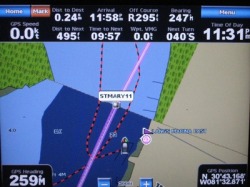
New Garmin 5208 Display
Charting a Course
We’ve been very happy with our Garmin 172C chartplotter that has seen us through our travels almost from the moment we stepped aboard Orion. However, as we looked ahead, we wanted to add radar and also enable the AIS signals (i.e., the identity and position of other ships) displayed at the helm, rather than on a computer down below. This meant that we would need a different chartplotter (or to use the industry’s term a multi-function display).
After researching various alternatives, we determined that it was critical to have the radar and new chartplotter integrate well, which typically meant having both units made by the same manufacturer. This ultimately led us to choose Garmin units for both. So, when we stumbled into a Garmin 5208 on sale during the Boater’s World closeouts in the spring, we were one major step closer to putting the pieces together. The unit sat in a box for months before we were able to mount it at the helm soon after arriving in Deltaville, after which Dave gradually wired into all of the boat’s instruments.
After installing dozens of connections, the unit was performing as we expected until shortly before leaving Deltaville, when we finally completed the final hookup to the radar. The radar signals worked, but a couple of the screens wouldn’t display. After attempting a software upgrade, the unit would then no longer boot up. We quickly contacted Garmin who had us ship our unit in and sent a replacement. The next one worked for about a week, until Dave attempted to load the routes for our trip south, when it too failed to boot up. We were now strapped. We were going to start moving and couldn’t wait for them to send a replacement unit. So, we strapped our old Garmin 172C on to the helm and headed out. It wasn’t until early November that we were able to catch up with the new unit from Garmin and re-install it.
Our first sea trial with the new unit therefore took place on a short run from New Bern to Adams Creek in NC. We loaded our routes without incident this time and were able to follow them and our track back down the Neuse River toward the ICW. Radar worked like a charm as well. We were also starting to learn where to find the different features we were used to, as well as new features that we hadn’t had before.
Unfortunately, there were no AIS signals so we didn’t know whether that feature worked or not. However, once we were leaving the Beaufort Inlet with a large ship in view and no signal displayed, we realized this feature didn’t work, although it still did on the PC below. The other more significant problem was the fact that the 5208 seems to default to using the autopilot heading sensor instead of just using its own GPS to orient the display when in “track up” mode. This is a problem because our autopilot compass is routinely misaligned from our magnetic compass heading (and has been since we installed it 3 years ago), but we have easily worked around this before. Not so now. With the chartplotter using this incorrect heading information, it would appear that we were heading off the route (and out of the channel), when in fact we were right on course, giving an incorrect indication that a course correction is necessary. This wasn't something we could live with.
We have contacted Garmin to see how to correct these problems, but in the meantime our 172C will continue to be our fallback until we get comfortable with the new one.
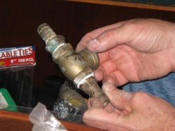
Dave installs a check valve on the new bilge pump line.
Other Boat Stuff
The rudder repair was holding and remained dry for a week of travel, until we started down the Neuse River on a flat calm day on the way to New Bern. During one of our hourly checks, Dave discovered a fair amount of water there. But in the over 40 hours of travel since, including some higher waves on the ocean, it has remained perfectly dry. With the possibility of water accumulating there, Dave decided to install a bilge pump by the rudder, tying it into an existing through hull with a t-fitting. When tested, it appeared to work as desired, triggered by a manual switch Dave installed just above it. Let's just hope we don't need it.
In the process of doing some dinghy motor maintenance, Dave discovered that the fuel tank mounts were once again broken. (This happened before in early 2008, causing the fuel line to break free and leak.) He bought a replacement, but after consulting with an outboard mechanic, he came up with a way to make a sturdier substitute, which will hopefully delay another failure.
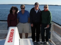
Carolina Travels
We traveled south through NC through the first 2 weeks of November, leaving Elizabeth City on Nov. 2nd for an anchorage in the remote southern Alligator River, which is surrounded by cypress swamps and not much else for miles. The trip across the Albemarle and down the Alligator was in 20-25 knot North winds, making for a good motorsail, with some pretty good following seas (i.e. from astern). Our usual anchorage at the bottom of the Alligator was churning from the wind and waves, so we tucked around the point to anchor in an area more protected from the strong north winds. As the day was quickly winding down and we were having trouble getting our anchor to set, we decided to raft to Marianna. Dave set up our anchor alarm to give us early warning if the additional load caused her anchor to drag, but we had no problems.
Unfortunately, the large following seas took a toll on Marianna’s autopilot steering plate. The next morning, Fred discovered that it had snapped and he was going to need to get it repaired. He wanted to be tied to a dock to investigate it further, so we pulled into R. E. Mayo for the next couple of nights. Since we had cell phone service here, Fred was able to make arrangements to get to a welder in New Bern which would be our next stop. We spent 2 nights on the dock at Hobucken, enjoying some of the fresh local catch (and filleting our first flounder), and exploring the tiny village of Hobucken. The bugs drove us below each night shortly before sunset. To the extent we ignored this precaution, we gave several large blood donations to the local mosquito population.
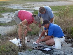
Filleting a flounder by committee
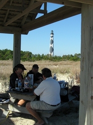
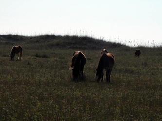
We spent 8 days in New Bern at Northwest Creek Marina, allowing Fred to repair his autopilot and to wait out some weather that obliterated the sun for almost a week. Before the storm set in, we rented a car and enjoyed 3 beautiful days traveling nearby New Bern. We finally visited Oriental, spending at least an hour at the local consignment store. With Fred’s impeccable timing, we slid on to the Minnesott Beach – Cherry Branch ferry seconds before it sailed and crossed the Neuse to its western side. The next day we drove down to Harker’s Island to explore the Cape Lookout National Seashore. We started in the Visitor’s Center and then took a picnic lunch over on the ferry to island. After anchoring in the bight on our trip south each of the past 2 years, it was good to finally get a closer look at the lighthouse (although we couldn’t climb it since it was currently under repair). The next day, we drove west to Kinston to visit the CSS Neuse museum. Unfortunately, it was closed, but the staff let us look around the next door Richard Caswell museum anyway. To end the day with an exclamation point, we had lunch at King’s BBQ, which had a buffet of home cooked southern food. It was delicious!
New Bern is the adopted home of Skip and Cherylle on Eleanor M, who had us over to their beautiful home a couple of times during our visit. We enjoyed their hospitality and the chance to catch up with them since we last saw them in Georgetown.
We pulled out of Northwest Creek on a still-overcast Monday for a short trip to Cedar Creek, just off Adams Creek as we begin to travel East toward Beaufort, NC. The next day was also a short one, taking us to the docks of Sanitary Fish Market in Morehead City, where we enjoyed a seafood dinner after a leisurely stroll around the waterfront. Sunday wasn’t the best time to visit, since many of the shops and museums were closed. Maybe next time, we’ll get to see more.
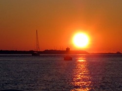
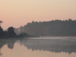
Sunrise over Beaufort inlet
Out to Sea
We used Morehead City as the jumping off point for a trip outside to South Carolina, leaving early on Monday morning, Nov. 16th. Once Fred confirmed that his autopilot repair was holding, we set our course for Winyah Bay, just south of Georgetown, SC, arriving at the inlet early the next morning. We hooked up with the ICW and proceeded most of the day through the record high tides to Isle of Palms Marina, just north of Charleston. After collapsing into bed for a good night’s sleep, we were up early for our short run to Charleston, where we post this entry.
We used Morehead City as the jumping off point for a trip outside to South Carolina, leaving early on Monday morning, Nov. 16th. Once Fred confirmed that his autopilot repair was holding, we set our course for Winyah Bay, just south of Georgetown, SC, arriving at the inlet early the next morning. We hooked up with the ICW and proceeded most of the day through the record high tides to Isle of Palms Marina, just north of Charleston. After collapsing into bed for a good night’s sleep, we were up early for our short run to Charleston, where we post this entry.
