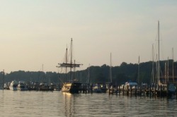
As Ernesto howls around us, we thought it would be a good time to write our latest update, since we don’t plan on going anywhere till the winds die down. The last 2 weeks have allowed us to travel to new ports and have taken us to the top of the Bay for the first time. There’s definitely a different feel to that part of the Chesapeake.
North!
As we’ve read in our guidebooks and can now confirm from our travels, the further north you go in the Bay, the fewer the ports available. This is due, in part, to the narrowing of the Bay and, in part, to the large amount of territory taken up by the Aberdeen Proving Ground, just south of Havre de Grace. Also, since we are not the hard-core “gunkholers” who are willing to try any anchorage that may or may not have the depth for their boat’s draft, we tend to be pretty selective about where we go. Advice like “this entrance is tricky, but the scenery is well worth it”, or “just stay near the middle of the channel and you’ll be fine” tend to make us look for another spot. That being said, we were even more limited in choices of harbors as we traveled north.
Our first stop was Swan Creek, just north of Rock Hall, MD, on the Eastern Shore. Although this was advertised as a beautiful anchorage, David was having trouble figuring out how to get to the described anchoring location, when the charts showed the 7 foot channel ending abruptly in 3 foot depths, just before the entrance to the anchorage. We therefore opted to take a mooring ball at Swan Creek Marina. Although the entrance to Swan Creek is well marked, we entered right at low tide, and even the locals were commenting on how much lower the water levels were than normal. It didn’t make us any more comfortable making our approach to hear a power boat on the radio that had run “hard aground” (his words) in Swan Creek, just as we were headed in. (Power boats draw something like 2 feet?) Reading depths that were running up to 2 feet below the soundings, Cathy was grateful that her chartplotter was turning out to be accurate in guiding her up the river and keeping Orion in deeper water. As we picked up the mooring in what the depth sounder said was 5 feet of water (it reads about 1.5 foot less than actual), we were assured by the marina office that there was “plenty of water” for our 5.5 foot draft. Well, I don’t know if I would describe that as “plenty” of water, especially since the next low tide was predicted to be almost another foot lower.
We visited the tiny town of Rock Hall, traveling by foot down the mile and a half from the marina. The cool breezes of the Bay evaporated as we walked down the unshaded 2-lane highway. We gratefully scooted into the grocery store at the edge of town to cool off and browse. When we discovered that the store offered its patrons free rides to/from their marinas, we decided we would indeed do some grocery shopping. We browsed the short distance of Main Street, but found few businesses open, since it was Monday. One that was open was Durding’s. It was delightful, with a soda fountain, some booths to enjoy our ice cream and even penny candy (or close to it). In the corner was a pay phone that apparently was the first in Rock Hall. It was a charming place for a relaxing treat. We explored Swan Creek in our dinghy a little more that evening and discovered that there was a channel through the “3 foot zone” on the charts, which enabled sailboats with our draft to anchor there.
Our next stop was supposed to be Still Pond, an anchorage that both of our guidebooks touted as being a wonderful anchorage. Unfortunately, when we arrived after several hours of motoring, we discovered that every inch of the pond was covered in crab pots. There appeared to be no opening wide enough to allow us to anchor and then swing on the anchor without snagging crab pots. Luckily David had already plotted the course to Havre de Grace, which became our new destination. We had left early enough that we would arrive there mid-afternoon. We picked up a mooring ball at Tidewater Marina, after a long day of motoring up the narrow channel into Havre de Grace.
We poked around the downtown area for the next day and a half, enjoying another ice cream at Bomboy’s and the amazing selection at the Tidewater Marine store at our marina. We also ended up going grocery shopping yet again at the Sav-a-Lot store, which had some great prices and was less than a block from the marina. (This happens so rarely, it’s hard to pass by.) At our mooring, we had a ringside view of the barge traffic from the local quarry. One night, a tug returned back up river pushing a barge, and had to navigate under the railroad bridge, part of which was obstructed by construction. It was impressive maneuvering.
Our next stop was Georgetown, Md, on the Sassafras River, where we picked up another mooring ball at Sailing Associates. It was better sailing weather on this trip and we were able to sail much of the way from Havre de Grace, well into the Sassafras River. This proved to be a more eventful arrival than normal, when David reached over to grab the line from the mooring ball, only to discover that there was none there. Now, what? He quickly grabbed the snubber line with a chain hook as a stop gap to give us time to think about what to do. The best solution seemed to be to use the anchoring bridle David had put together, but not yet used. David reinforced the connection with one of our anchor shackles and then attached a heavier dock line as a backup. It held fine, but needless to say, our departure took a bit longer as he undid all of this hardware. He has since made a mooring pennant out of ¾” line, inserting a galvanized thimble in the end and purchasing a ¾” shackle to attach it to any future “bare” mooring balls.
We stayed at Georgetown for 4 days, but didn’t travel very far on land. Georgetown itself consisted only of marinas, a few restaurants and a Post Office. Galena, the nearest town of any size, was over 2 miles away and also on a unshaded 2 line highway. We weren’t keen about sweating our way through that, since the humidity and heat were on the rise while we were there. We did take advantage of the Post Office, since we had a large package to mail, but lacked the box to send it. The postmistress graciously offered us an empty box of just the right size. On one cooler day, we decided to make the trek into Galena. We had read about Twinney’s, a local restaurant that supposedly served good ice cream. It was still there, but no longer served ice cream. However, its popularity with the locals made us decide to try it out. We had a great breakfast there.
We probably traveled furthest from Georgetown by dinghy, heading up the Sassafras River under the Route 213 bridge for several miles. There were a number of well-appointed houses and properties up the river, and a surprisingly large number of boats, most of which required a bridge opening to go downriver. We discovered, after watching the boat traffic for the few days we were there, that the bridge opens on demand and frequently. It was rare that more than 10 seconds went by between a request for an opening (signaled by a long-short horn blast) and the bridge gates going down and the span rising. Also, the bridge would frequently open up within minutes of closing. Local car travelers must just be used to it.
One other nuance of our stay in Georgetown that we hadn’t yet experienced elsewhere was mosquitos. They descended for about an hour and a half just before and after sunset. Once we understood their pattern, we managed to avoid them.
We left Georgetown, hoping to sail much of the way back to Annapolis. “Small Craft Warnings” had been issued, which we thought would bring strong winds for much of the morning. However, the higher winds, which never exceeded 16 knots lasted less than 2 hours. Much of the day the wind speeds registered at less than 5 knots, even occasionally dipping below 1 knot. It was another long day of motoring back South.
In general, we enjoyed our trip north and the stops along the way. It is definitely a different world from the middle and southern bay. The proximity to the Susquehanna River and other feeders meant a lot more debris in the water, mostly floating logs that required a vigilant lookout. The dull thunder of ordnance explosions at Aberdeen Proving Ground was also a little unsettling at first. These can be heard from just after Rock Hall all the way north to Havre de Grace and up the Sassafras to Georgetown. However, the slower pace and small town friendliness of the places we visited were worth the trip.
Where else?
We haven’t completely abandoned the anchoring for mooring balls, however. We managed to take a trip over to the Wye River off Eastern Bay for 2 nights in mid-August. It was a beautiful couple of days. We also re-visited the first place we anchored (on the Annapolis Sailing School trip 2 years ago) on the Rhode River. Wouldn’t you know it, our first attempt at setting anchor wouldn’t hold? We were experienced enough now to detect it and reset in a different location without incident.
The rest of the time we keep re-visiting a mooring ball in Annapolis. The easy access to services and the lively harbor make it a nice harbor to come back to. We’ve also enjoyed the band concerts from the shore and racers dashing through the moorings to the finish line (They do know what they’re doing don’t they?) and the Sunday services at the US Naval Academy Chapel.
Who’s driving?
We’ve been advised by many long-time cruisers that an auto-pilot would make for much less stressful days, especially on the trip down to Florida and across to the Bahamas. The choice is between a wheel-mounted system, which is less expensive, but also less robust, and a below decks system, which is much more expensive, must be professionally installed, but handles more difficult sailing conditions. David has been consulting with a number of installers and more experienced sailors to determine which way to go.
Where are we?
Following up on the discussion from our last log entry, we have now ordered the Fugawi software package as a backup chartplotter software which uses the NOAA electronic charts. We still plan to upgrade and expand our Garmin charts, but haven’t purchased them yet.
We are also planning to purchase paper charts as another backup. There seems to be a unanimous consensus that the Explorer charts are the best for the Bahamas.
Finally, we are investigating guidebooks for the ICW and the Bahamas, which describe anchorages, marinas and services along our route. Another consistent recommendation for the Bahamas is Stephen Dodge’s Guide to Cruising Abaco, Bahamas. For the both the ICW and the Bahamas, Skipper Bob’s Guides are mentioned as essential by many people we meet. He lists details about costs as well as services along the way. There are also guides by Dozier and other publishers to consider.
Feedback
We were excited to get some unsolicited feedback from our weblog recently. It’s always fun to know that our logs are being read and are (maybe) entertaining and/or informative. In case you didn’t know, we have a mailing list which we notify when we publish an update. If you would like to be added to it, simply click the link at the top and follow the instructions.
Experience Counts
We continue to meet other cruisers who willingly share their experience and advice with us for the next phase of our trip. In Havre de Grace, our mooring field neighbor dinghy’d over and talked about his trips to the Bahamas, answering questions about essential systems and where to go. Similarly, back in Annapolis, another neighbor in the harbor had heard we were looking at auto-pilots and stopped by to discuss them with us. This has been true up and down the bay.
When the wind blows . . .
As Cathy talked to her Mom from the Georgetown harbor, she was asked what were we doing about the upcoming storm. What storm? That turned out to be Ernesto, which was then headed for the Gulf. That direction, of course, changed to an east coast route. We were in Annapolis on a mooring ball, as it became clear that we needed to decide how to handle the winds and rain of Ernesto. The main mooring ball area in Spa Creek off the US Naval Academy wall will handle winds up to 50 mph, but who wants to bob around like a cork in that open water? We decided to move further up Spa Creek to the mooring balls that were more protected, and were also more securely attached to the bottom by helix anchors, not mushroom anchors. David used his newly created mooring pennant as a backup for the one already provided on the mooring ball. Cathy had been sewing chafe protection all summer, using old jeans and whipping line, which was put into service for the mooring pennants, to protect the lines from wearing through during the storm. We tightened everything down and just waited for the winds to blow. Luckily, Ernesto is not a hurricane, so we don’t expect to experience winds that are too bad.
So, we sit here next to the condos in Annapolis (they are close enough to talk to the people on their porches) and wait for the storm to blow over. Here’s hoping this is the worst we get . . .
