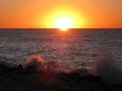
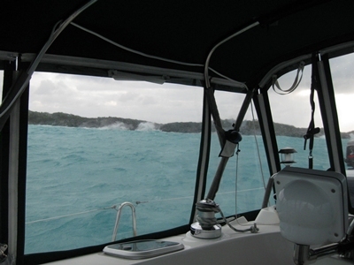
We motored out of Emerald Bay on a calm Monday morning after the latest front had blown itself out over the Valentine’s Day weekend. It was to begin a pattern for (at least) the next 2 weeks. The wind howls, the front moves through, the wind howls some more from a different direction and then we get a day or maybe 36 hours of calm weather before it starts again. We moved to new ports in the calm between fronts, making for more motoring than we’d have liked, but better than being pounded by the wind. Then we searched for shelter from the storm – sometimes more successfully than at others
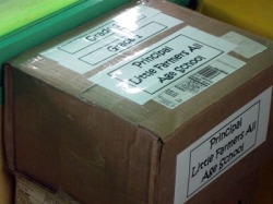
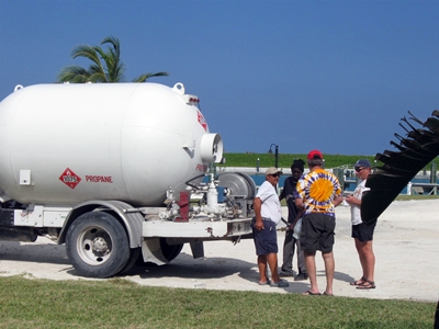
One of 5 boxes of textbooks to be delivered.
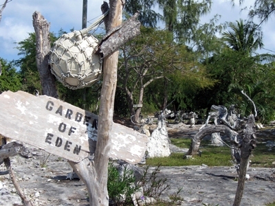
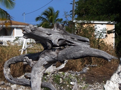
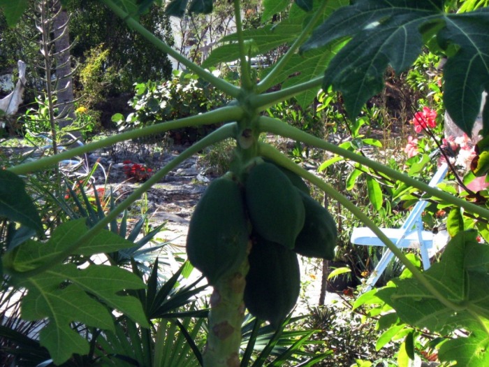
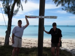
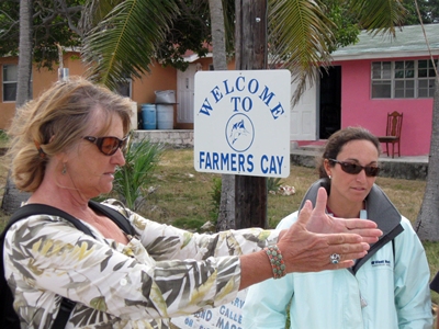
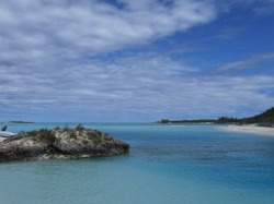
Little Farmer's Cay
We had a delivery to make on Little Farmer’s Cay, so there was no question that we would be stopping here for a visit as we made our way back north through the Exumas. After leaving Emerald Bay, we motored through a gentle Exuma Sound, reaching Galliot Cut by lunchtime. The long frequency between swells minimized their impact on the open water, but coming through the cut, we were reminded that the power of the current through the cut with wind and waves opposing is not something to be taken lightly. The rough water at the entrance to the cut, mild in comparison to rage conditions, was still an unexpected contrast to the rest of the trip to Little Farmer’s.
We had a delivery to make on Little Farmer’s Cay, so there was no question that we would be stopping here for a visit as we made our way back north through the Exumas. After leaving Emerald Bay, we motored through a gentle Exuma Sound, reaching Galliot Cut by lunchtime. The long frequency between swells minimized their impact on the open water, but coming through the cut, we were reminded that the power of the current through the cut with wind and waves opposing is not something to be taken lightly. The rough water at the entrance to the cut, mild in comparison to rage conditions, was still an unexpected contrast to the rest of the trip to Little Farmer’s.
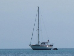
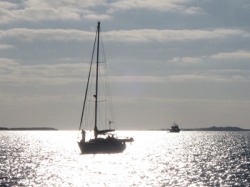
Our neighbor aground on Little Farmer’s Cay.
By the time we reached the anchorage, the winds were completely calm. We arrived in the early afternoon, an hour or so before low tide, and were a little surprised to see another boat already in the anchorage. After re-assessing the situation, we realized that our neighbor was aground and was getting higher out of the water. Having run aground on a falling tide, he was not going anywhere until just after dark. We offered our assistance, but there was little to be done but wait for the water to rise. By 7:30, he was off the bar and anchored nearby.
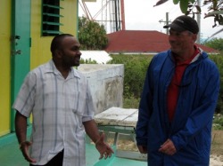
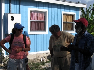
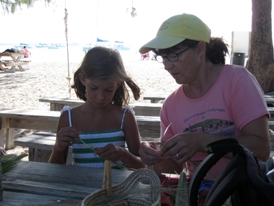
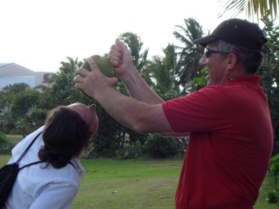
David talks to the principal about setting up a computer lab, with the two computers he has managed to purchase and those he hopes to add.
But our reason for going to Little Farmer’s was not to be entertained by the misfortune of another boater (all evidence to the contrary). We had 5 boxes of textbooks to deliver to the Little Farmer’s All-Age School. It was too late in the day to deliver them on Monday afternoon when we arrived, so we decided to carry them ashore around 9am the next morning. Unfortunately, showers started arriving overnight, and by mid-morning they were passing over in regular intervals. Since we didn’t want to get our cargo wet, we decided to wait. Finally, by early afternoon, they had eased up enough to give us a window to go in. Since the waves were up and the showers were still threatening, we took precautions to keep the boxes (and ourselves) dry. We were successful and were rewarded with a warm thank you and a brief tour of the two-room school by the principal, where the 12 students from first to 9th grade on the island are taught.

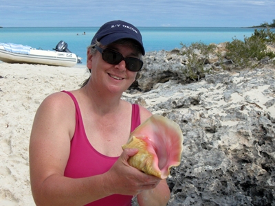
We spent some time exploring the island, making the obligatory stop at Ocean Cabin to see Terry Bain and, in the process, heard Symmetry on the radio coming into the harbor. We met them there the next day for lunch, catching up with their travels over some good food and a beautiful view, as the skies cleared, but the winds began to pick up. With the winds coming in from the northwest, we decided to hunker down at Little Farmer’s for one more day. We stayed on the boat, since our anchorage on Little Farmer’s west side was exposed to the northwest, and the long fetch kicked up a swell. By Thursday, the winds had finally calmed down and we were ready to move on and explore new ports.
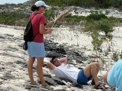
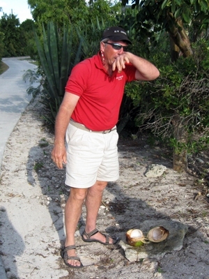
Dave compares profiles with a friend.
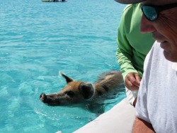
Big Major's Spot (aka Piggy Beach)
Our next stop was a new port for us. We anchored off Big Major’s Spot, an island whose only inhabitants are a herd of wild pigs that are not above begging for handouts from the boaters who venture nearby in their dinghies. The bolder ones swim out to meet you in hopes of scarfing up the best of the goodies. We got to meet 2 of these cuties shortly after dropping anchor and taking a ride over.
Our next stop was a new port for us. We anchored off Big Major’s Spot, an island whose only inhabitants are a herd of wild pigs that are not above begging for handouts from the boaters who venture nearby in their dinghies. The bolder ones swim out to meet you in hopes of scarfing up the best of the goodies. We got to meet 2 of these cuties shortly after dropping anchor and taking a ride over.
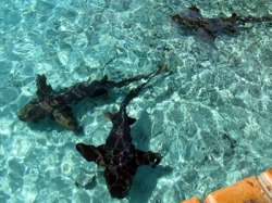
Nurse sharks ply the waters of Staniel Cay
The pigs weren’t the only wildlife that gave us a close encounter. After the pigs left us for better feeding grounds, we headed around the end of Big Major’s to Staniel Cay, tying up to the Yacht Club’s dinghy dock. Before we had even attached the lines, we saw a huge shark (7ft or so) swimming underneath the dinghy. It was a nurse shark. We scrambled onto the dock quickly, only to realize there had to be half a dozen or more sharks swimming underneath all the boats. We were guessing that these big guys were not too much of a threat, given the calm demeanor of our fellow boaters, but their size alone got our attention.
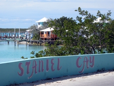
Staniel Cay is a little larger and has a few more services than Little Farmer’s. There were 3 grocery stores, a private clinic, at least a couple of restaurants, a marina with fuel, an airport and several pastel-colored guest cottages along the water. The availability of services made it a popular stopping place for cruisers, since boats were anchored in the harbor and around the bend at Big Major’s to take in the sites. We walked around the island and managed to buy some whole wheat bread (but no groceries – the stores were closed because the proprietors had gone to Nassau for a funeral). Then we moseyed back to the boats to take advantage of some calm weather for a swim before getting together again for games after dinner with the crew of Marianna.
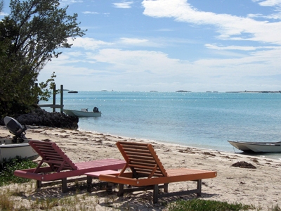
The next day was going to be another calm one, so we decided to take advantage of the light winds and slack tide to go snorkeling near the cut off Little Major’s Spot, just north of our anchorage. Using the information from our guidebooks, we found a likely spot. It was surprisingly good snorkeling, with lots of coral and fish, albeit spread out over the bottom. But slack current disappeared quickly. We had to swim with some effort to stay still and not get swept toward the cut. We took at least one dinghy ride up current to drift over the coral and to reach some more sites further in. By lunchtime, we were ready to take a break and beached the dinghy on a nearby unnamed cay for a picnic and some exploration.
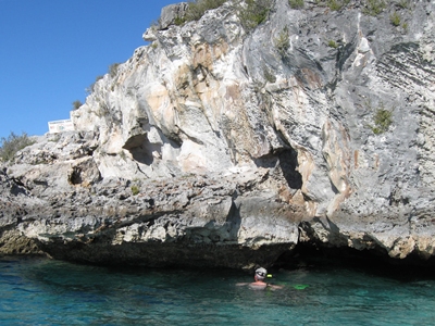
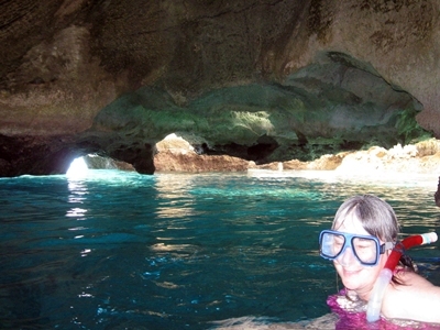
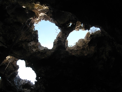
We couldn’t call it quits yet, since we had not visited the area’s most famous spot – Thunderball Cave. On Staniel Cay, the vintage James Bond movie Thunderball’s underwater scenes had been shot in a dramatic cave with openings above that let light filter into the water below. We tied up to a dinghy mooring just outside and let the current pull us into the cave. We were at mid-tide, so we had to be careful not to get too close to some lower hanging rocks on the way in, but the view inside was worth it. The entrance was crowded with fish, and the sun filtering into the cave from the holes above made for dramatic snorkeling. Some brave souls even jumped in from the ceiling, but none of our crew was so brave. By the time we had finished our underwater spelunking, we were congratulating ourselves on all we had managed to squeeze into this beautiful day. We capped it off with drinks on Orion, but then began preparing to head out the next morning for Warderick Wells. Another front was coming (sigh!) and we wanted to pick up a mooring ball for its passage.
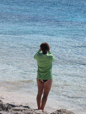
Shroud Cay Swimming Hole
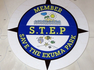
Back to the Park
We arrived at Emerald Rock on the western side of Warderick Wells (home of the headquarters of the Exuma Land and Sea Park) in the early afternoon, after finally getting in a pleasant sail north from Big Major’s. We anchored just outside the mooring field for the calm weather forecast overnight. This also placed us pretty close to the reefs on the west side of the small island that gives the anchorage its name. We headed over to explore. The water was a little chilly, but otherwise the conditions were good for us to swim over the reef, with the dinghy on a mooring ball nearby. There were some large fish, obviously enjoying the protection that the Land and Sea Park affords, even though the reefs themselves were small.
The next morning we picked up a mooring ball, so we could ride out the next front without worries about someone (or us) dragging anchor. Other than a quick dinghy ride in to pay, we spent the day on the boat, checking the internet via a fragile connection and visiting with Pat, Fred and Julie. Dave did get a chance to talk to Tenacity, whom we had met in Deltaville. They were working their way back to the states and planned to leave the boat in Florida before returning home to England in May.
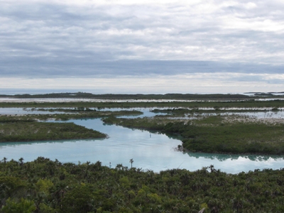
Although we had originally planned to spend the next day at the park exploring some more, we realized that if we instead moved to our next stop, Shroud Cay, we would hit the tide right to explore the northernmost mangrove creek. We decided to change plans and headed out shortly after checking in on the Waterway Net. By 1:30pm, we had secured a mooring ball and were headed in the dinghy through the mangrove creek toward Exuma Sound. The tide was just about at its peak, which would give us an unimpeded ride to our favorite swimming hole, but we would need to be sure to head back out before the water levels dropped too far. After our swim, Julie, Pat and Cathy made a trip up the hill to get a better view of the terrain. By the time they returned, the ebb current was picking up, so we took a few rides through the small cut before heading back to the boats.
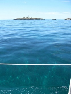
Calm conditions provide amazing visibility into 11 ft of water.
When the Winds Blow . . .
When we returned, the water was like glass, and the sun warm as it set over the Exuma Bank. Looking down into the clear water, we could see the bottom through 11 feet as if we were looking through no more than a blue filter. This was all going to change, as a strong front was making its way toward us. It arrived in the middle of the night (as they all seem to do) with downpours and thunder and lightning. Initially, we had some protection from shore until the winds moved to the west and then northwest, where they howled and blew up an enormous sea, making sleep or anything else impossible for the next 18 hours. Orion and Marianna were tossed around like corks, and things below were flying around worse than our toughest offshore passage. We stowed things, scooped up debris and then started an unofficial watch system as we wanted someone in the cockpit to make sure that the rocky shore behind us didn’t start getting closer and our bridle remained secure.
When we returned, the water was like glass, and the sun warm as it set over the Exuma Bank. Looking down into the clear water, we could see the bottom through 11 feet as if we were looking through no more than a blue filter. This was all going to change, as a strong front was making its way toward us. It arrived in the middle of the night (as they all seem to do) with downpours and thunder and lightning. Initially, we had some protection from shore until the winds moved to the west and then northwest, where they howled and blew up an enormous sea, making sleep or anything else impossible for the next 18 hours. Orion and Marianna were tossed around like corks, and things below were flying around worse than our toughest offshore passage. We stowed things, scooped up debris and then started an unofficial watch system as we wanted someone in the cockpit to make sure that the rocky shore behind us didn’t start getting closer and our bridle remained secure.

As day broke, we became concerned that our worst fears were coming true. Fred called to ask us whether we were any closer to Marianna. We looked around and felt everything looking uncomfortably close – especially the waves crashing on the rocks. As Cathy started the engine, Dave went forward to check the mooring bridle. He saw no chafe and the lines seemed firmly attached to the pennant, which also seemed fine. Cathy watched the track we traced on the chartplotter, which we turned on with the engine for the first time since picking up the mooring the day before. It was obvious we had moved from the time we had arrived in yesterday’s calm conditions, but with the wind shift that would be expected. Had we moved more than we should have? Were we still moving back? The waves on the rocks seemed close, but the instruments were beginning to tell a story that we were staying put. With our fears calmed, we killed the engine, but left the instruments on until nightfall. Dave went forward to check the bridle periodically, which held fine, but Marianna was not so lucky. One of their lines chafed through, reinforcing the importance of having 2 separate bridle lines through the mooring pennant. As the sun set, the winds were down to below 20 knots (from the 30+kts in the morning ) and had shifted to the north, where we had more protection. However, the waves were still on our beam, so sleeping was fitful at best. By morning, winds and seas had calmed more, but we were ready to move on. The good news was that we had held through the storm and, in what is becoming an all-too-familiar pattern, our trip north to Eleuthera was once again on a glassy calm sea.
The water off Beacon Cay (in the distance) is over 20 feet deep, but we could see the bottom clearly.
Leaving the Exumas Behind
Our overall travel plan had been to move from the Exumas to Eleuthera, positioning ourselves in the lee of its northern islands in order to wait for a window to cross the Northeast Providence Channel (aka the ocean) to the Abacos, arriving in Marsh Harbor by mid-March. So, our destination upon leaving Shroud Cay was the east side of Current Island, a long, thin island that reaches out to the southwest from Eleuthera’s western-most point. We would anchor for one night and then this would position us for a short run to Spanish Wells the next morning, allowing us to time our passage through the short but infamous Current Cut, just north of our anchorage, on a favorable current.
In planning a route north, Dave and Fred explored options that took us through one of a number of cuts between the Exuma islands, out into Exuma Sound and across to the Eleuthera banks. However, it turned out the most direct route would take us straight up the remaining island in the northern Exumas, into Eleuthera without entering the deeper waters of the Exuma Sound. So, we headed northeast, paralleling the island chain until we reached Beacon Cay, where we bid the Exumas goodbye. About 5 miles north of this landmark, we entered a 5-mile stretch of coral heads, some of which were reported to be less than 6 feet deep. With near-perfect conditions, they were easy to spot and avoid any that might be a concern. Once through them, we made another course change off Finley Cay and were setting anchor just before sunset.
One irony of this amazingly calm day was its contrast to the 36 hours that preceded it. While on the mooring, we had to secure everything and hold on for dear life. While underway, nothing moved at all. We even took showers, something we didn’t even consider in the pitching and rolling we had left the day before. It’s amazing what a difference a day makes.
Waiting for a Window
We arrived in Spanish Wells with little drama, but will be here until we can see a window to head north to the Abacos. We enjoyed our stay here last year, so we expect this visit will give us more time to explore further – and, of course, wait out the fronts.